Map of Alliance Ohio
$119.00
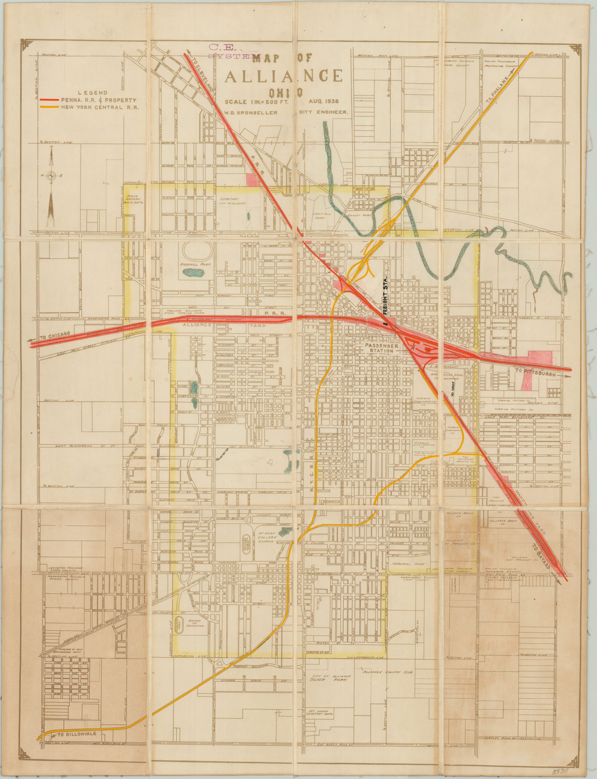
Custom municipal map of Alliance, Ohio created for use by the Pennsylvania Railroad.
1 in stock
Description
This detailed street plan of the city of Alliance, Ohio was designed by city engineer W.D. Sponseller and first published in 1938. Issued at a large scale of 1″ to 500′, the map shows parks, geographic features, local businesses, schools (including Mt. Union College), and prominent public buildings.
This particular copy of the map has been customized for use in the Central Engineering Department of the Pennsylvania Railroad and has been dissected and mounted on linen for preservation and convenient storage. Vivid color has been applied by hand to denote property and track ownership throughout the city as of the mid-1950’s.
A custom index has been added adjacent to the title to identify the two railroad operators within the city; The Pennsylvania Railroad (red) and New York Central Railroad (yellow).
Map Details
Publication Date: 1938
Author: W.D. Sponseller
Sheet Width (in): 17.50
Sheet Height (in): 23.00
Condition: B
Condition Description: Dissected into 12 panels and mounted on linen with black leather covers. Strong discoloration visible on two panels from the adhesive used to affix the covers to the verso. Narrow right margin and scattered soiling, but remains in good condition given the map's history and use.
$119.00
1 in stock