Map of Alaskan Military Reconnaissance of 1898
$250.00
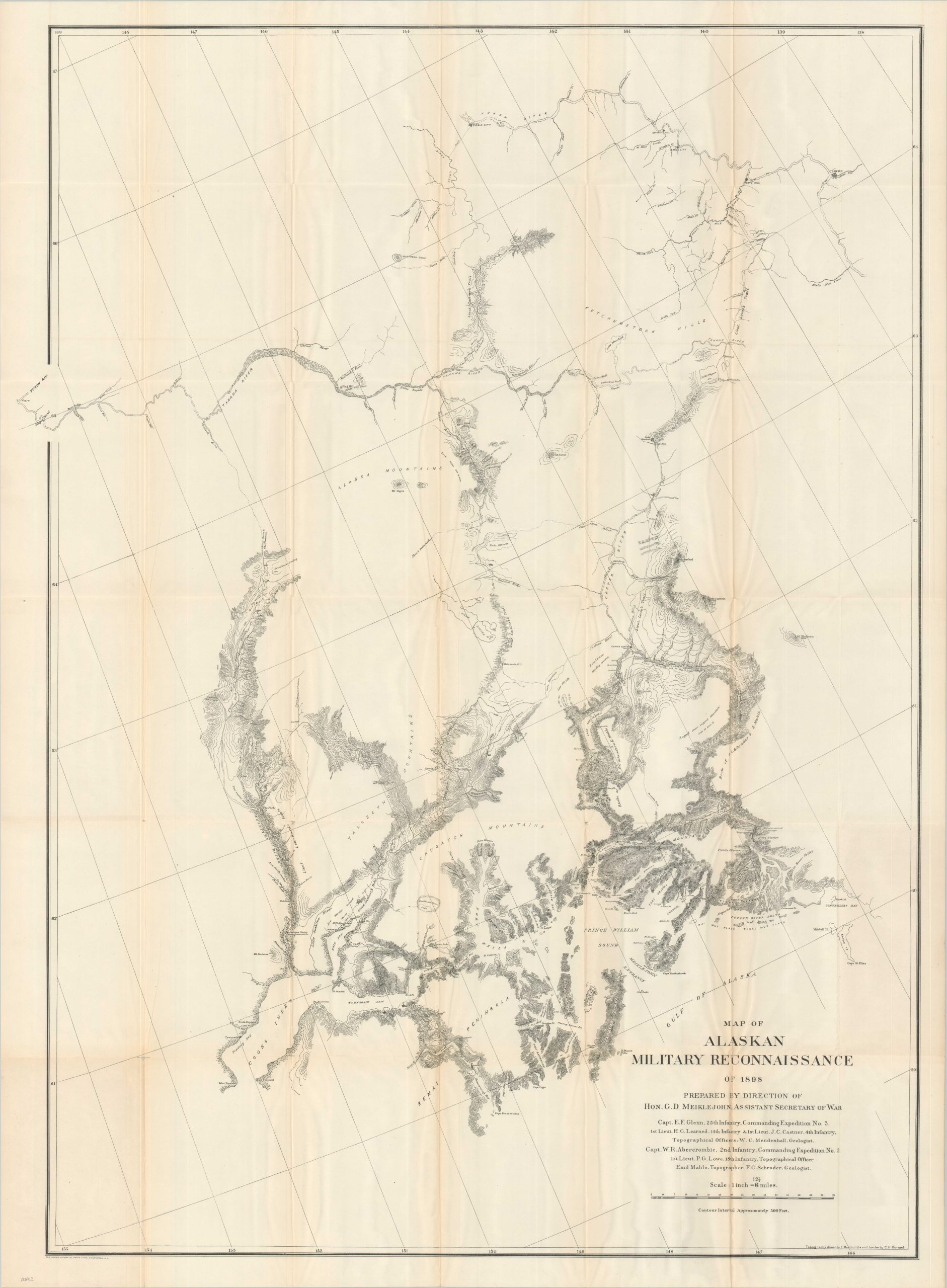
Mapping America’s last frontier.
1 in stock
Description
This detailed 1898 map reflects the urgent efforts of the United States War Department to fill a significant “black hole” in the cartography of Alaska’s interior, stretching from Cook Inlet and Prince William Sound to the Yukon and Copper Rivers. Following the 1896 discovery of gold in the Klondike, the U.S. was keenly interested in establishing an “All-America Route” to the goldfields that circumvented Canadian-controlled territory. To this end, military expeditions led by Captains Glenn and Abercrombie were dispatched to conclusively identify a viable inland path.
The resulting map, drawn by engineer Emil Mahlo, provides an authoritative and accurate rendering of the topography of this remote region. Notable early settlements such as Valdez, Tyoonock, Sunrise City, and Hope are identified, while formidable geographic features – including the massive glaciers of the Alaska Range and Lake Louise – are carefully labeled alongside the documented tracks of the explorers. The surveyed routes presented here would ultimately serve as the foundational alignment for the Richardson Highway (Alaska’s first wagon road) and, eventually, the Alaska Railroad.
Map Details
Publication Date: c. 1898
Author: Emil Mahlo
Sheet Width (in): 33.50
Sheet Height (in): 45.00
Condition: A
Condition Description: Single-sided black and white lithographed map on a folded sheet. slightly wrinkled and creased, with a few small splits at the fold joints. Very good condition overall.
$250.00
1 in stock