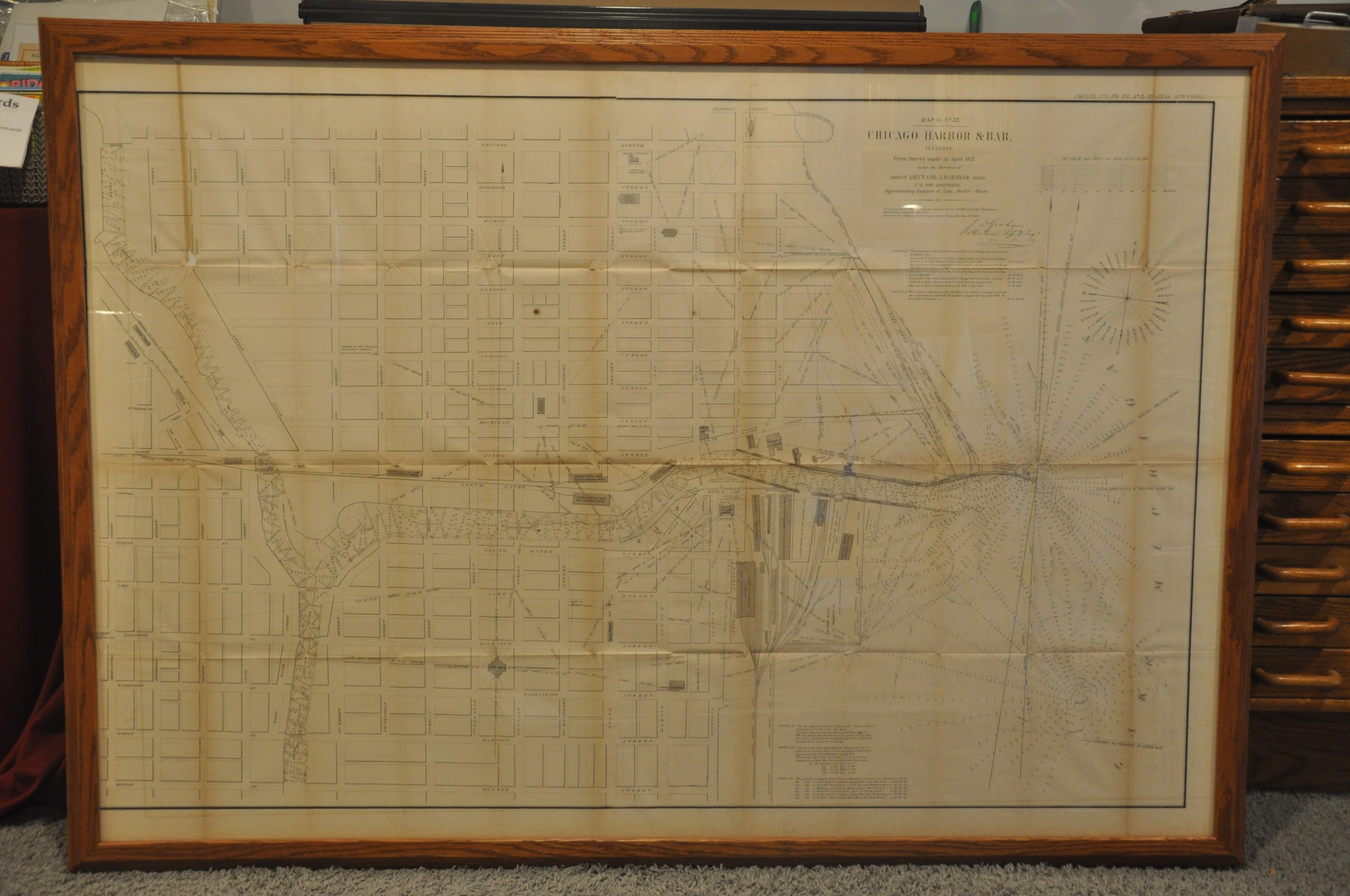
Map G. No. 52 Chicago Harbor & Bar
$750.00
Improving Chicago’s commercial prospects in the mid-19th century.
1 in stock


Description
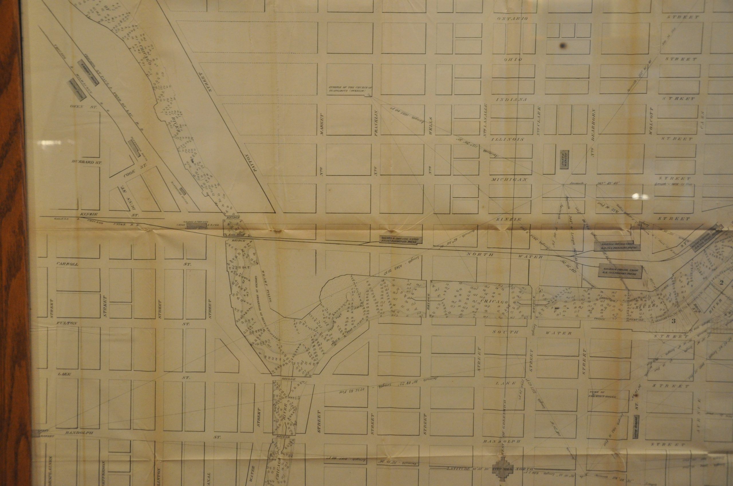
This spectacular plan of Chicago is based upon the surveys conducted by the US Topographical Engineers, under the direction of Lieutenant Colonel J.D. Graham in April of 1857. It was originally issued by the Government Printing Office as part of a congressional report on the status of ongoing improvements to the Chicago River. The large-scale image presents a detailed overview of downtown Chicago in the decades preceding the Great Fire – one of the finest such impressions to be printed before the Civil War.
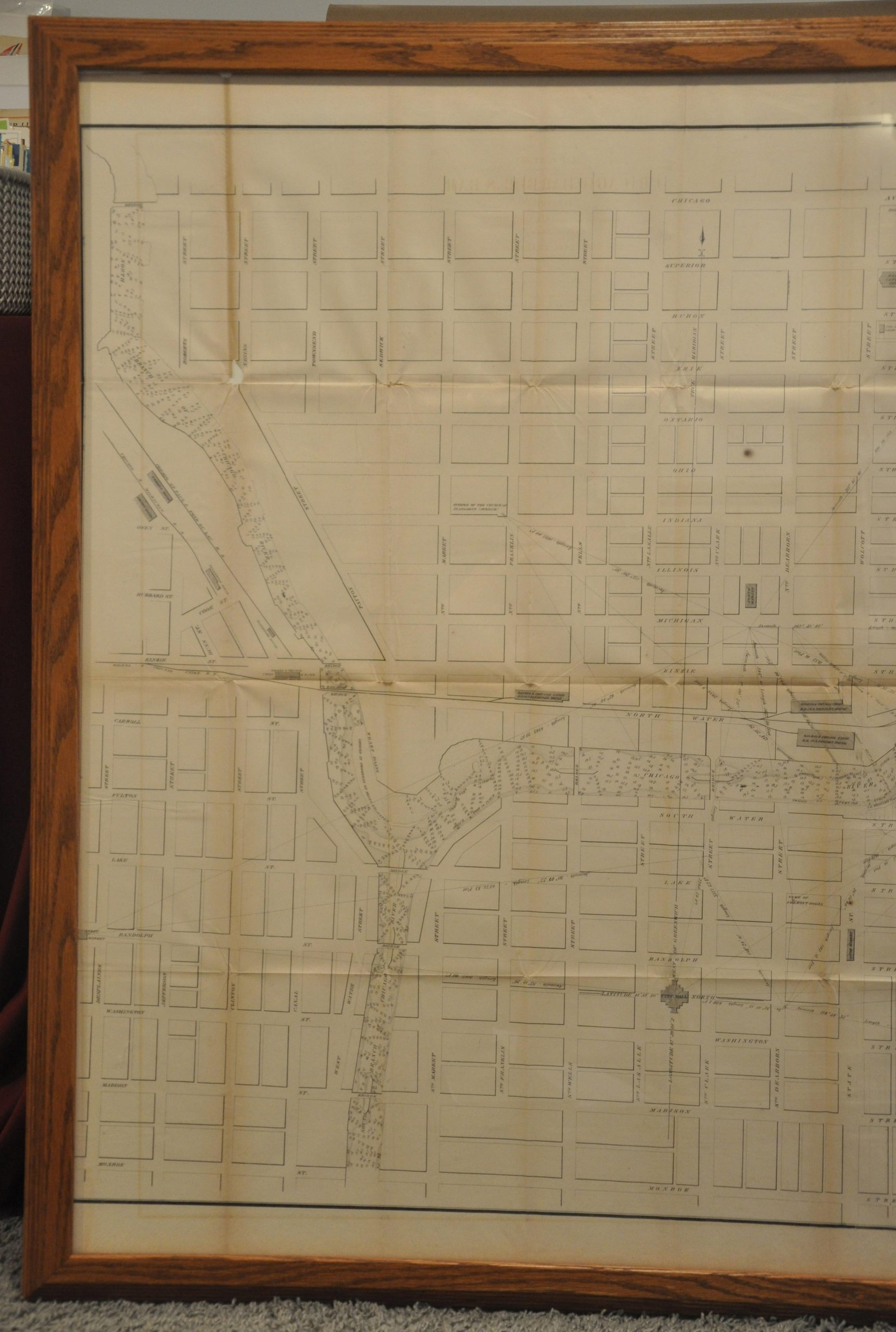
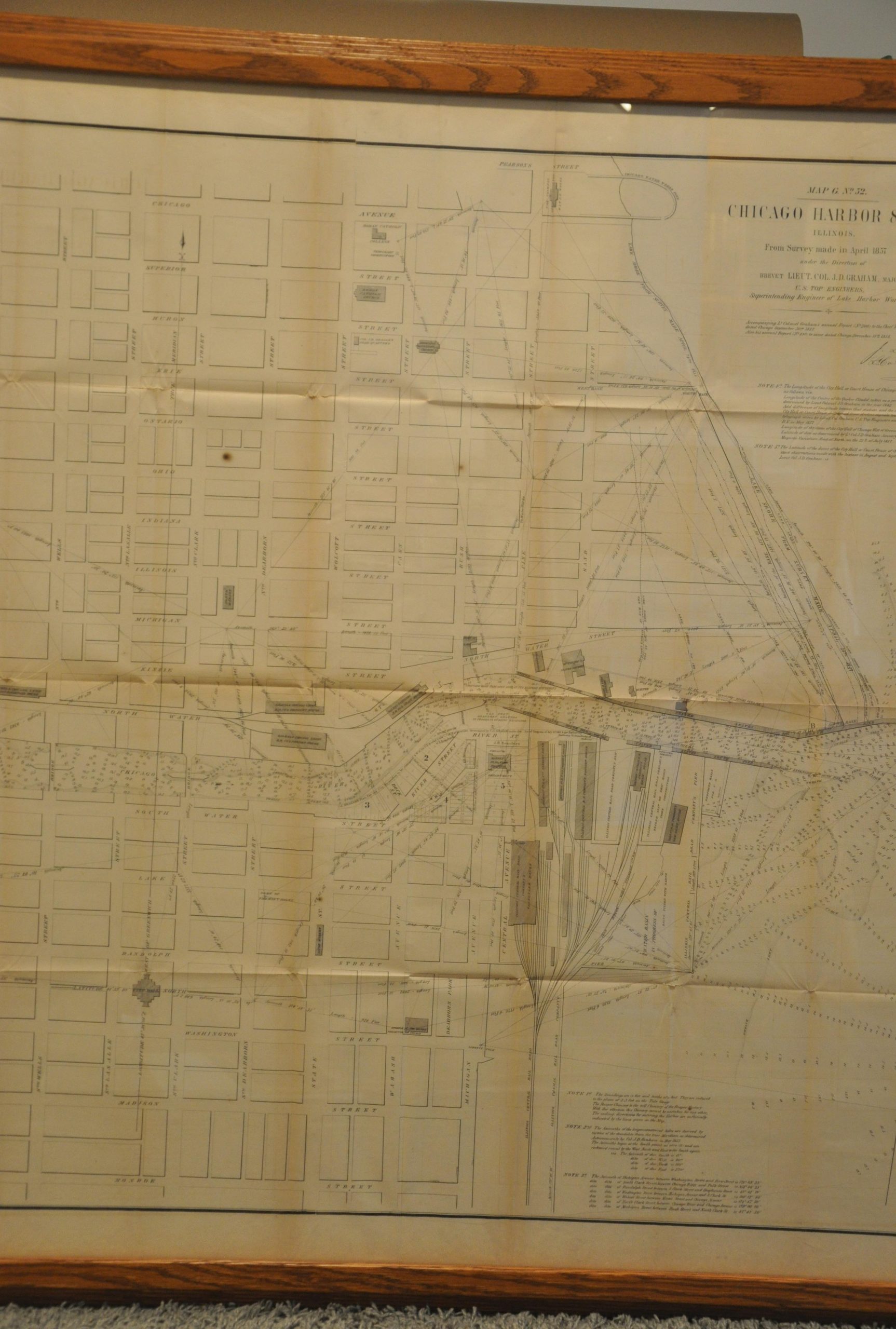
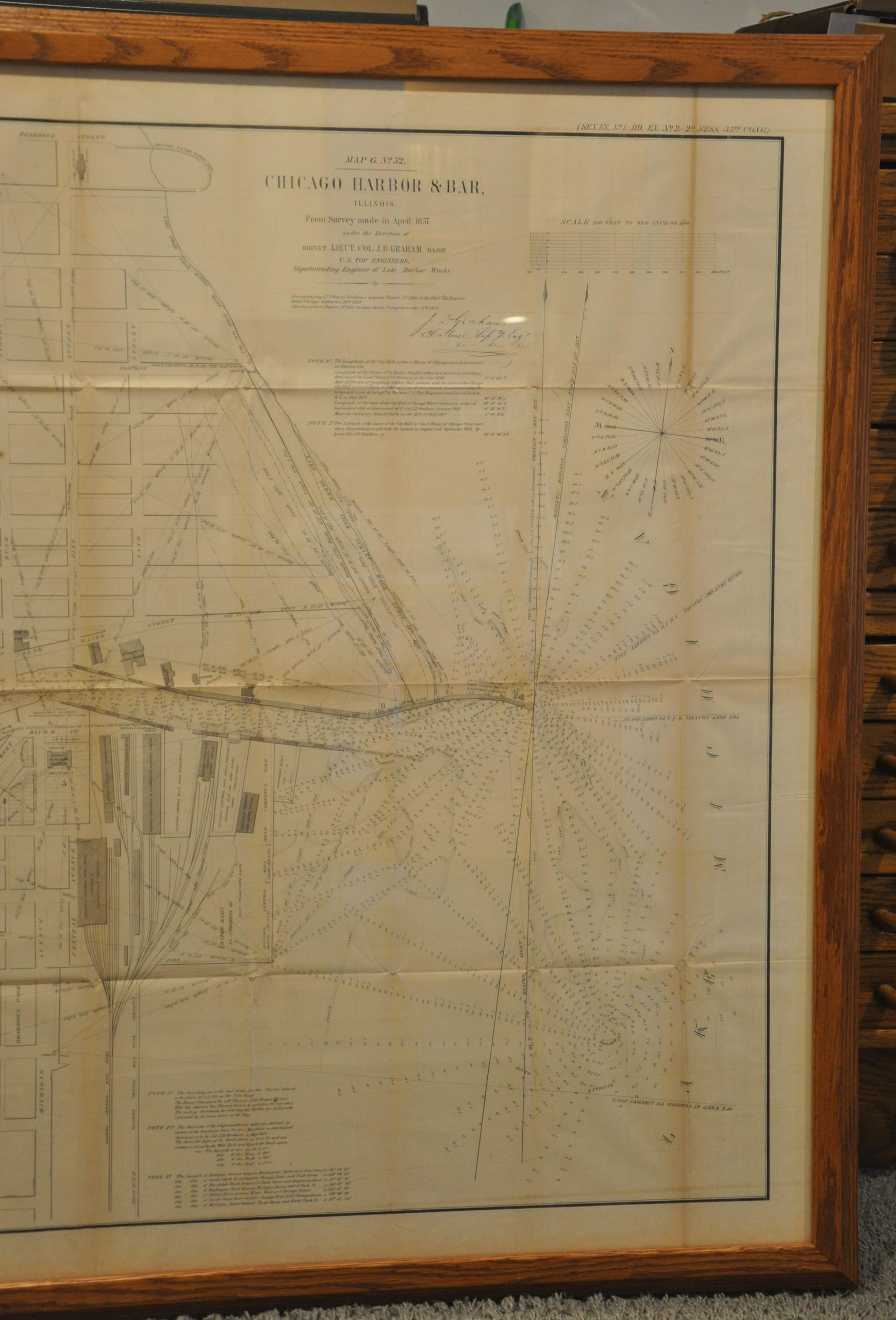
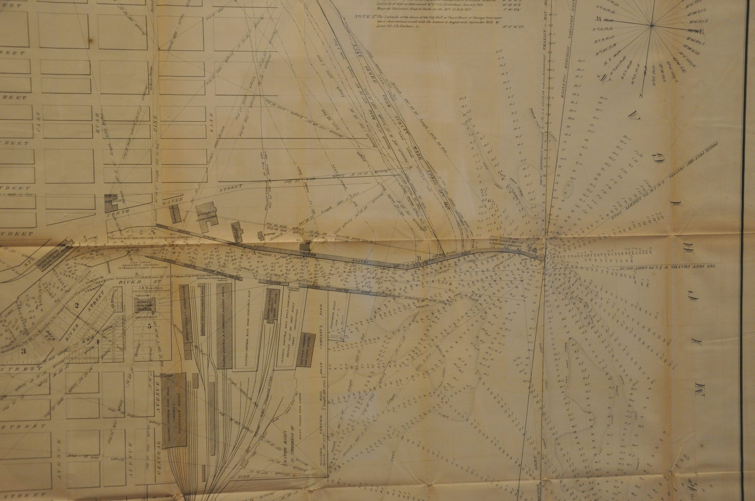
The image stretches from Lake Michigan up the Chicago River to Wolf Point, where it then splits into the North and South branches. It is bounded by Des Plaines St. in the east, Chicago Avenue to the north, and Monroe Street to the south. The map’s focus is on the Chicago Harbor (in reality, the river) and bar, the sand hazard at the mouth of the river that was a constant irritation to maritime navigation. An incredible corpus of information is displayed that reflects the tremendous work behind the map’s production – depth soundings, directional measurements, survey lines, and much more.
A fascinating variety of buildings are outlined and labeled, reflecting the massive train facilities of the Illinois Central, waterfront warehouses and industries (including the McCormick Reaper Factory), the grounds of Old Fort Dearborn, pre-fire churches, City Hall, and even Graham’s headquarters during his surveys! All of these structures have since been destroyed or demolished. Street names downtown reflect a pattern that remains largely to this day (with the notable exclusion of Lake Shore and Wacker Drives). As noted in the online description of the map by the Newberry Library:
In the 1850s, Chicago’s harbor emerged as a critical link between the waterways of the Great Lakes, including the Erie Canal, and the new railroads leading from riverside docks and piers (as shown on this map) to the interior of the country. Repeated attempts to keep the river and harbor clear of sediment had had only temporary effect. In April 1854, the government brought Lieutenant Colonel James Duncan Graham (1799-1865), a member of the Army Corps of Engineers, to Chicago in April 1854 to direct more comprehensive improvements. The improvements cost $200,000, four times the amount spent on previous improvements.
Graham’s 1858 map of the Chicago Harbor and Bar records the data from soundings taken by his engineers in order to determine the water depth and hence the silt accumulation on the harbor’s floor. Detailed notes on the map describe the process he used to calculate the precise latitude and longitude of the site. This enabled him to pinpoint the underwater locations needing to be dredged. The detailed three-dimensional visualization of the river mouth and adjacent lakeshore offers a clear picture of how the prevailing southward flow of the lakeshore current and consequent drift of lake sand constantly pushed the natural flow of the river towards the south.
The entire area occupied by Lake Michigan would eventually be filled in, much of it by rubble from the Great Fire of 1871. Some of Chicago’s most iconic features like Navy Pier, Lake Shore Drive, and Grant Park would ultimately occupy this new territory. A fascinating snapshot of the heart of the Windy City during a period of tremendous growth and development.
Sources: WTTW; History of Chicago (A.T. Andreas);
Map Details
Publication Date: 1858
Author: J.D. Graham
Sheet Width (in): 50.5
Sheet Height (in): 35
Condition: B
Condition Description: Wear and toning along originally issued fold lines, with heaviest evidence seen on the far left and right sides of the sheet. The left side has a small chip with minor paper loss, about the size of a dime, at a fold intersection in the upper left. Trimmed left margin. Printed on somewhat thin paper that has become brittle with age. Good condition overall. Currently housed in a fine wood frame constructed from archival materials. Included, but shipping is extra. Scans available upon request.
$750.00
1 in stock