Map and Plan of Chicago Harbor, Illinois.
$250.00
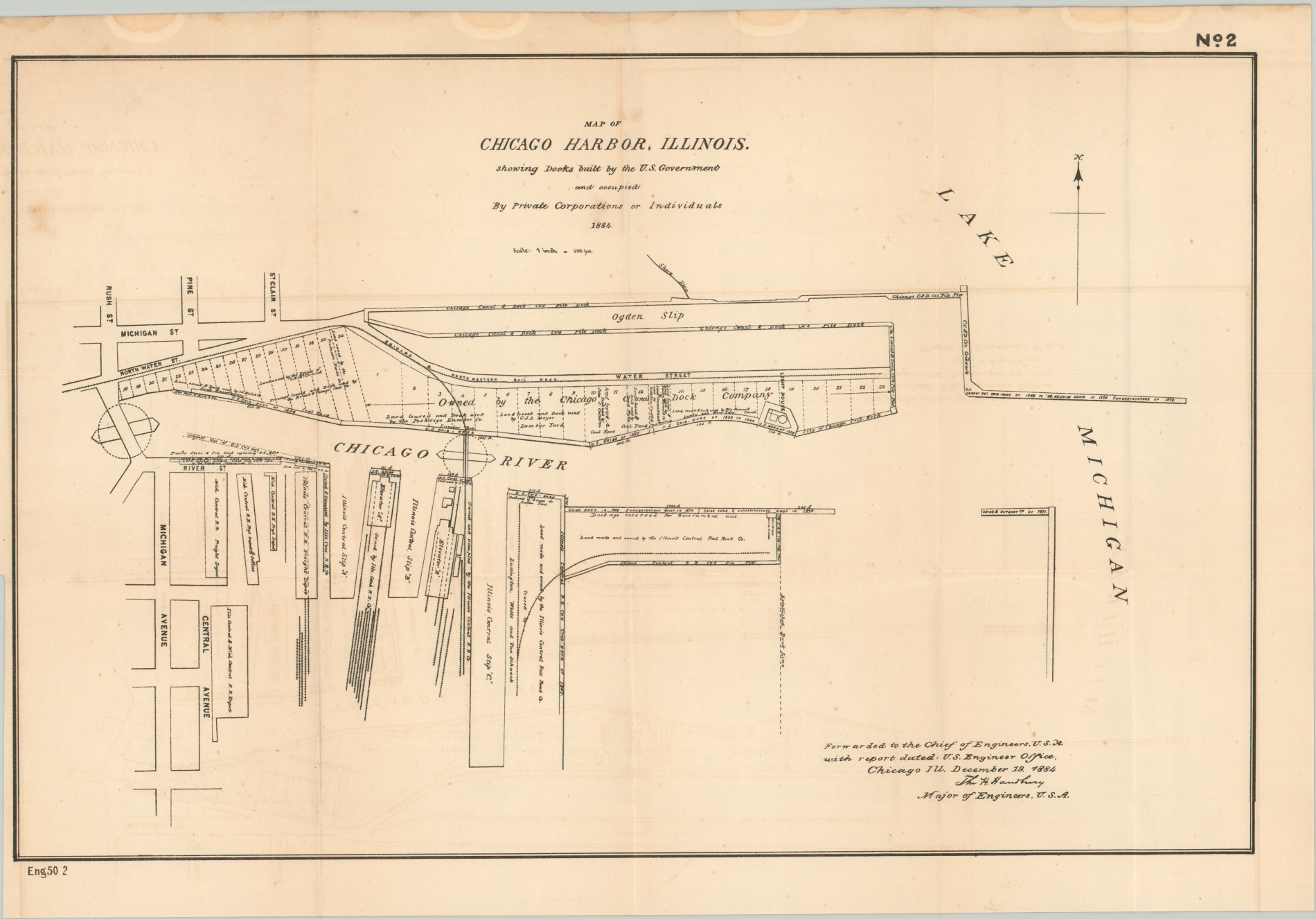
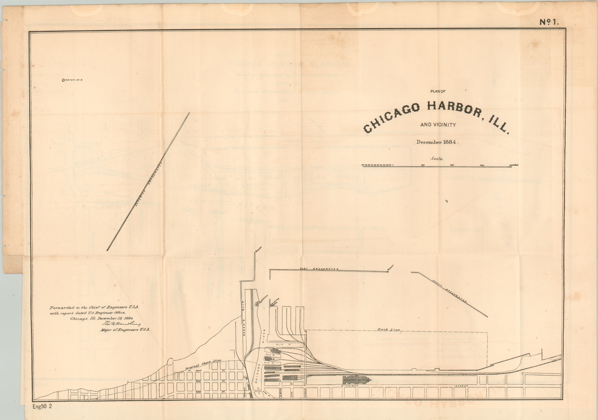
The mouth of the Chicago River in the mid-1880’s.
1 in stock
Description
This pair of surveys created by the Army Corps of Engineers was published to accompany a Congressional report in 1884, and they highlight the constant efforts to keep the mouth of the Chicago River clear of sediment that impeded maritime traffic.
The first sheet shows the harbor and vicinity, with several breakwaters and the municipal pier reflecting recent improvements. Sites along the lakeshore include the Exposition Building, constructed just a few years after the Great Fire, the lighthouse, and the life-saving station. One of the city’s longest-lasting swing bridges at Rush Street is also noted.
The second plan shows specific details around the mouth of the river, including the railroad depots of the Illinois Central and a vast property owned by The Chicago Dock Company. Infrastructure updates are outlined and dated, with the earliest references dating to crib work from the 1830s.
Map Details
Publication Date: 1884
Author: Thomas Handbury
Sheet Width (in): See Description
Sheet Height (in): See Description
Condition: B
Condition Description: Two sheets affixed to a single page of a congressional report from 1884. Each measures approximately 19.75" x 14" and has water rings along the top margin and shows faint spotting scattered elsewhere. Light offsetting and creasing along fold lines. Remains in good condition overall.
$250.00
1 in stock