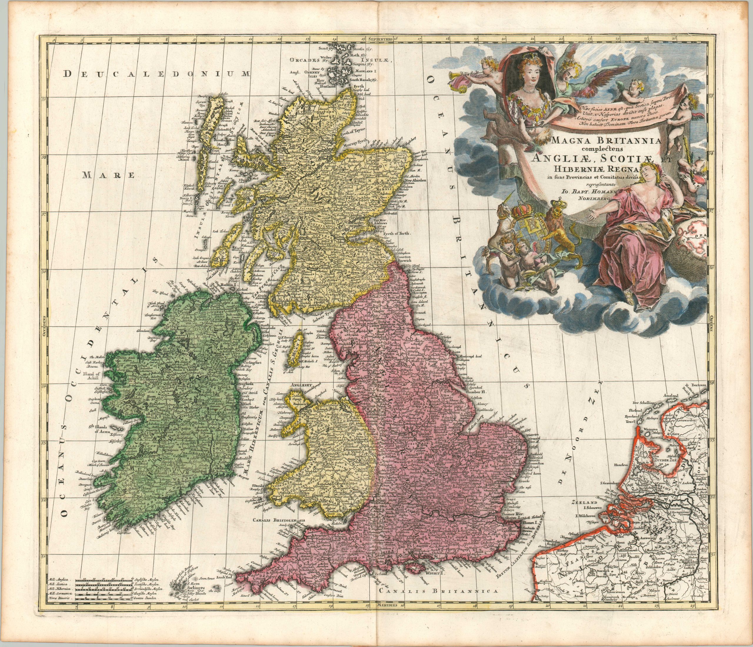
Magna Britannia complectens Angliae, Scotiae, et Hiberniae Regna
$350.00
An early map of Great Britain published shortly after the 1707 Acts of Union.
1 in stock
Description
This elaborate copperplate engraved map highlights the new political unit of Great Britain; composed of England, Wales, and Scotland and united under Queen Anne for the first time in 1707. (Ireland remained a separate kingdom under the authority of the British crown until 1801.)
The regal figure is depicted in the decorative title cartouche (upper right), which gives her credit for bringing peace to Europe. The image also includes the nearby coast of France and the Netherlands, a constant political and economic consideration for Great Britain.
Published in Nuremberg around 1711 as part of the Atlas Novus Terrarum by Johann Baptiste Homann.
Map Details
Publication Date: c. 1711
Author: Johnann Baptiste Homann
Sheet Width (in): 24.75
Sheet Height (in): 21.25
Condition: A-
Condition Description: Copperplate engraved map printed on thick, watermarked paper. Some discoloration to the image, probably as a result of the original impression, can be seen in the North Sea between the coastline and cartouche. A bit of soft creasing and faint discoloration along the vertical centerfold. Light scattered wear around the edges of the sheet, confined to the margins. Very good condition overall, with nice modern hand color.
$350.00
1 in stock

