Los Angeles Street Map
$75.00
L.A. street map with intimate notes from a previous owner.
1 in stock
Description
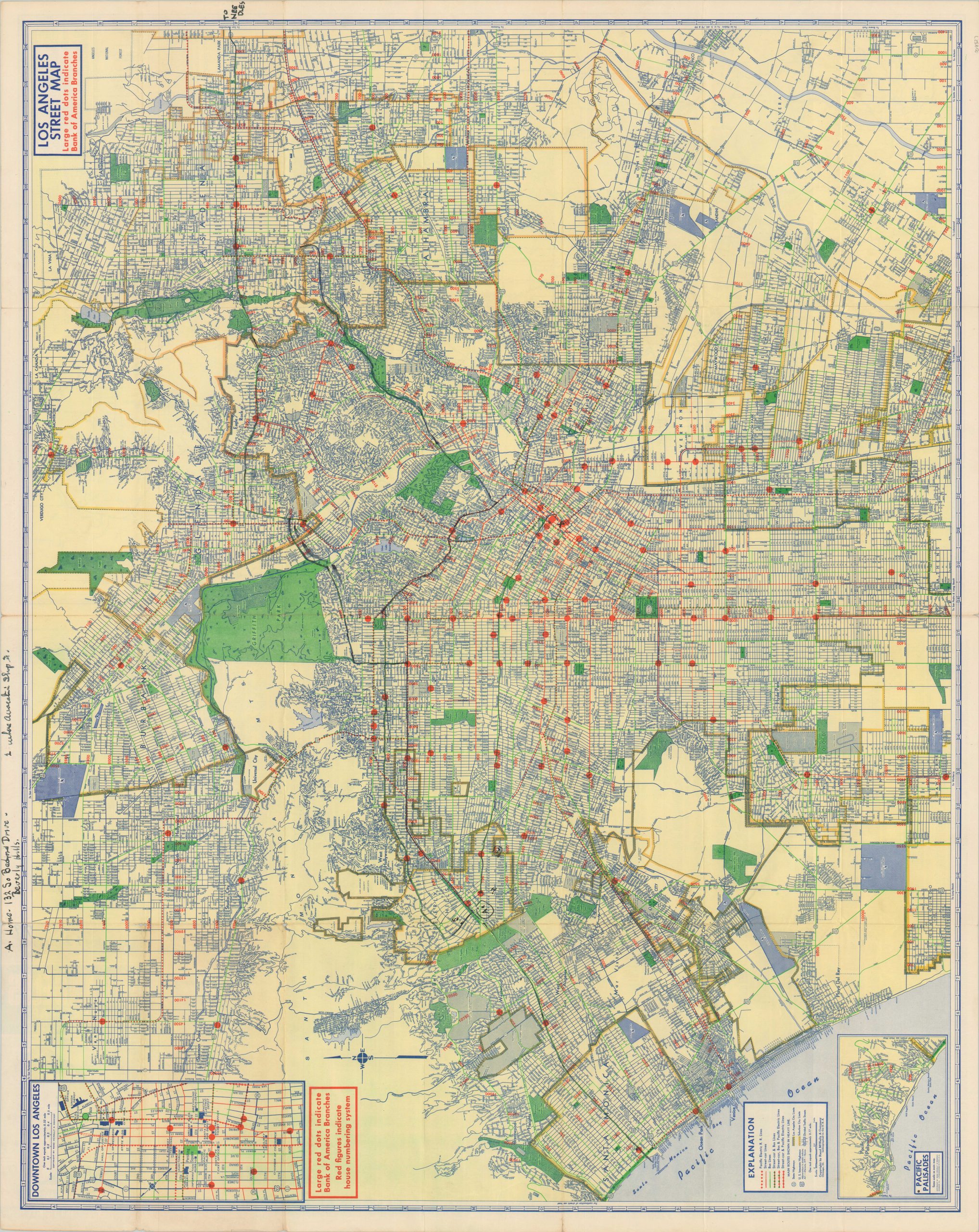
This intricately detailed map of Los Angeles was probably published in 1954 by Rand McNally on behalf of the Bank of America (the date code in the lower right is indicative of the age, though there are several outdated points of interest within the image). Large red dots indicate the location of BoA branches across the greater Los Angeles area, though a wealth of additional information is also presented.
Various attractions, public buildings, parks, and schools are labeled throughout, and the transportation network is outlined according to the legend in the lower left. Inset maps show downtown Los Angeles (upper left) and the Pacific Palisades (lower left). Here is one example of obsolete details – though the Getty Museum opened nearby in 1954, the image still shows Bernheimer’s Oriental Gardens (destroyed in 1951).
The verso presents a similar map of Los Angeles County that accentuates the network of the Pacific Electric Railroad near its height. On both sides of the map can be seen numerous manuscript annotations, likely providing contemporary directions to a distant friend or relative. Route recommendations, a custom key identifying A. Home and 1. Vacation Shop, and a brief note are included in black ink and red pencil.
Source: Dating Rand McNally Maps; Historical Timeline of Los Angeles;
Map Details
Publication Date: c. 1954
Author: Rand McNally
Sheet Width (in): 34.75
Sheet Height (in):
Condition: B+
Condition Description: Road map folded into 28 panels. Moderate wear along fold lines, including creasing, small tears along the edges, and small holes at fold intersections. Several areas are heavily marked with black ink (recto) and red pencil (verso). About good condition overall.
$75.00
1 in stock