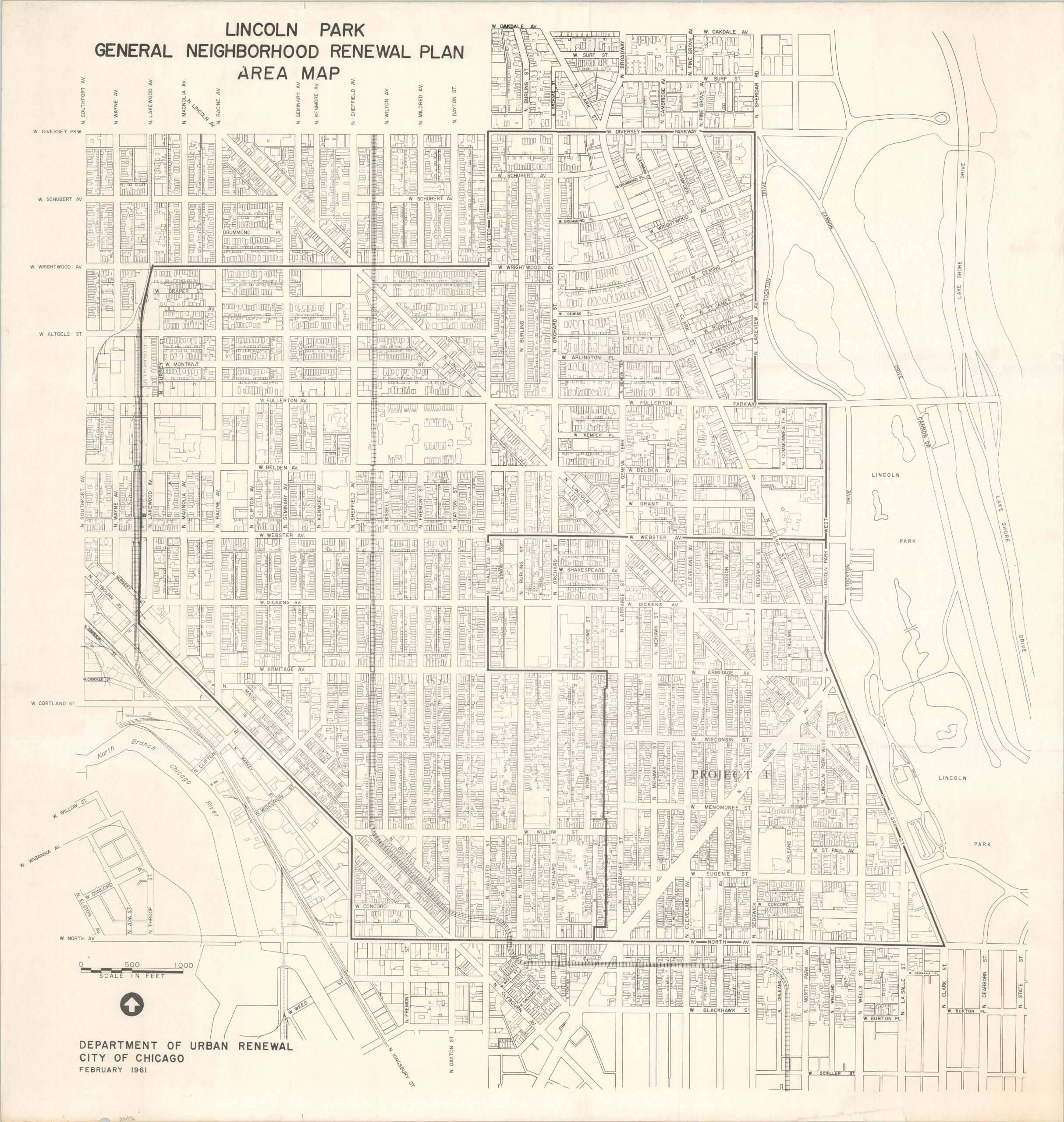
Lincoln Park General Neighborhood Renewal Plan Area Map
$275.00
Reinvigorating one of Chicago’s most popular neighborhoods.
1 in stock
Description
This detailed plan of Chicago’s Lincoln Park neighborhood was published by the city’s Department of Urban Renewal in 1961. Footprints of individual buildings are outlined throughout the image, which is bounded by Lake Shore Drive (east), North Avenue (south), Southport Avenue (west), and Diversey Parkway (north). The map was issued during a period of increasing concern about the historic preservation of the neighborhood, leading to conflict with the predominantly minority residents there. According to the Encyclopedia of Chicago,
“In 1956, Lincoln Park was designated a conservation area, and in the 1960s the city began implementing its “General Neighborhood Renewal Plan.” Although the LPCA had consciously tried to avoid the wholesale clearance that took place in Hyde Park, it incurred the wrath of poor people who lived in the southwestern quarter of Lincoln Park. The Concerned Citizens of Lincoln Park argued that Puerto Ricans and African Americans were being displaced from their homes and priced out of the renewing neighborhood. Developers bought land near the park and built high-rise apartment buildings, to the consternation of LPCA, which had hoped to keep the district congenial to families.”
Sources: Encyclopedia of Chicago; WTTW;
Map Details
Publication Date: 1961
Author: City of Chicago Department of Urban Renewal
Sheet Width (in): 29.9
Sheet Height (in): 31.3
Condition: A-
Condition Description: Creasing along old fold lines and moderate wear along the outer edges of the sheet, including a tiny chip in the lower left. Very good condition overall. Blank on verso.
$275.00
1 in stock