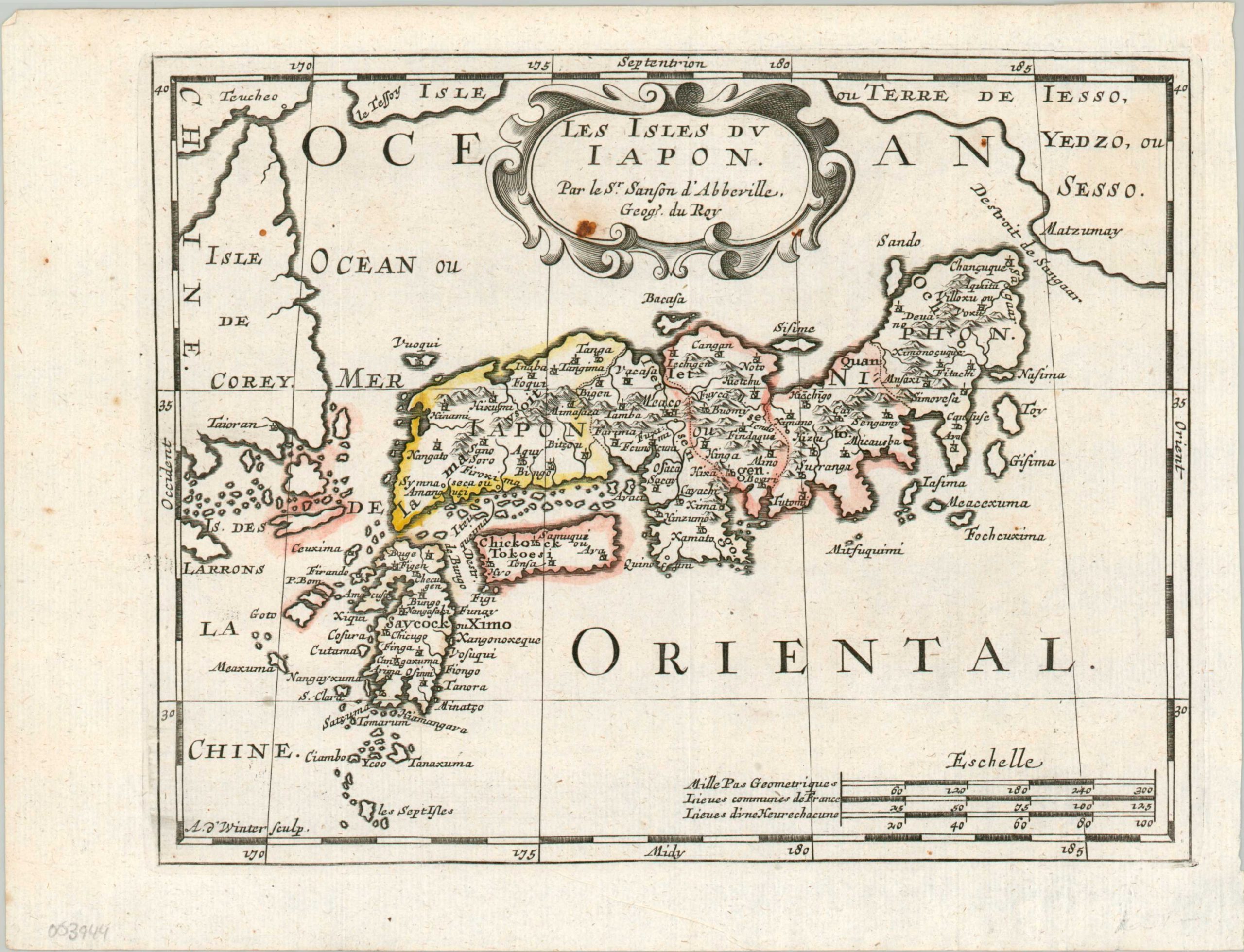
Les Isles du Japon
$250.00
The first edition of a pirated map of Japan.
1 in stock
Description
This interesting map of Japan was originally issued in 1652 by Nicholas Sanson, Royal Geographer to the King of France. This is a later example engraved by Antoine de Winter and published in Utrecht by Francois Halma in 1683 as part of a pirated edition of L’Europe en plusieurs cartes. According to Daniel Crouch;
“Francois Halma (1653-1722) set up his printing business in Utrecht in 1674, where he issued a number of pirated maps and atlases. In this instance, since Sanson was dead, Halma may have felt that there no harm and much profit to be gained from re-printing his work. The engraver, Antoine de Winter (c1652-1700) achieved some notoriety for plagiarizing Petter Gedda’s charts of the Baltic Sea, selling them on to Loots and Doncker, for inclusion in their atlases, who were subsequently sued, and ordered to surrender the plates and pay a fine of 300 florins.”
The image is based on Dutch and Jesuit sources and shows the island chain oriented east-west between the ‘Isle de Corey’ (Korea) and the ‘Terre de Iesso’ (Hokkaido). Numerous smaller surrounding islands are also labeled and topography is depicted pictorially. A fascinating depiction of the archipelago that also reflects the economic realities of contemporary cartographic production that continue to this day.
Map Details
Publication Date: 1683
Author: Nicholas Sanson
Sheet Width (in): 11
Sheet Height (in): 8.7
Condition: A-
Condition Description: Creased along originally issued fold lines and one small spot visible in the title cartouche. One small tear, confined to the margin in the lower right, has been repaired on the verso with archival tape.
$250.00
1 in stock

