Leonard’s Chronological and Geographical Family Guide to the Holy Bible
A custom composition outlining many of the Bible’s genealogical and geographic principles.
Out of stock


Description
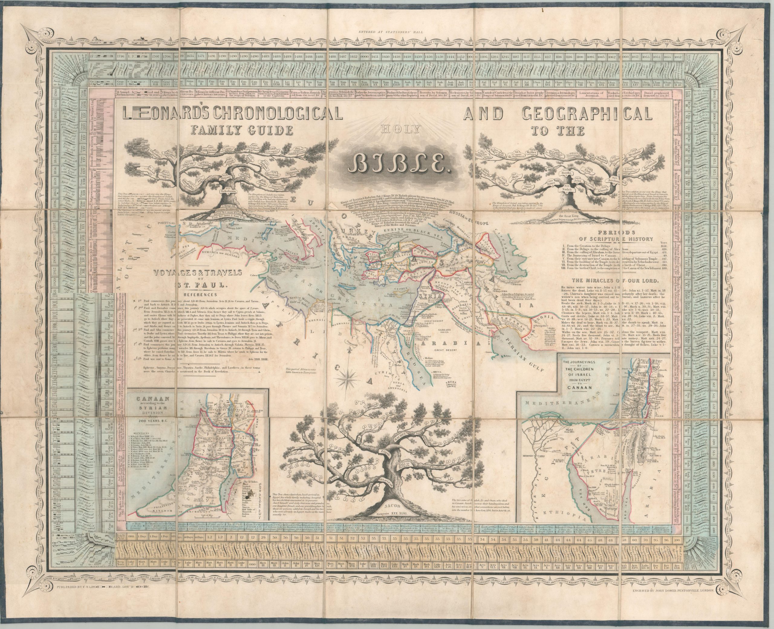
This impressive historical arrangement was engraved by John Dower and published in London by C.W. Leonard in the mid-19th century, probably around 1855-1860. A fascinating mix of maps, family trees, and tables of information provides a wealth of detail on various elements of the Old and New Testaments.
The central image shows the Voyages and Travels of St. Paul across the Mediterranean, while two insets in the lower corners outline the Twelve Tribes of Canaan and the Journeys of the Israelites. The crisply designed maps label a variety of historic sites (often with Biblical references), geographic features, and major settlements. Several annotations provide further ancient and contemporary context, with one notable example in the Sahara Desert reading “This part of Africa is very little known to Europeans.”
Genealogical diagrams in the forms of literal trees are provided for the families of Jacob, Jeroboam and the Kings of Israel, and the Kings of Judah. Concentric borders offer additional information in the form of summaries of books of the Bible, a timeline of the creation of the world (begin inning in 4004 B.C.), and particulars of Jewish beliefs and traditions (including a conversion for weights and measures).
Map Details
Publication Date: c. 1855
Author: John Dower
Sheet Width (in): 30
Sheet Height (in): 25.6
Condition: A-
Condition Description: Dissected into 15 panels and mounted on linen backing. Remains bound to original gilt embossed full black leather covers. The sheet is beginning to pull away from the backing in a few areas around the edges. Scattered soiling, with a stain in the map of Canaan in the lower left. Very good overall, with nice original hand color.
Out of stock