
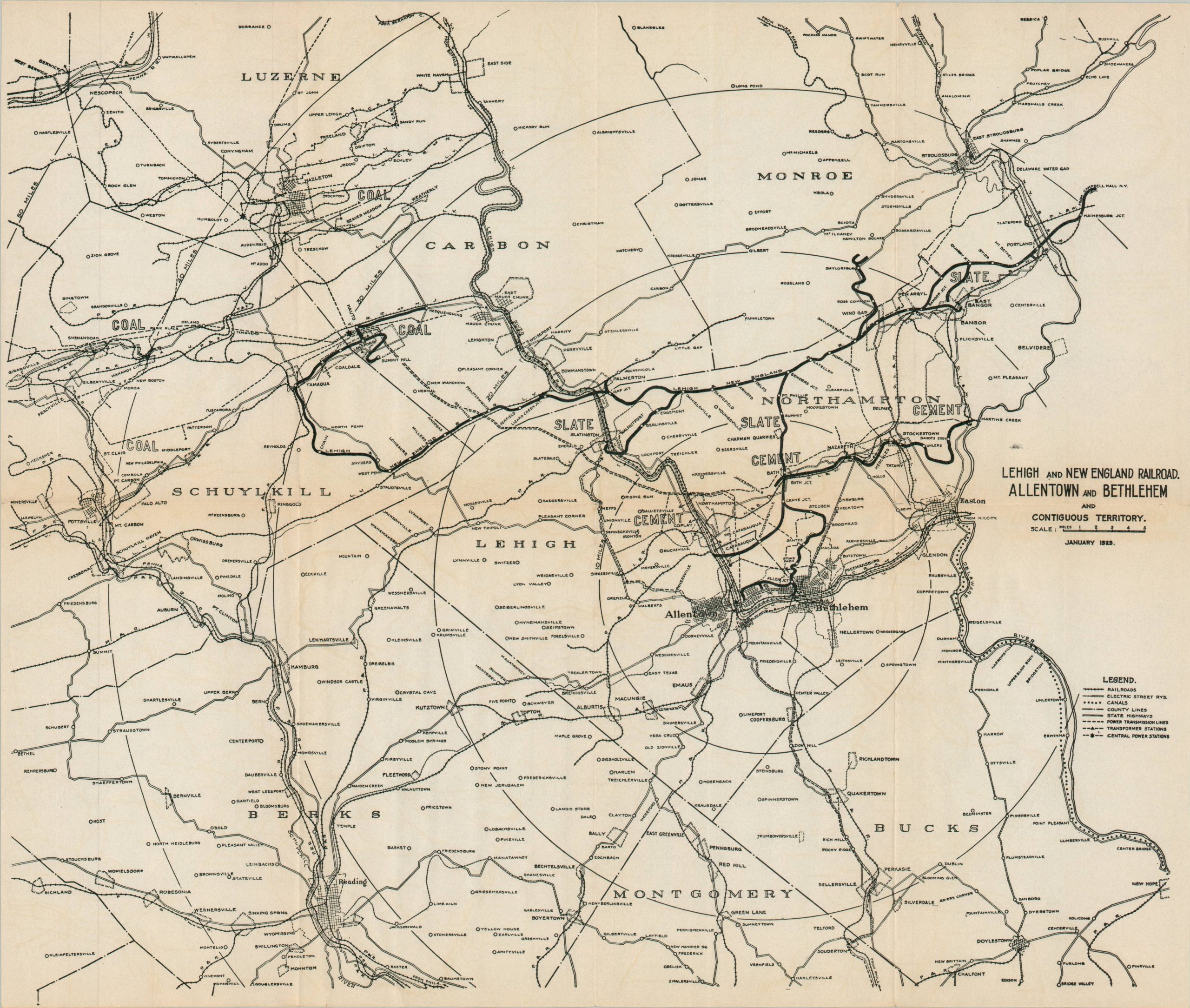
Lehigh and New England Railroad Allentown and Bethlehem and Contiguous Territory
$75.00
The industrialized region of the Lehigh Valley in the early 1920s.
1 in stock
Description
This interesting map of the area around Bethlehem, Pennsylvania, was issued by the Lehigh and New England Railroad in 1923 as part of a series of promotional maps of the line. The heavily industrialized area in the Lehigh Valley is shown in some detail, noting electrical infrastructure, transportation routes, and local boundaries according to the legend in the lower right. Concentric circles radiate in 10-mile increments from the manufacturing centers of Allentown and Bethlehem. Deposits of coal, slate, and cement are labeled, though topographic information is notably absent (the area is quite mountainous and rugged).
The Lehigh and New England Railroad (L&NE) was a regional carrier primarily serving Pennsylvania, New Jersey, and a small portion of New York, focused on transporting anthracite coal and cement from the Lehigh Valley to tidewater connections and industrial centers. By the early 1920s, the railroad was at the height of its operations, having completed significant expansions and modernizations following its 1904 reorganization under the control of the Lehigh Coal and Navigation Company. The dependency on the coal market would ultimately lead to the financial decline of the railroad, which was among the first major American carriers to voluntarily abandon its lines in the early 1960s.
Map Details
Publication Date: 1923
Author: Lehigh and New England Railroad
Sheet Width (in): 16.9
Sheet Height (in): 14.3
Condition: A-
Condition Description: Single-sided black and white map on a watermarked sheet. Creasing along old folds and light toning along the outer edges and the horizontal centerfold. Very good condition overall.
$75.00
1 in stock