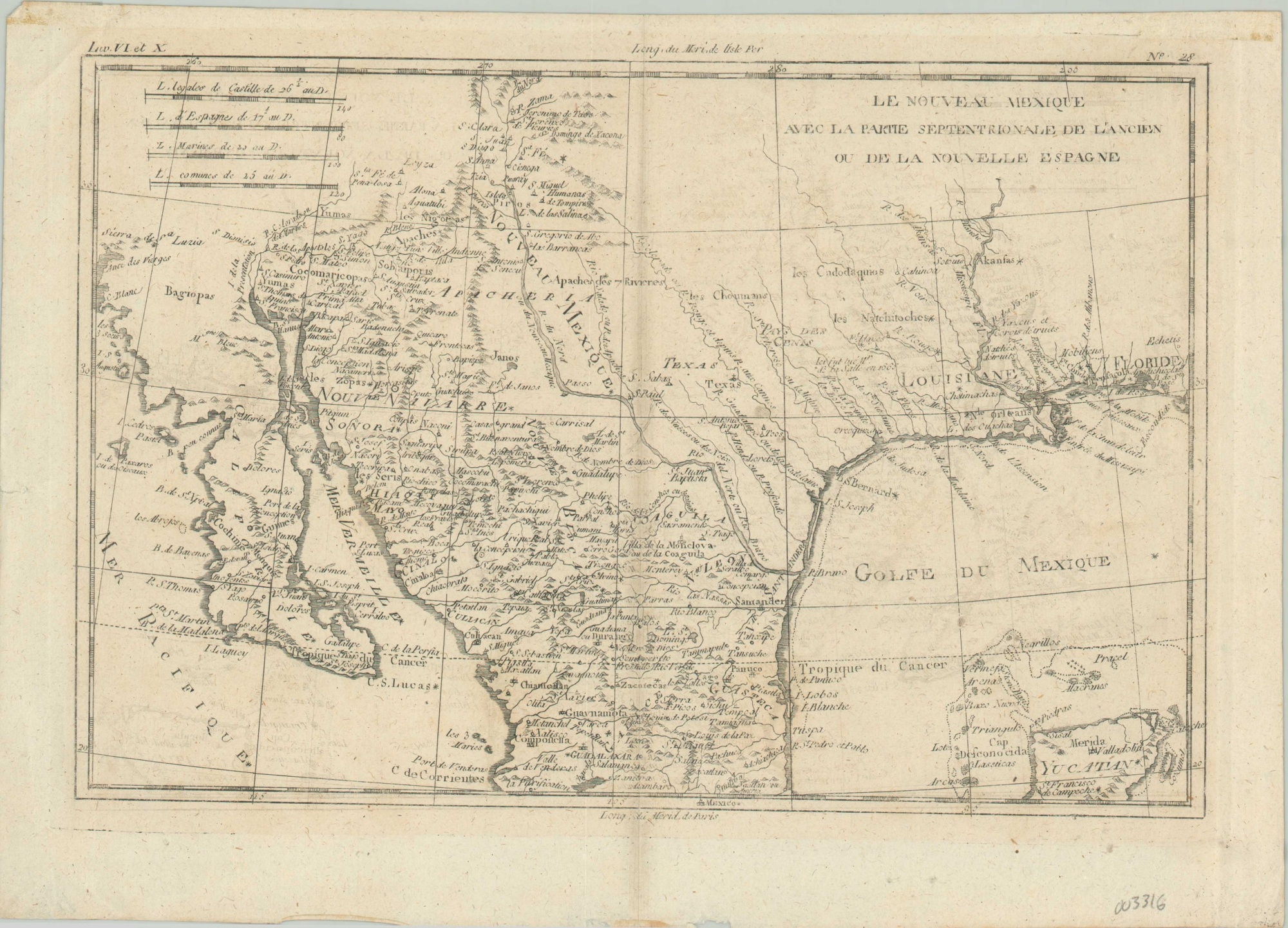
Le Nouveau Mexique, Avec La Partie Septentrionale De L’Ancien, ou De La Nouvelle Espagne
$195.00
The northern provinces of New Spain during the late 18th century.
1 in stock
Description
This fascinating map covers an area of modern day Mexico and the southwestern United States between Baja California and the Florida Panhandle, extending north as far as Taos, New Mexico. Toponyms reflect an interesting mix of Spanish missions, indigenous villages, ranchos, settlements, and more.
New Orleans, Pensacola, Mobile and San Antonio are all labeled. Topography is depicted pictorially and a large Rio du Nord (Rio Grande) is shown running from the top of the page into the Gulf of Mexico.
Published in Paris around 1780 by Rigobert Bonne.
Map Details
Publication Date: c. 1780
Author: Rigobert Bonne
Sheet Width (in): 14.10
Sheet Height (in): 10.1
Condition: B
Condition Description: Discoloration along the vertical centerfold and a bit of offsetting combined with a light impression has resulted in some legibility issues on the right side. Light wear and creasing in the margins, consistent with age.
$195.00
1 in stock