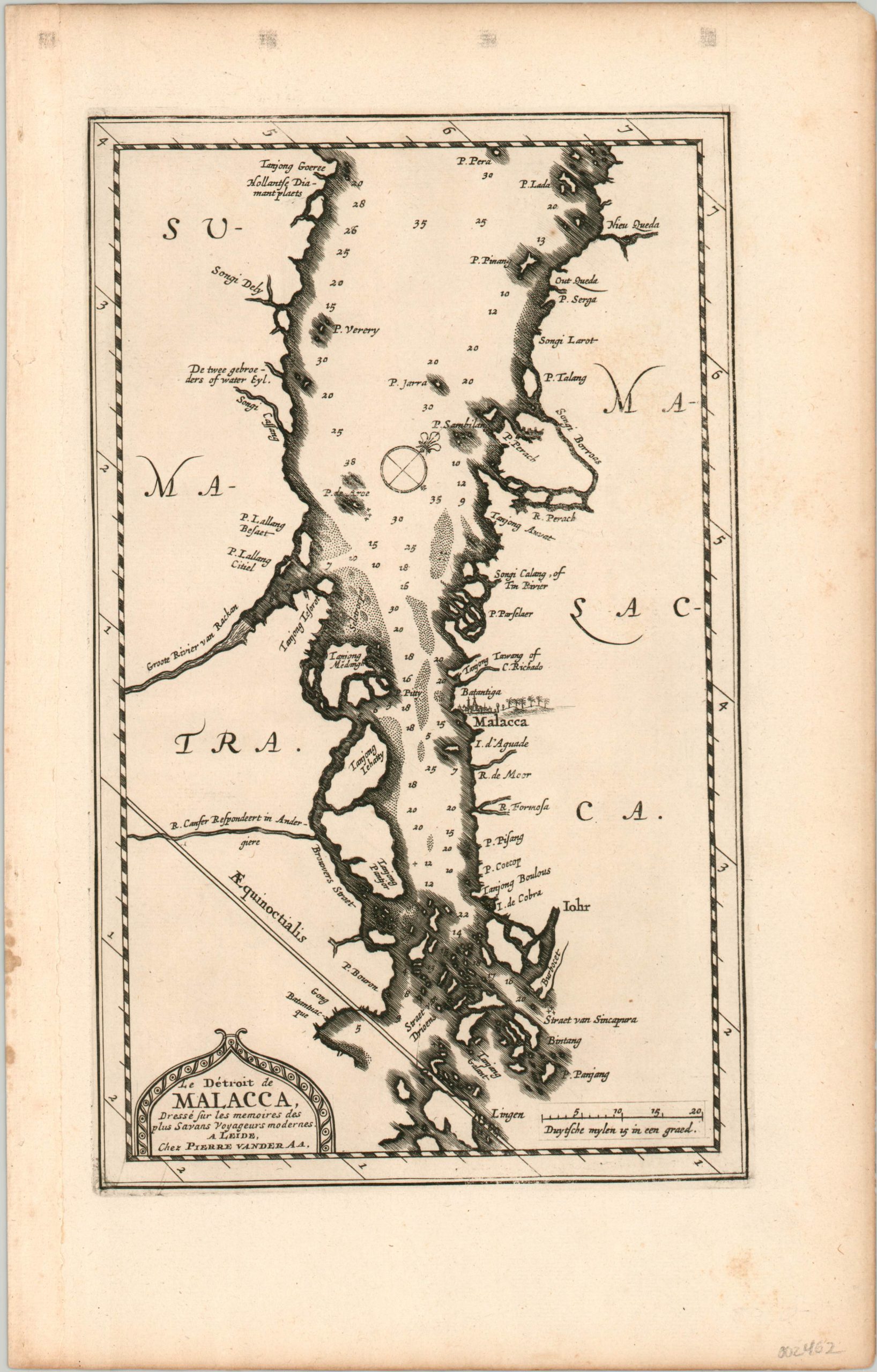
Le Detroit de Malacca
$425.00
Engraved map from 1717 showing one of the most important shipping lines in the world.
1 in stock
Description
The Malacca Strait runs for approximately 575 miles, between the island of Sumatra and the Malay Peninsula. It’s one of the most direct waterways connecting the Indian and Pacific Oceans and has been one of the most historically important waterways for the exchange of goods, people and ideas around the globe. It served a vital role during the spice trade of the 16th-19th centuries, when the Dutch, Portuguese, English, and local leaders competed for regional authority and market control, especially in and around the city of Malacca.
The strait is shown on this map with north oriented slightly to the right, likely to maximize the available space on the page. Depth soundings are noted throughout the image, with the Singapore Strait at the bottom of the sheet having the shallowest waters. It remains a barrier to the largest tanker ships today, who have to travel around.
The map was created by Pieter Van der Aa and published in Leiden in 1717 as part of Jean Mandelslo’s “Voyage de Perse aux Indes Orientales.” This epic travelogue details the voyages of Jean-Albert (Johan Albrecht) Mandelslo – a German diplomat who traveled to Russian and Persia in the late 1630’s on a political mission for the Duke of Holstein but was separated from his group.
He would carry on through India, Ceylon, and Madagascar before returning home to write about his travels. Information on the Far East, including the Spice Islands, was included in the publication, but garnered from other sources.
Map Details
Publication Date: 1717
Author: Pieter Van der Aa
Sheet Width (in): 8.40
Sheet Height (in):
Condition: A
Condition Description: Uneven left binding edge and a few faint spots confined to the margins. Near fine.
$425.00
1 in stock

