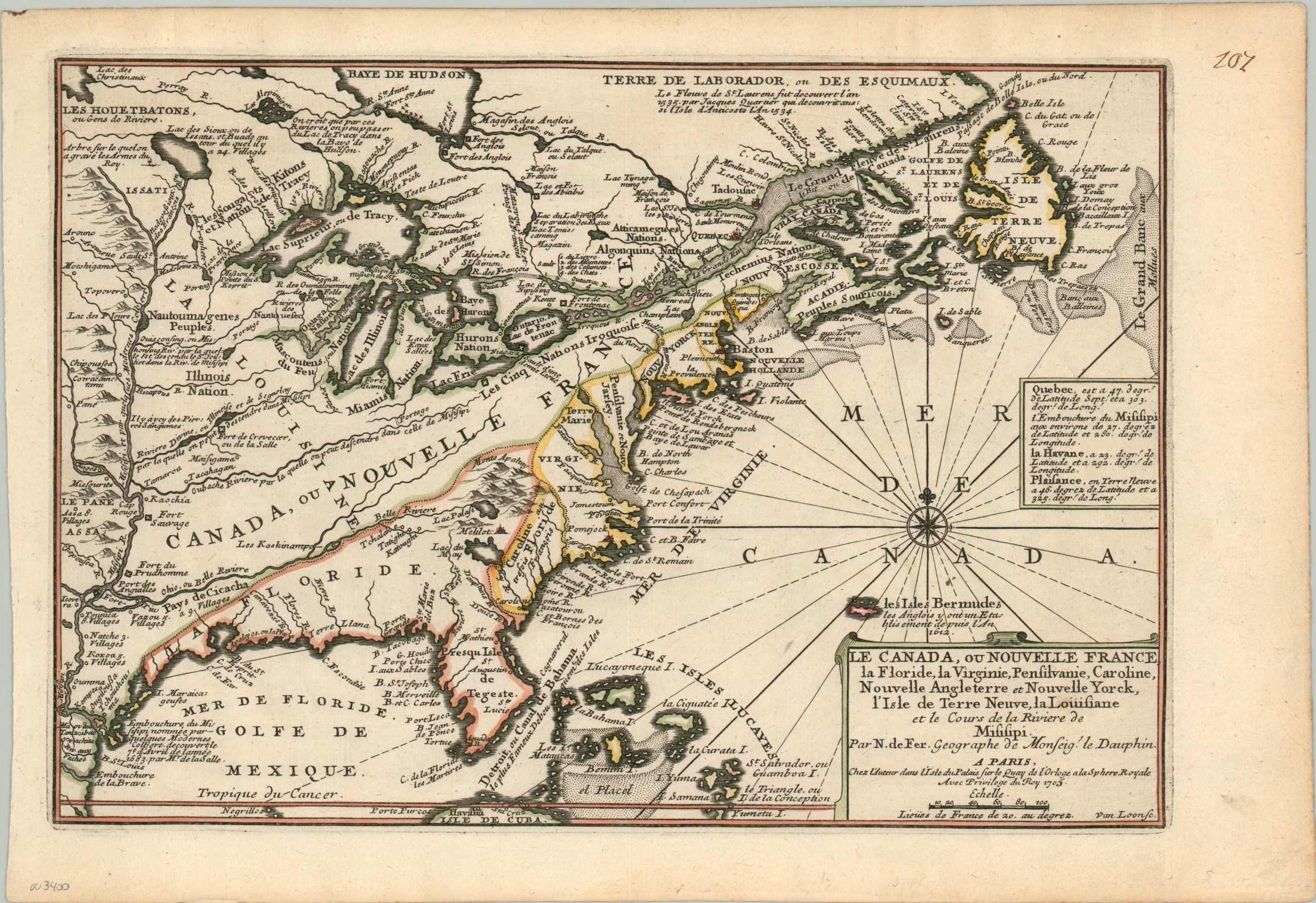
Le Canada, ou Nouvelle France, la Florida, la Virginie…
$825.00
Early 18th century colonial America, east of the Mississippi River.
1 in stock
Description
Competing claims among the French, Spanish, Dutch, and English across North America are highlighted on this map showing the continent east of the Mississippi River. The French are evidently in the ‘lead’, with alleged control of huge territories north of the Ohio River and west of the Appalachian Mountains. English colonies are confined to the restricted Atlantic seaboard and Bermuda, while Spanish control extends far north in Florida and across the Caribbean, most of which is conveniently excluded from the image.
Place names and several annotations throughout the map provide fascinating details, both contemporary and historic. Examples include river rapids and portages, frontier fortifications, and a ‘tree on which the king’s arms are engraved’. A fascinating snapshot of early colonial America from the French perspective.
The map was engraved by Van Loon and published in Paris in 1705. It was originally included as part of Nicholas de Fer’s impressive Atlas Curieux.
Map Details
Publication Date: 1705
Author: Nicholas de Fer
Sheet Width (in): 15.50
Sheet Height (in): 10.60
Condition: A
Condition Description: Very good to near fine condition. A dark, clear impression with attractive hand color on a clean sheet. Old manuscript page number in the upper right margin.
$825.00
1 in stock

