
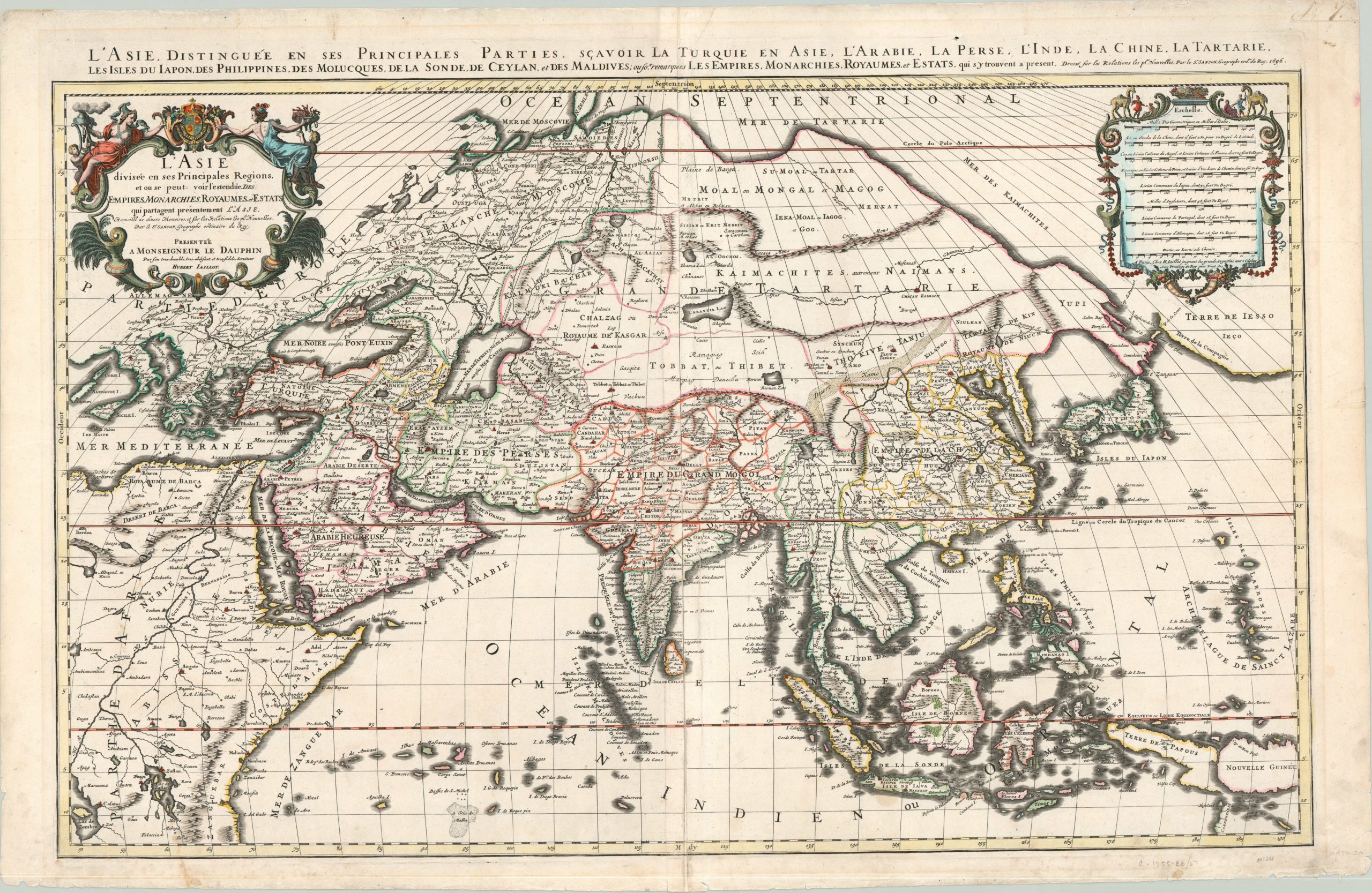
L’Asie divisee en ses Principales Regions
$1,200.00
Large map of Asia published at the close of the 17th century.
1 in stock
Description
A pair of interesting cartographic myths frame this large and decorative map of Asia, published by Alexis Hubert Jaillot in 1696.
Far to the east, in the center of the “Dark Continent”, the large bodies of water Zembre and Zaflan represent early renderings of the African Great Lakes and date back to lakes allegedly found at the foothills of the Mountains of the Moon. At the westernmost edge of the map, the Terre de Iesso reflects geographic misconceptions from a Dutch journey in 1643 which alludes to a possible connection between the Japanese island of Hokkaido and North America.
Between these extremes, Jaillot shows extensive detail with a somewhat higher degree of accuracy, though the coast of New Guinea and Papua are left incomplete. A decorative cartouche and numerous distance scales are also included. He based this map on the earlier works of Nicholas Sanson and first issued an enlarged two-sheet copy in 1674. This particular example is dated to 1696.
Map Details
Publication Date: 1696
Author: Alexis Hubert Jaillot
Sheet Width (in): 37.60
Sheet Height (in): 24.40
Condition: B+
Condition Description: Faint wear along the vertical centerfold and a few small tears in the outer margins. The margins also feature some soiling, but the image itself is clean and features lovely hand color in the outlines and cartouche.
$1,200.00
1 in stock