Las Vegas Nevada – Still a Frontier Town
$175.00
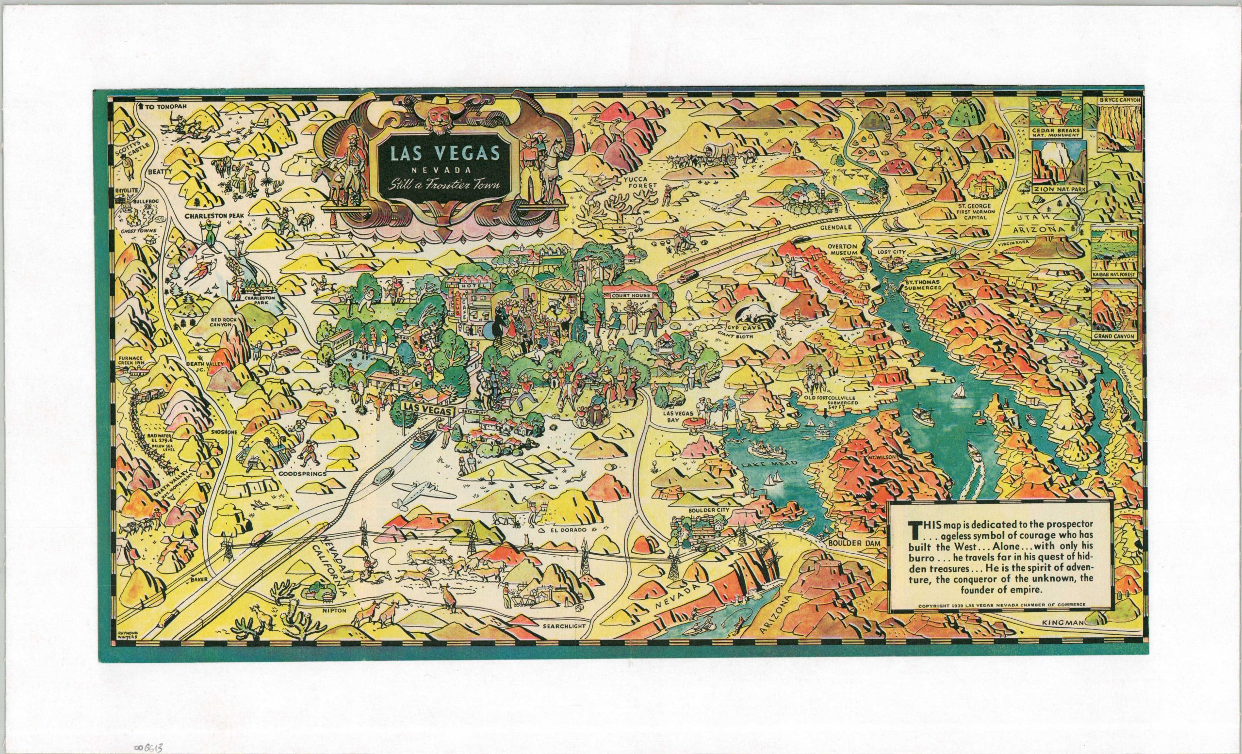
Charming pictorial map of Las Vegas and the surrounding area.
1 in stock
Description
This map, originally published in a promotional foldout for Las Vegas and Boulder Dam, depicts the area from Death Valley to Lake Mead and includes a decorative strapwork cartouche flanked by cowboys and prospectors. According to a corresponding text box, these dedicatory figures are “ageless symbols of courage who built the West” and the map represents the environment in which “the spirit of adventure, the conqueror of the unknown and the founder of empire” still existed. Even the title of the map alludes to the frontier nature of Las Vegas and the surrounding area: an interesting perspective to take by a local Chamber of Commerce.
However, the completion of the Hoover Dam in 1935 and the corresponding wide availability of electricity in the area shortly thereafter propelled Las Vegas (albeit slowly, at first) to the destination of bright lights we’re familiar with today. This ‘modern’ side of the city can be seen through the illustrations of marriage ceremonies, raucous dance halls, golfing, rodeos, and horse races, which are juxtaposed against scenes of mining, cattle driving, and hunting in the neighboring regions.
The map was designed by Raymond Winters and copywritten in 1939 by the Las Vegas Chamber of Commerce.
Map Details
Publication Date: 1939
Author: Raymond Winters
Sheet Width (in): 16.1
Sheet Height (in): 8.9
Condition: A
Condition Description: Vibrant color printed pictorial map with trimmed margins, professionally mounted onto linen for preservation and stability. Very good condition overall.
$175.00
1 in stock