
Las Vegas Fun Map
$450.00
The scarce second edition of King’s groovy map of Vegas.
1 in stock
Description
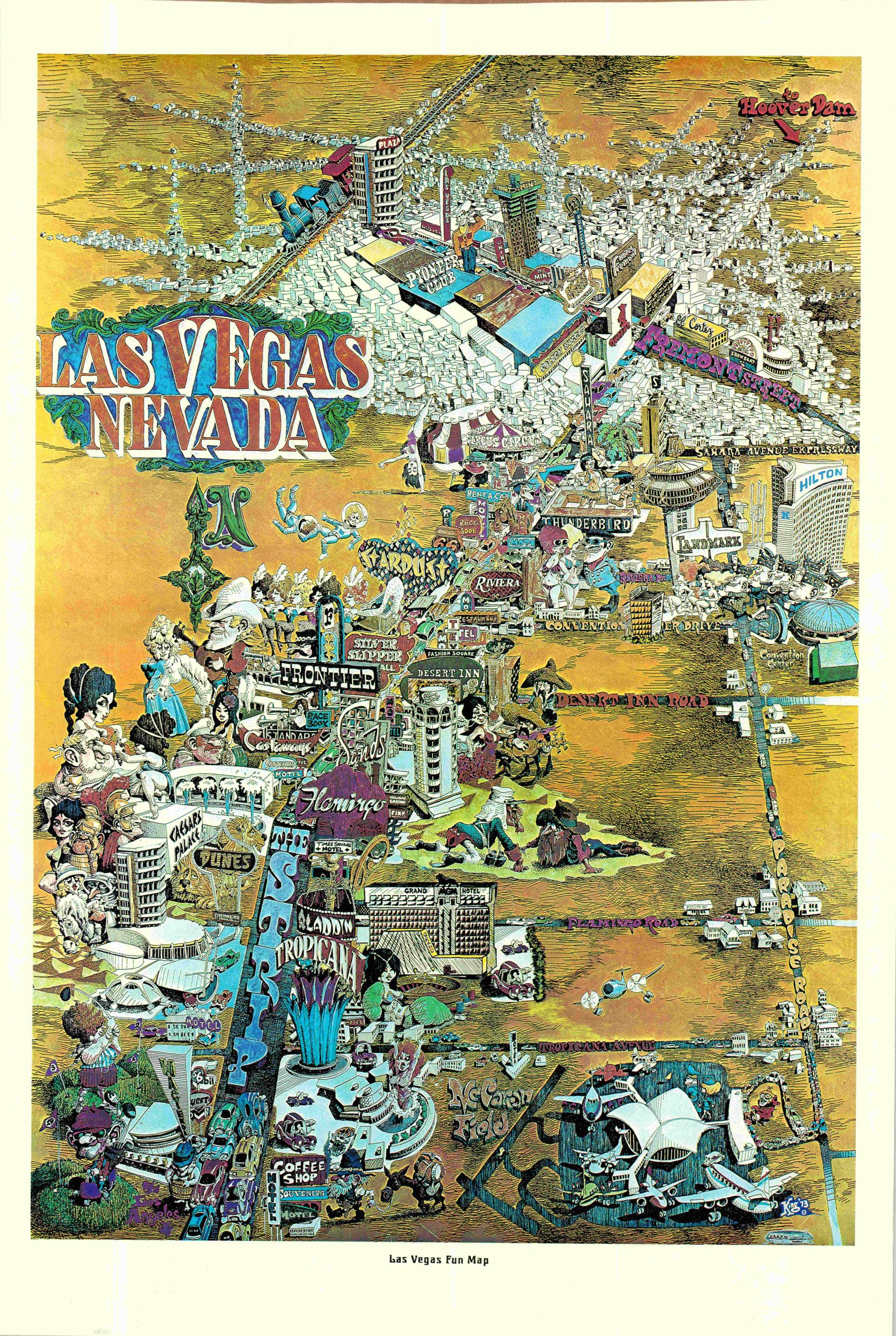
This amusing map of Las Vegas presents a whimsical overview of Sin City during the early 1970s. The iconic Strip is flanked by a series of lavish casinos, with their distinctive signage largely standing in for the physical structures. Popular destinations at the time included Caesars Palace, the Flamingo, the Sands, and the Stardust.
As one travels through bumper-to-bumper traffic, they encounter historic Fremont Street and the rapidly expanding neighborhoods, generically pictured as featureless white buildings. Paradise Road, connecting the Convention Center with McCarran Field, is also labeled, although the surrounding swathes of desert reflect the relatively undeveloped landscape of the area at the time. Throughout the composition, caricatured figures capture the allure of Las Vegas. Old fogies enjoy the golf course, beautiful dancers kick their legs, and lusty tourists abound. Yet signs of Old Vegas remain, including prospectors, cowboys, and steam engines.
The map is signed “King ’73” in the lower right, although the artist’s first name has not been definitively identified. King first created the map in 1960, while this scarcer second edition incorporates new construction and imagery at the cost of a slightly fuzzier image. Of particular note is the inclusion of the MGM Grand, which opened in December 1973, providing a useful clue to the dating of this revised edition.
Map Details
Publication Date: 1973
Author: King
Sheet Width (in): 25.00
Sheet Height (in): 38.25
Condition: A
Condition Description: Color printed map on a single-sided sheet of glossy paper. Lightly creased throughout as a result of being previously rolled. Very good to near fine condition overall.
$450.00
1 in stock