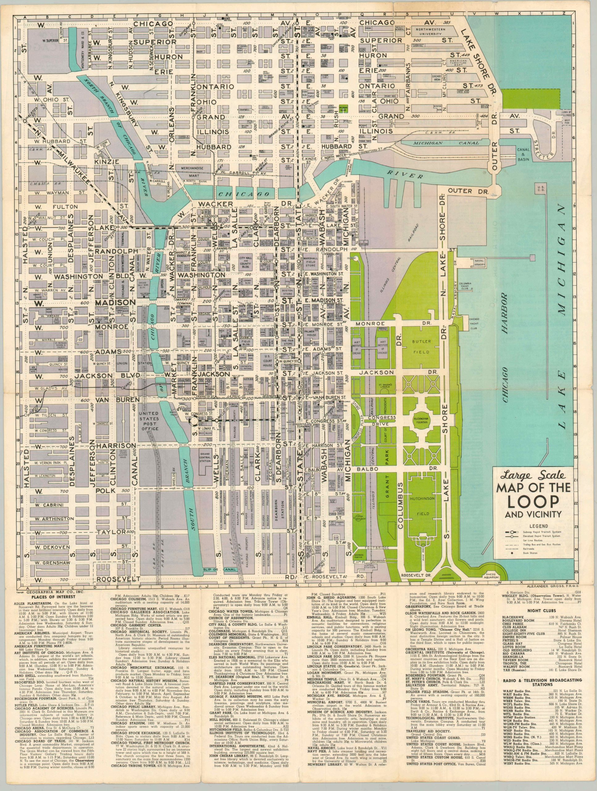
Large Scale Map of the Loop and Vicinity
$125.00
Interesting look at the heart of pre-war Chicago.
1 in stock
Description
The Chicago River and Lake Michigan have been at the heart of the city’s development since the earliest settlement, and it is no different in this pre-war map of the area known as the Loop. With the two water features and Roosevelt Road comprising the boundaries, the etymology is likely derived from the elevated railways that encircled the area. It is the commercial and transportation district of Chicago, which explains the purpose behind a detailed large scale map like this one.
In addition to typical information available in the legend like transit routes and, interestingly, bookstores, this map also labels dozens of important buildings within the Loop, River North, and Near West. It’s easy to imagine the work required to confirm the orientation of each building on each block, which perhaps explains why most maps don’t provide this level of granular detail. Below and on the verso are organized lists of locations within the city including night clubs, restaurants, churches and department stores. A detailed transportation map of the Chicago area is also present on the verso.
Map Details
Publication Date: c. 1936
Author: Alexander Gross
Sheet Width (in): 20.5
Sheet Height (in): 26.8
Condition: B+
Condition Description: Originally issued fold lines exhibit some wear and beginnings of separation at intersections. Fading evident in a few panels on the right side.
$125.00
1 in stock