Land Use in Chicago Volume II Chicago Land Use Survey
An intimate examination of the composition of Chicago in 1941.
Out of stock


Description
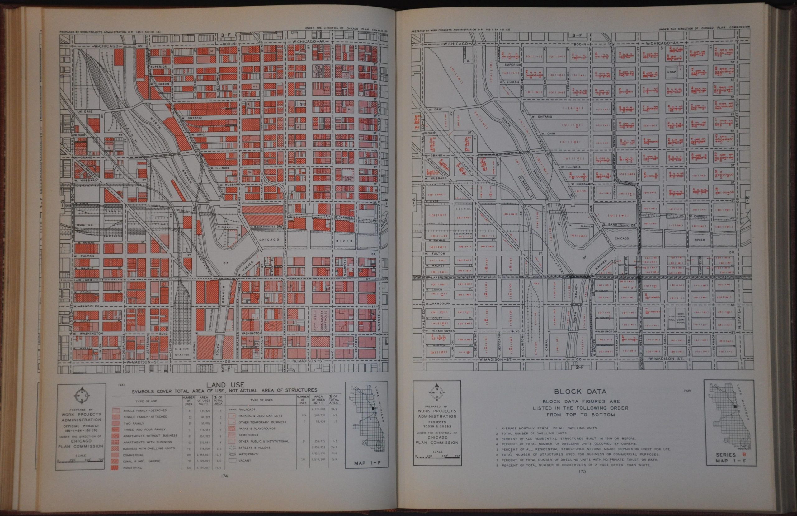
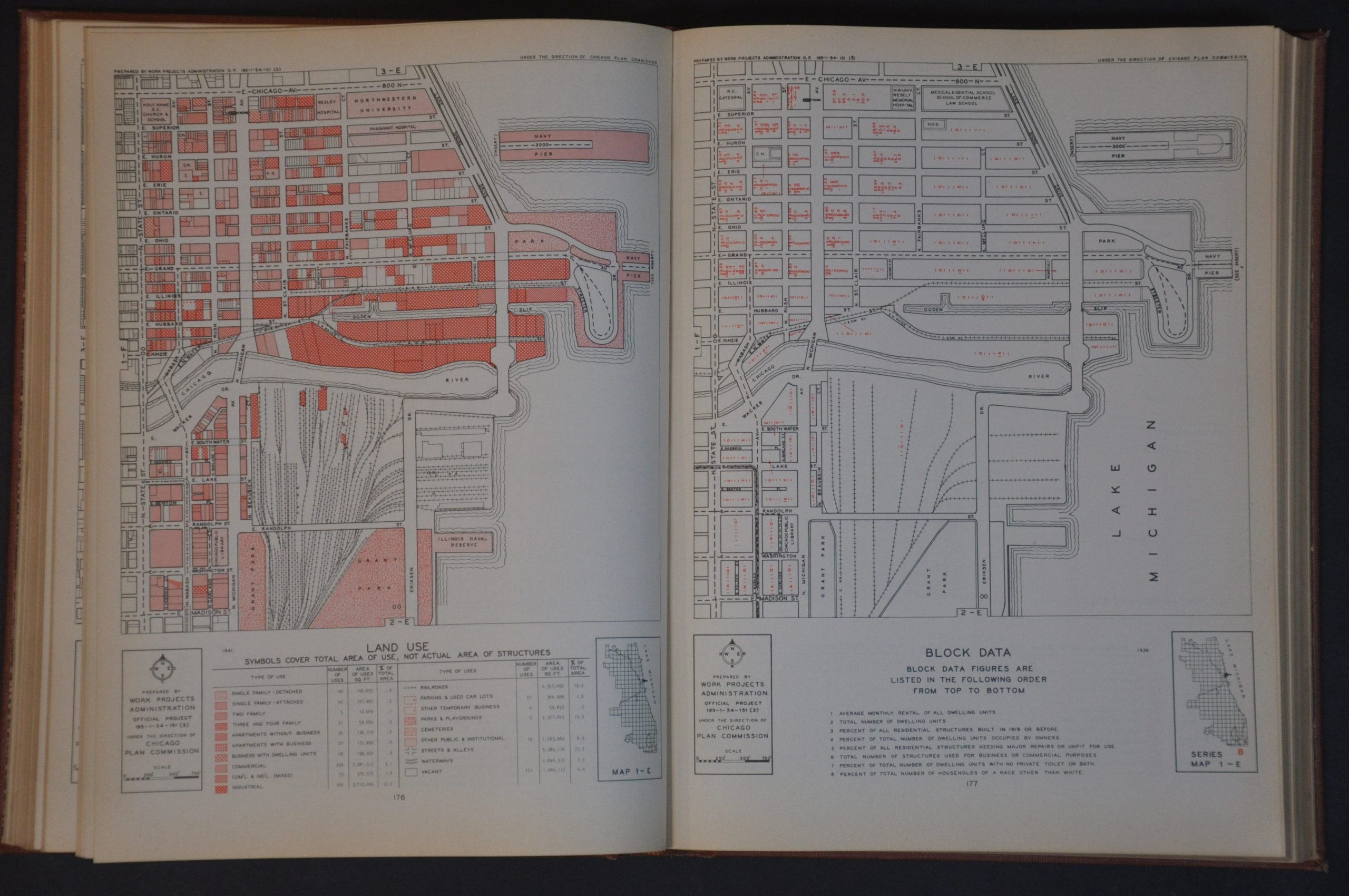
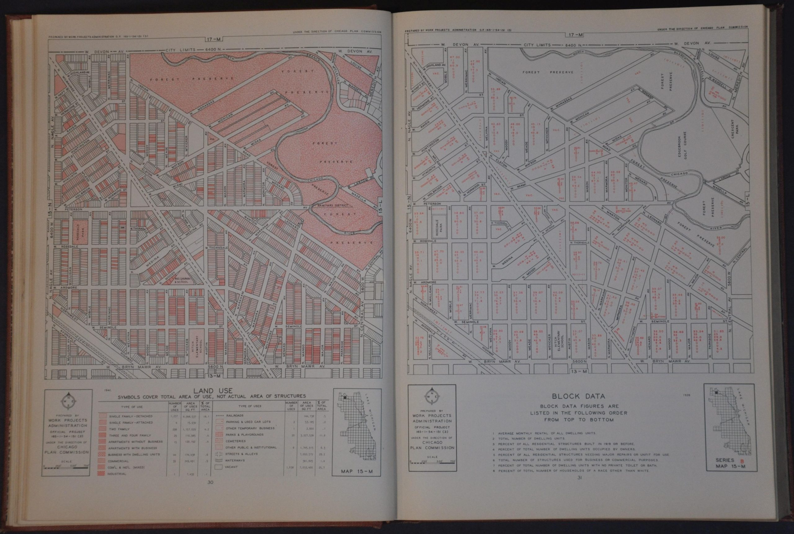
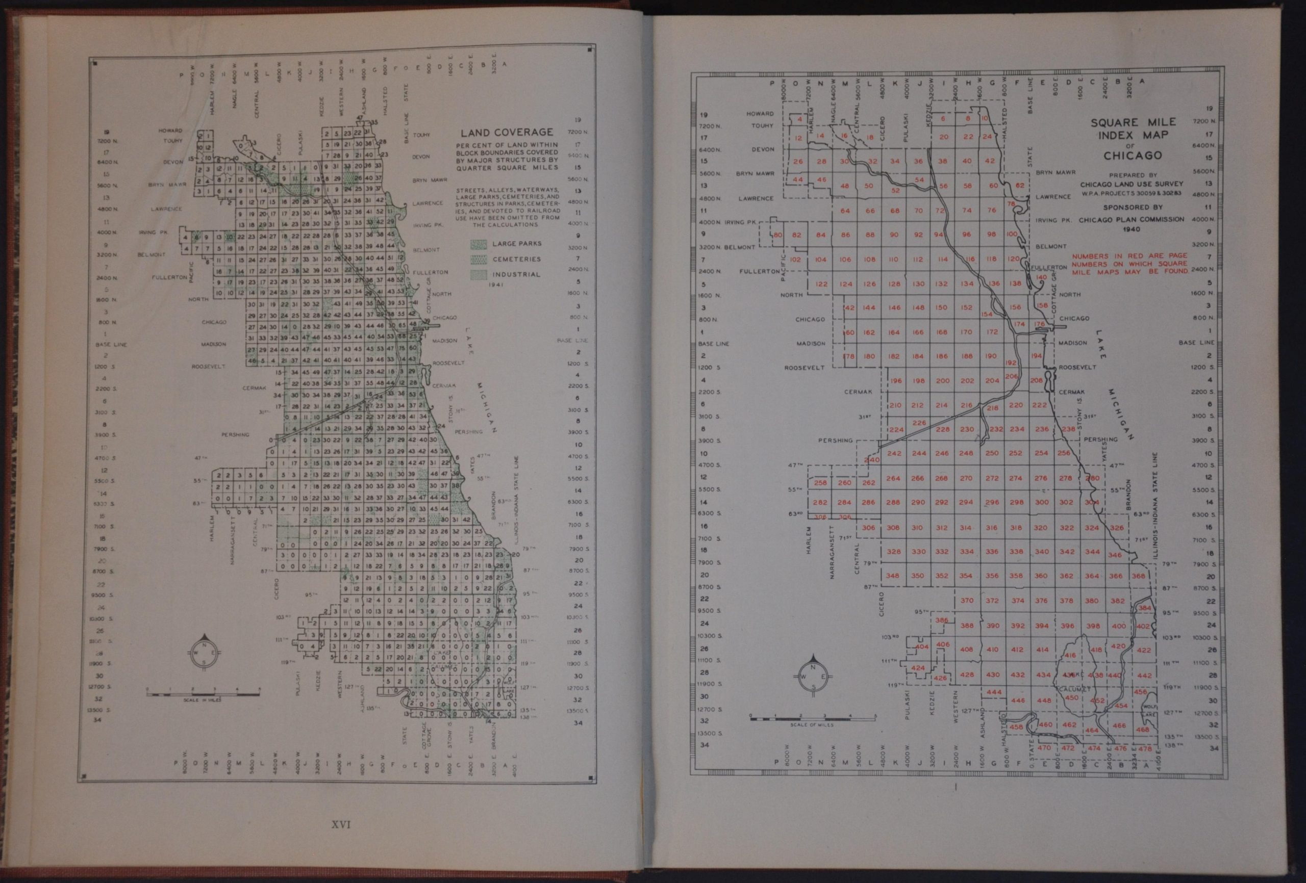
This minute overview of Chicago provides a block-by-block plan of the entire city limits during the early 1940s. A series of around 240 maps prepared by the Works Project Administration each show approximately 1 square mile (for the most part). The left sheet presents land use, while the right offers block data for the same parcel.
Each page notes notable buildings, geographic features, transportation infrastructure, and more. Red overprinting defines various types of uses, including residential, commercial, industrial, parks, cemeteries, and parking lots. Embedded data notes various statistics, including the number of units, average monthly rent, residences without proper amenities, and “Percent of Total Number of Households of a Race Other Than White.” Striking levels of segregation are evident across Chicago.
Map Details
Publication Date: 1941
Author: Chicago Plan Commission and Work Projects Administration
Sheet Width (in): 12.25
Sheet Height (in): 9.50
Condition: B+
Condition Description: Vol. II only. i - xvi + 479 pages, all bound in original red cloth. Covers are moderately worn and soiled, with some dirty fingerprints also obscuring the title page. Contents are generally in good condition, with toned margins and the odd creased corner, spot of dirt, etc. Old owner's rubberstamp. Good condition overall.
Out of stock