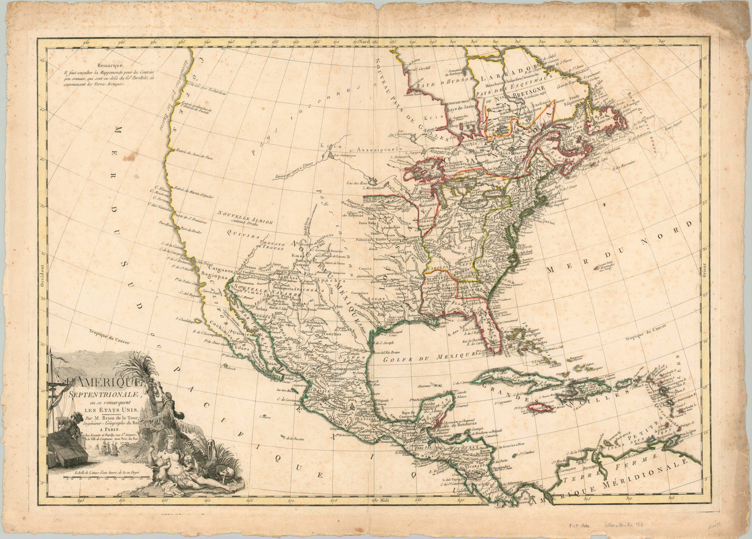
L’Amerique Septentrionale ou se Remarquent Les Etats Unis
A rare example of one of the earliest printed maps to name the United States.
Out of stock
Description
This is the first state of Brion de la Tour’s copperplate engraved map of North America, which is only the second printed map to name the United States (preceded only by the 1778 map by J.B. Eliot), and the first to use it in the title. Though the nominal nation was fighting for its life in the midst of the Revolutionary War, this may have been an effort by the French to showcase their support for the fledgling Yankees.
Color is successfully used throughout the image to outline the various territories of competing rival powers. The new country is outlined in green east of the Appalachian Mountains, with the original English territorial claims shown extending west to the Mississippi River (Illinois was Virginia’s western-most county!). An annotation next to the river identifies it as “the limits of the Spanish and Anglo-American dominions.” Remaining British claims are relegated to the Midwest and Great Lakes Region.
Further west, much of the area is labeled as Pays inconnu (unknown lands), but there are several cartographic myths also prominently featured. The River of the West can be seen in the middle of the region, while the legendary golden Spanish city of Quivira and phantom islands in Lake Superior also make an appearance.
The map also includes a large, decorative cartouche in the lower right corner. An allegorical Native American representing the continent (wild, but bounteous, surrounded by fruit and game) can be seen suckling two cherubs – representations of commerce and shipping that are further reinforced by the other imagery in the cartouche.
Reference: Sellers & Van Ee #166. Ristow pp. 61-62.
Map Details
Publication Date: 1779
Author: Brion de la Tour
Sheet Width (in): 31.50
Sheet Height (in): 22.75
Condition: B+
Condition Description: Scattered foxing visible throughout the image, concentrated most heavily along the right half of the sheet. One larger stain is visible in the Pacific Ocean, but otherwise the image is clean and features original outline color. The margins are soiled and worn, but most of it remains well away from the image with the exception of the upper right corner. Remains in good to very good condition overall. Printed on watermarked paper.
Out of stock

