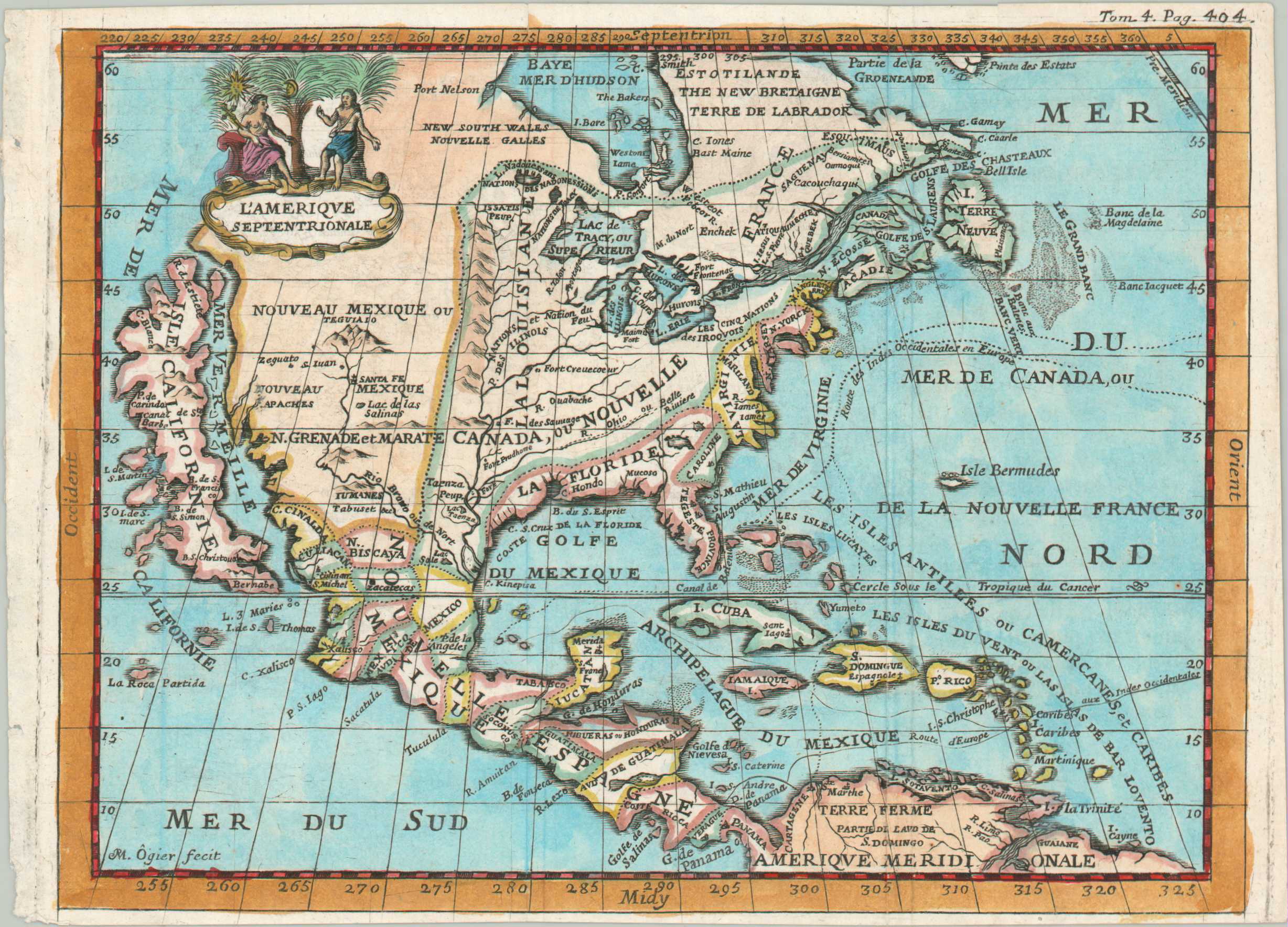
L’Amerique Septentrionale
A quaint map of North America featuring California as an Island.
Out of stock
Description
This unusual and uncommon map of North America was engraved by Matthew Ogier and published near the end of the 18th century. It reflects an interesting mix of European geographic conceptions and priorities about the continent.
The Great Lakes are immediately recognizable and somewhat close to their ‘true’ form, though the Mississippi Valley and presentation of California as an island are outdated and inaccurate representations. Several fishing banks are labeled off Newfoundland, emphasizing the importance of the massive commercial fishery to the global economy. Primary shipping routes, the path for Spanish treasure ships, are also shown.
Across New France, scattered fortifications contrast with different Native American tribes. The implied conflict is continued through the decorative title cartouche, which shows a Native American holding a cross.
Map Details
Publication Date: c. 1700
Author: Matthew Ogier
Sheet Width (in): 8.1
Sheet Height (in): 5.75
Condition: A-
Condition Description: Small copperplate engraved sheet disbound from a 17th century travel volume. Soft creasing along old folds and narrow margins, as issued. Nice modern hand color. Very good condition overall.
Out of stock