Lake Regions of Northern Minnesota
An interesting map of the canoe routes in Minnesota’s North Woods region.
Out of stock
Description
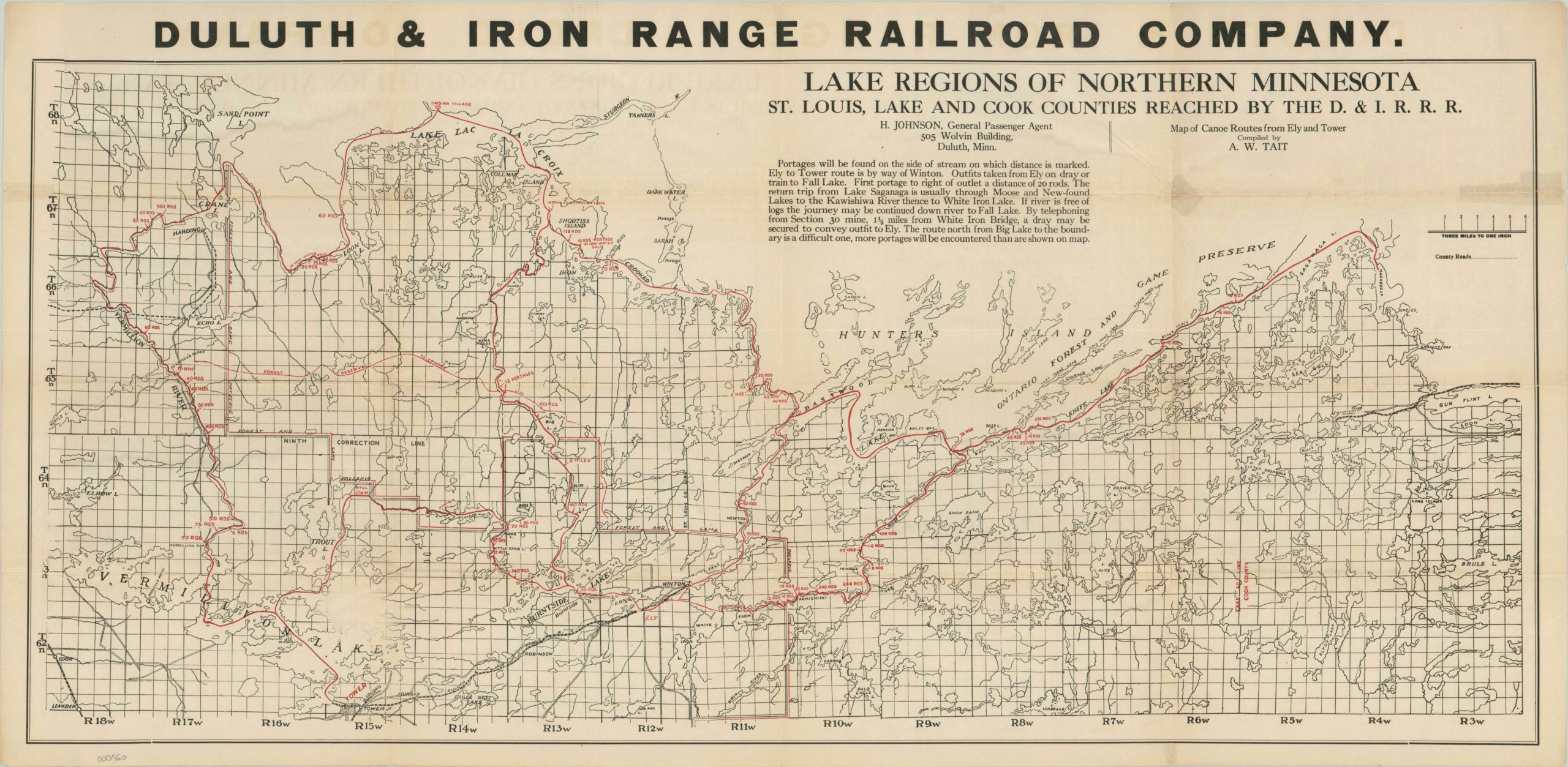
Although the name Duluth & Iron Range Railroad Company features boldly and prominently across the top of this map, the line itself plays a minimal role. Originally conceived in 1874 to service the route between Two Harbors and Soudan (the latter seen in the lower southeast), the primary purpose of the line was to haul minerals, primarily iron ore, from newly established mines in the region. By the early 20th century, mining operations had slowed and the railroad was looking to boost profits through alternative methods. One such idea was common among railroads – the tourist dollar.
Northern Minnesota is the region behind the state’s nickname “Land of 10,000 Lakes” and outdoor enthusiasts had lauded the area’s natural beauty for decades. Seeing an opportunity to capitalize on visitors to the area, the railroad sponsored this map, the focus of which is on canoe routes served from the towns of Tower and Ely, both of which are conveniently situated along the Duluth & Iron Range route. These canoe trips were not for the faint of heart – numerous listed portages represent only a portion of the difficulties. Communication, weather, wildlife, and provisioning were all challenges in the North Woods, but local entrepreneurs did their best to provide comfort and convenience. A text box under the title explains one such effort – a dray (flatbed wagon) could be called to transfer one’s canoe if portages were not cooperative.
Map Details
Publication Date: c. 1910
Author: A.W. Tait
Sheet Width (in): 32.25
Sheet Height (in): 16.00
Condition: B+
Condition Description: Creasing and some separation at fold lines and intersections, a few with old tape repairs. One faint area in lower left from surface abrasion, but overall very good.
Out of stock