La France Ses Conquetes, Ses Acquisitions & les Bornes
$90.00
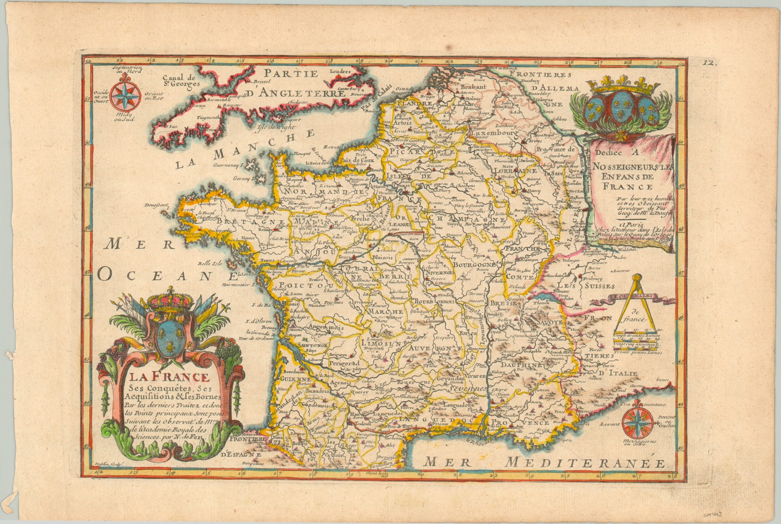
The kingdom of France in the early 18th century.
1 in stock
Description
This lovely copperplate engraved map is a visual celebration of the kingdom of France under Louis XIV, alternatively known as the Sun King. At the time, France was the dominant power on the continent and was protected largely by the natural borders of the Pyrenees, the Atlantic Ocean, the Mediterranean Sea, the English Channel, the Rhine River, and the Alps.
A variety of different settlements are labeled, with small symbols above each denoting its ecclesiastical status as a diocese or archdiocese. Canals, geographic features, and French regions are also noted throughout. Two decorative cartouches feature symbols of French regal authority, including the coat of arms and a crown. Also of note are the two compasses roses, one in French and one in Italian.
The map was published in Paris by Nicholas de Fer, Royal Geographer to the Dauphin (son of the king) of France, in 1705. It is dedicated to ‘our lords the children of France’, according to the text in the upper right.
Map Details
Publication Date: 1705
Author: Nicholas de Fer
Sheet Width (in): 15.4
Sheet Height (in): 10.4
Condition: A-
Condition Description: Light soiling visible around the outer edges of the sheet, most evident in the lower right where it just enters the image. One small spot in the upper margin. Very good condition, with attractive modern hand color.
$90.00
1 in stock