
L. & N.W.R. Illustrated Route Map
$75.00
A two-dimensional tour of the primary railroad between London and Liverpool.
1 in stock
Description
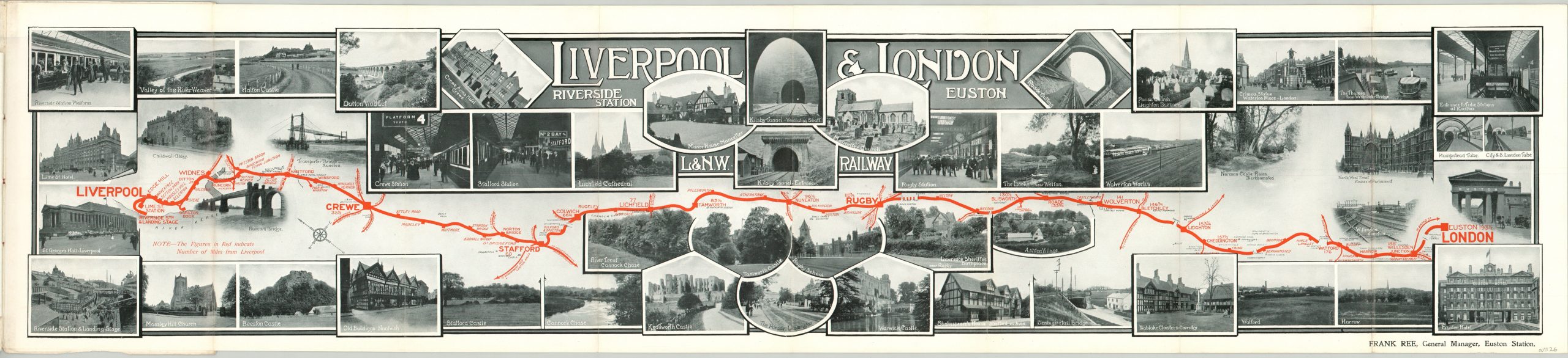
The line between Liverpool and London’s Euston Station is almost an afterthought on this map, which is featured as a centerfold in a promotional pamphlet for the London & North Western Railway. A bevy of photographs showcasing the sights along the line immediately captures the attention of the audience, primarily Americans arriving in Liverpool.
The linear route is shown boldly in red, with adjacent numbers indicating distance traveled from Liverpool in miles, rather than kilometres. An accompanying 31 pages of text provides a detailed description of the places of interest passed through by the trains, called “American Specials.”
The map is attributed to Frank Ree, General Manager of the Euston Station who would be knighted in 1913, and was printed in London by McCorquodale & Company.
Map Details
Publication Date: c. 1912
Author: Frank Ree
Sheet Width (in): 37
Sheet Height (in): 8.2
Condition: A-
Condition Description: Map folds out from 8 panels into centerfold of accompanying travel guide. Smaller guidebook (also attached) is 31 pages. All in good shape; clean with faint wear along fold lines. Original paper covers are soiled and have blue ink markings, but otherwise in good condition.
$75.00
1 in stock