
KNTV…The Way to San Jose
$400.00
The marketing power of TV in the Bay Area during the mid-1970s.
1 in stock
Description
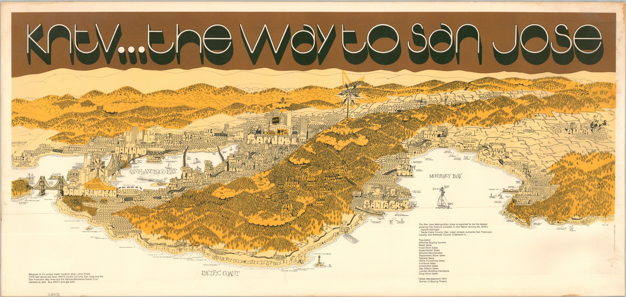
“Because of its unique tower location atop Loma Prieta, 4,079 feet above sea level, KNTV covers not only San Jose and the San Francisco Bay Area, but the Salinas/Monterey/Santa Cruz markets as well. Buy KNTV and get both.” – Text in lower left.
This incredibly vibrant and eye-catching promotional view of the San Francisco Bay Area and Central Coast was illustrated by artist Warren Lamb and published in 1974 by television station KNTV (Channel 11). Designed as a media-buy marketing piece, the map was distributed to entice regional and national corporate advertisers to purchase airtime by highlighting the station’s massive dual-market broadcast range.
The highly stylized pictorial landscape captures a charming snapshot of the region just prior to the sweeping tech boom that fully transformed the Santa Clara Valley into Silicon Valley. Meticulously detailed vignettes represent the local “flavor” of various municipalities, contrasting the dense urban concentration around the Bay with the sprawling, fenced cattle ranches of Salinas and the rugged, separating mountain ranges. Rendered in a warm, undeniably 1970s palette dominated by two distinct shades of muted orange, the map relies on these tones as an aesthetic design choice to delineate geographic zones rather than to mathematically chart the station’s actual broadcast contours.
Map Details
Publication Date: 1974
Author: Warren Lamm
Sheet Width (in): 29.50
Sheet Height (in): 14.00
Condition: B
Condition Description: Color printed map on a single sided sheet of sturdy, textured paper. Moderate toning along the edges and some visible surface soiling along the right side, extending beyond the margin into the image. Good condition overall.
$400.00
1 in stock