Know Your Illinois
$110.00
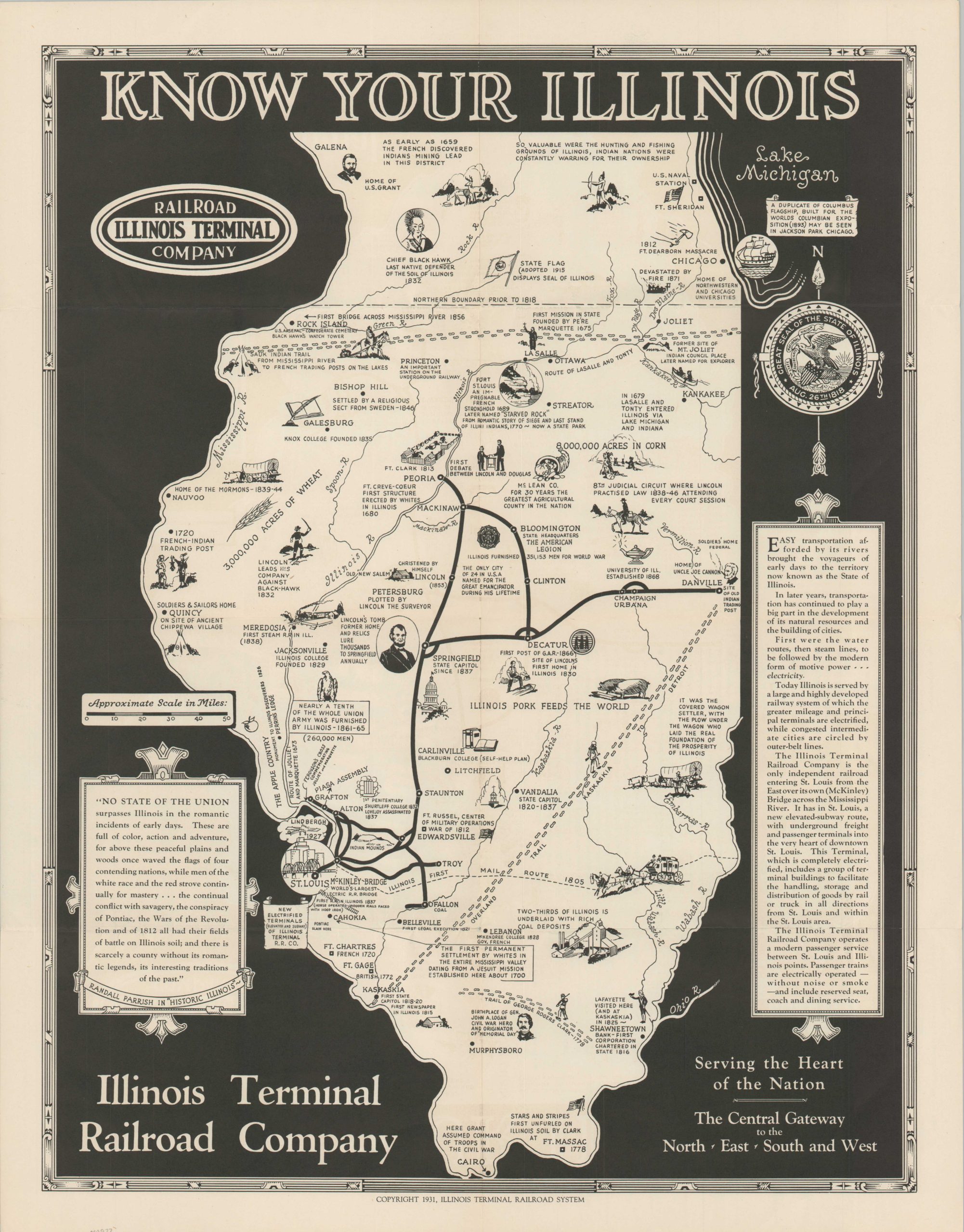
Bold black & white pictorial advertising for both a state and a rail network.
1 in stock
Description
This map presents an interesting mix of the old and the new in the state of Illinois. The route of the Illinois Terminal Railroad Company and its state-of-the-art passenger service is shown in black through the center of the state, while the rest of the area is occupied by illustrations and notes related to historic events. In fact, the only other networks of transportation shown are important routes traveled by notable explorers and Native Americans, despite text assuring the reader that “today Illinois is served by a large and highly developed railway system.” Further examples of state pride are evident throughout the production; as several areas within the map relate to rich agricultural opportunities and a glowing excerpt from Randall Parish’s “Historic Illinois” is provided in the lower left.
The map was published by the Illinois Terminal Railroad System and is dated 1931, though text on the verso indicates this example was issued in 1937. Also of interest on the verso is a table outlining the “Chain of Title” to the land comprising the state, from the original Illinois Indians (Extent of Claim: Indefinite) to admission as a state by Congress in 1818.
Map Details
Publication Date: 1931
Author: Illinois Terminal Railroad System
Sheet Width (in): 18.75
Sheet Height (in): 24.1
Condition: A
Condition Description: Creasing along originally issued fold lines and faint wear along the outer edges of the sheet, consistent with age. Near fine overall.
$110.00
1 in stock