Kardpak Sectional Auto-Trails Ohio
$80.00
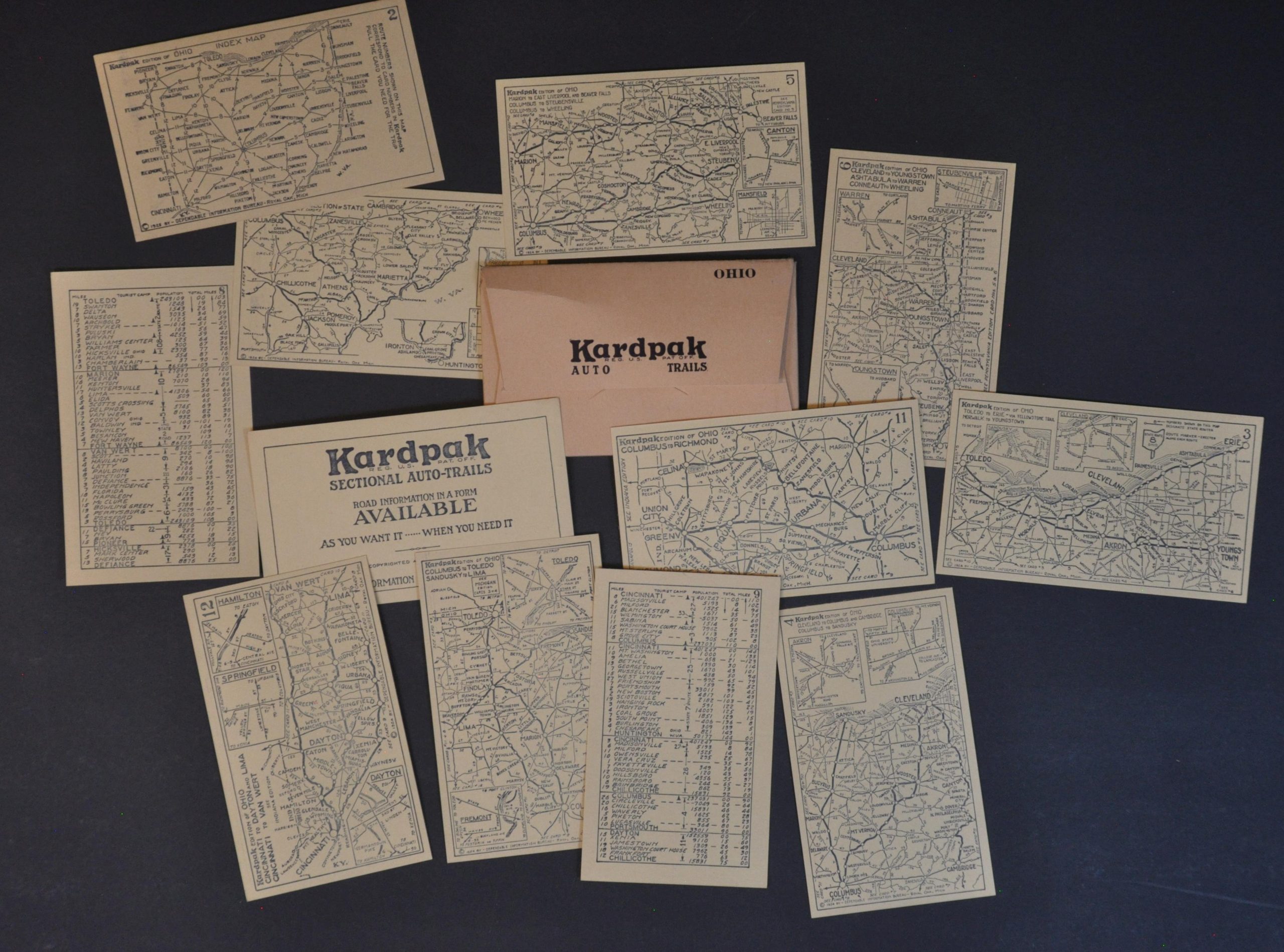
A neat little set of cards covering Ohio’s roads during the mid-1920s.
1 in stock
Description
“Road Information In a Form Available As You Want It — When You Need It.”
This quaint little collection offers a pocket-sized guide to the roads of Ohio. A key map and plan of the area around Cleveland are accompanied by 10 double-sided maps that show the primary automobile routes across different sections of the Buckeye State. Distances between points are noted and insets provide simple street plans of major urban centers. Town population and route mileage are printed on the verso of each card.
Copyrighted in 1925 by the Dependable Information Bureau of Royal Oak, Michigan. Originally sold for 25 cents, according to the original paper envelope. A text box on the Cleveland map notes there is a Kardpak Edition for Every State, but the complete sets are relatively uncommon on the market.
Map Details
Publication Date: 1925
Author: Dependable Information Bureau
Sheet Width (in): 5.00
Sheet Height (in): 3.10
Condition: A
Condition Description: Complete set of twelve double-sided map cards with original paper envelope. A bit of faint wear, but overall in near fine condition.
$80.00
1 in stock