
Johnson’s Turkey in Asia, Persia, Arabia, &c.
$95.00
The playing board of The Great Game.
1 in stock
Description
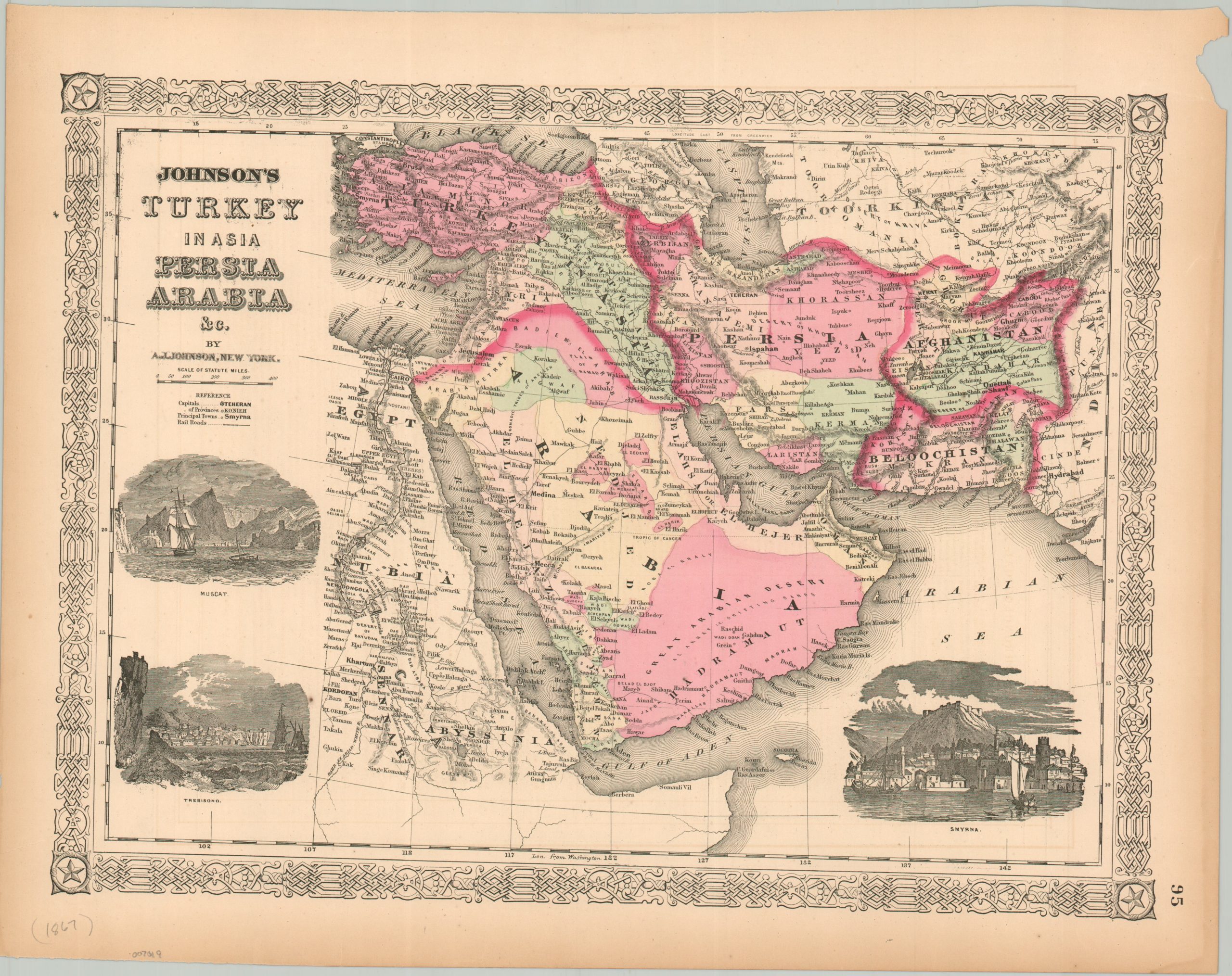
This beautiful antique map of the Middle East was originally published in the 1867 edition of Alvin Jewett Johnson’s New Illustrated Family Atlas. Soft color, applied by hand, outlines the political elements of the southern Ottoman Empire, Afghanistan (in the midst of a Civil War), Persia (Iran), an independent Balochistan (under British influence), and a largely unorganized Arabian Peninsula.
Caravan routes across the desert are noted. Toponyms identify a fascinating variety of ethnic groups, geographic features, important places, and more. Three vignettes show dramatic views of important port cities – Muscat, Trebisond, and Smyrna.
At the time of publication, much of the region was subject to the intense diplomatic rivalry between Great Britain and Russia that would become known as the Great Game. Both empires sought to expand their borders or protect overseas territories through the direct influence of vast regions in Central Asia. The map reflects a landscape not only of mountains and deserts, but of imperial ambition, with every frontier watched for signs of strategic advantage or encroachment.
Map Details
Publication Date: 1867
Author: A.J. Johnson
Sheet Width (in): 18
Sheet Height (in): 14
Condition: A-
Condition Description: Steel engraved map with original hand color. Wear in the margins, including toning, a chipped upper right corner and a closed tear, .5", repaired in the lower left. Faint offsetting from the black ink, most evident along the lower edge of the sheet. Good to very good condition.
$95.00
1 in stock