Johnson’s Texas
$250.00
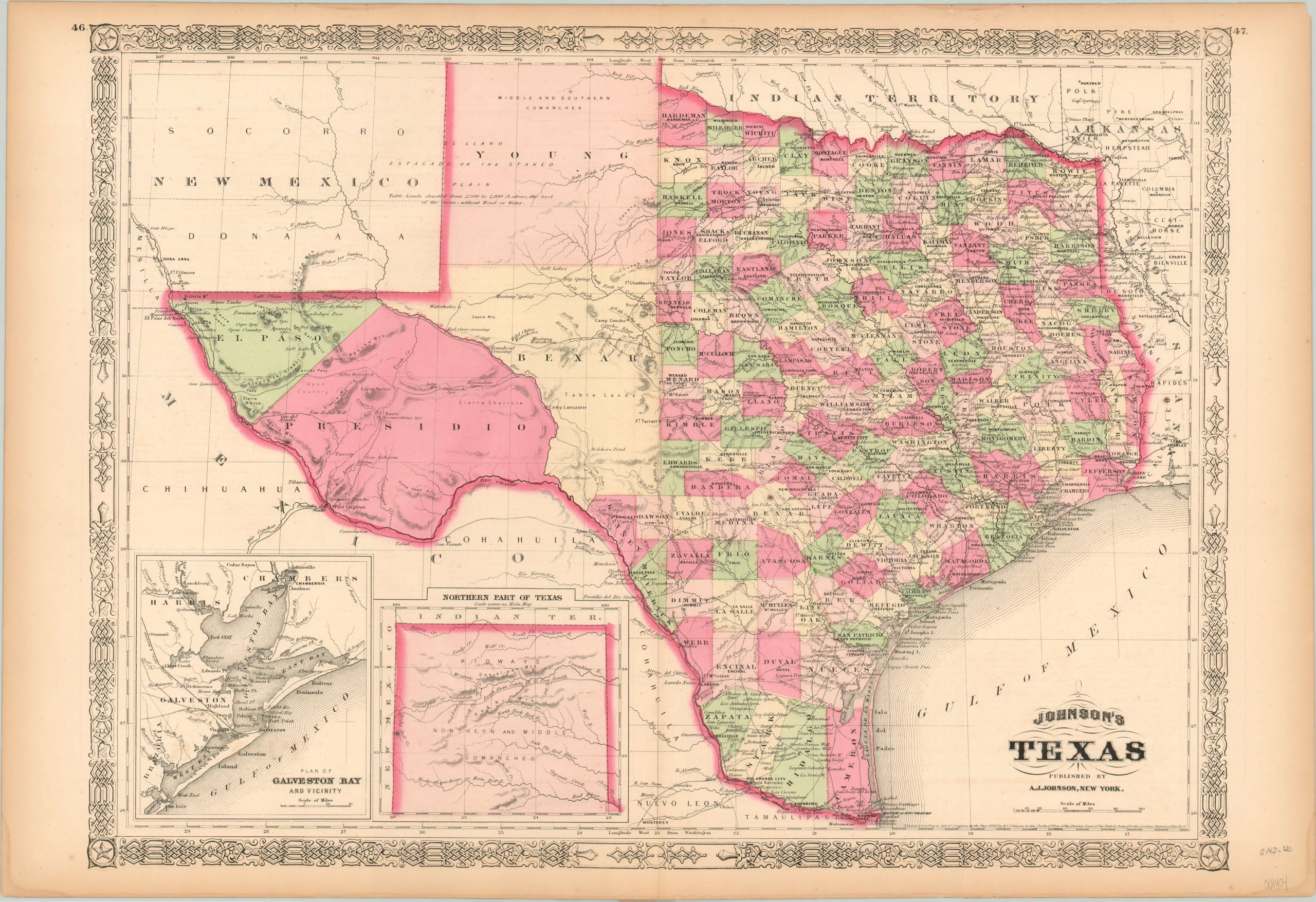
Detailed map of Reconstruction Era Texas.
1 in stock
Description
This detailed map of Texas highlights the disparity in settlement between the eastern and western portions of the state, with vast portions of the latter labeled as table lands (without wood or water), mountains and deserts. Springs, watering holes, and a few scattered forts are individually labeled and offer the only respite in the vast scrubland.
Much of the northern portions (including the area in the inset) are shown as home to the Comanches, though by the time the map was published their numbers had been decimated by war, disease, and forced relocation. A second inset of Galveston Bay shows the important harbor connected to one of the few railroads in operation throughout the state. Published in New York by Alvin Jewitt Johnson in 1866.
Map Details
Publication Date: 1866
Author: A.J. Johnson
Sheet Width (in): 26.50
Sheet Height (in): 18.00
Condition: B+
Condition Description: Faint toning along the outer edges of the sheet and two slight damp stains in the lower corners. Very good condition, a bold impression with nice original hand color.
$250.00
1 in stock

