Johnson’s Austria, Turkey in Europe, and Greece
$110.00
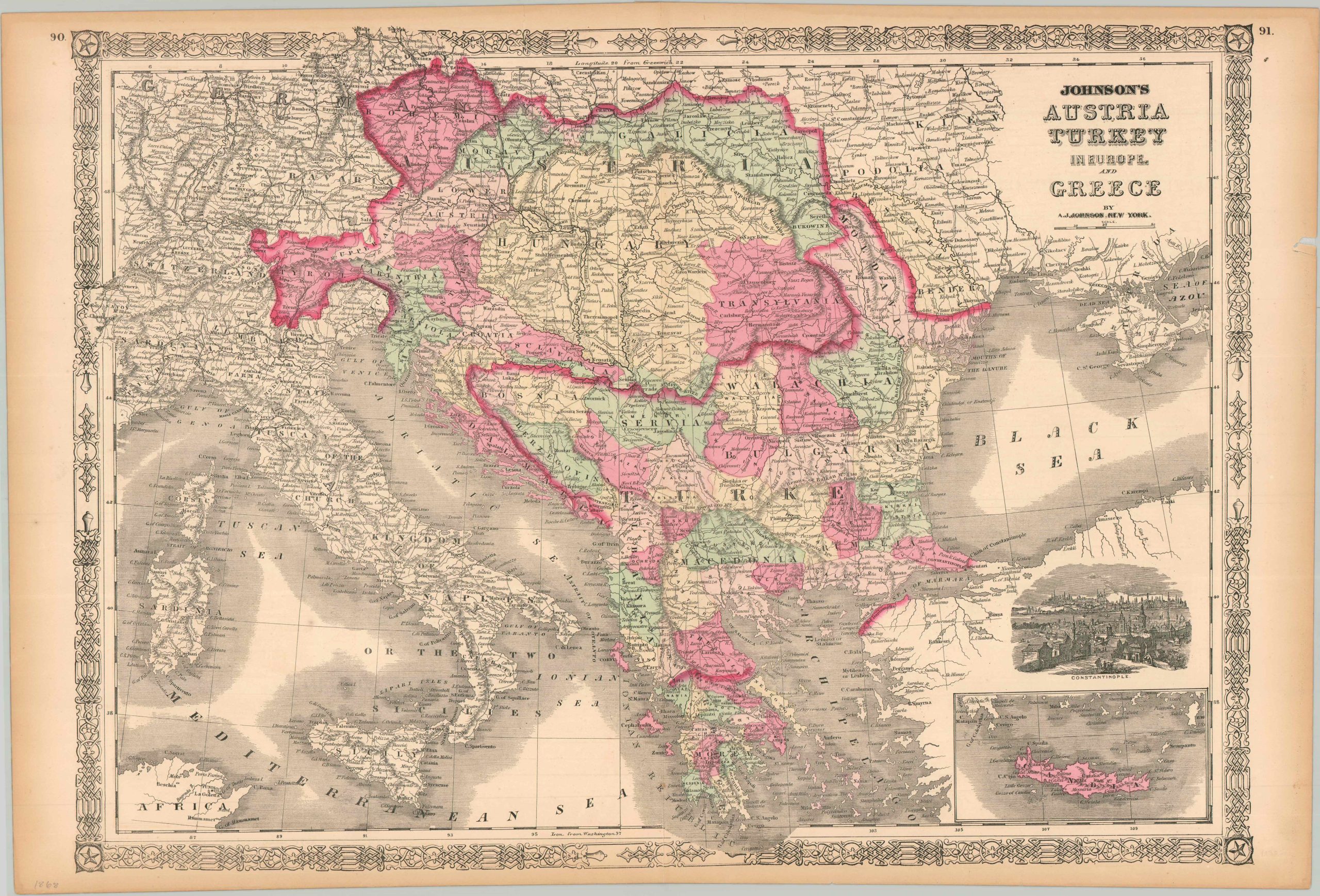
Mapping the decline of the ‘Sick Man of Europe.’
1 in stock
Description
This beautifully colored map focuses on the Balkan Peninsula, a historically volatile region that experienced a surge of nationalism and the 19th and 20th centuries. The stories of independent Serbia, Bulgaria, Croatia, etc. are beginning to take shape during this period, despite still nominally being a part of the Ottoman Empire or Austria-Hungary (as indicated by the heavy red outline). Numerous regions are shaded and individually labeled, though the realities of local self-identity, political affiliation, and ‘real’ administrative power were far more complex than the author could present. An inset in the lower right shows an outline of Crete, undergoing a bloody revolution at the time of publication. Immediately above is a view of Constantinople from the east, with the distinctive elements of Topkapi Palace and Hagia Sophia among the numerous towers and minarets in the skyline.
The map was published in New York in 1868. Originally issued as part of Alvin Jewett Johnson’s popular work, Johnson’s New Illustrated Family Atlas.
Map Details
Publication Date: 1868
Author: A.J. Johnson
Sheet Width (in): 26.60
Sheet Height (in): 18.00
Condition: B
Condition Description: Steel engraved map on toned and somewhat brittle paper, with several small edge tears repaired on verso. Vibrant original color, likely applied by stencil. Good condition overall.
$110.00
1 in stock