Japan
$850.00
Rare missionary map of Japan from the late 19th century.
1 in stock


Description
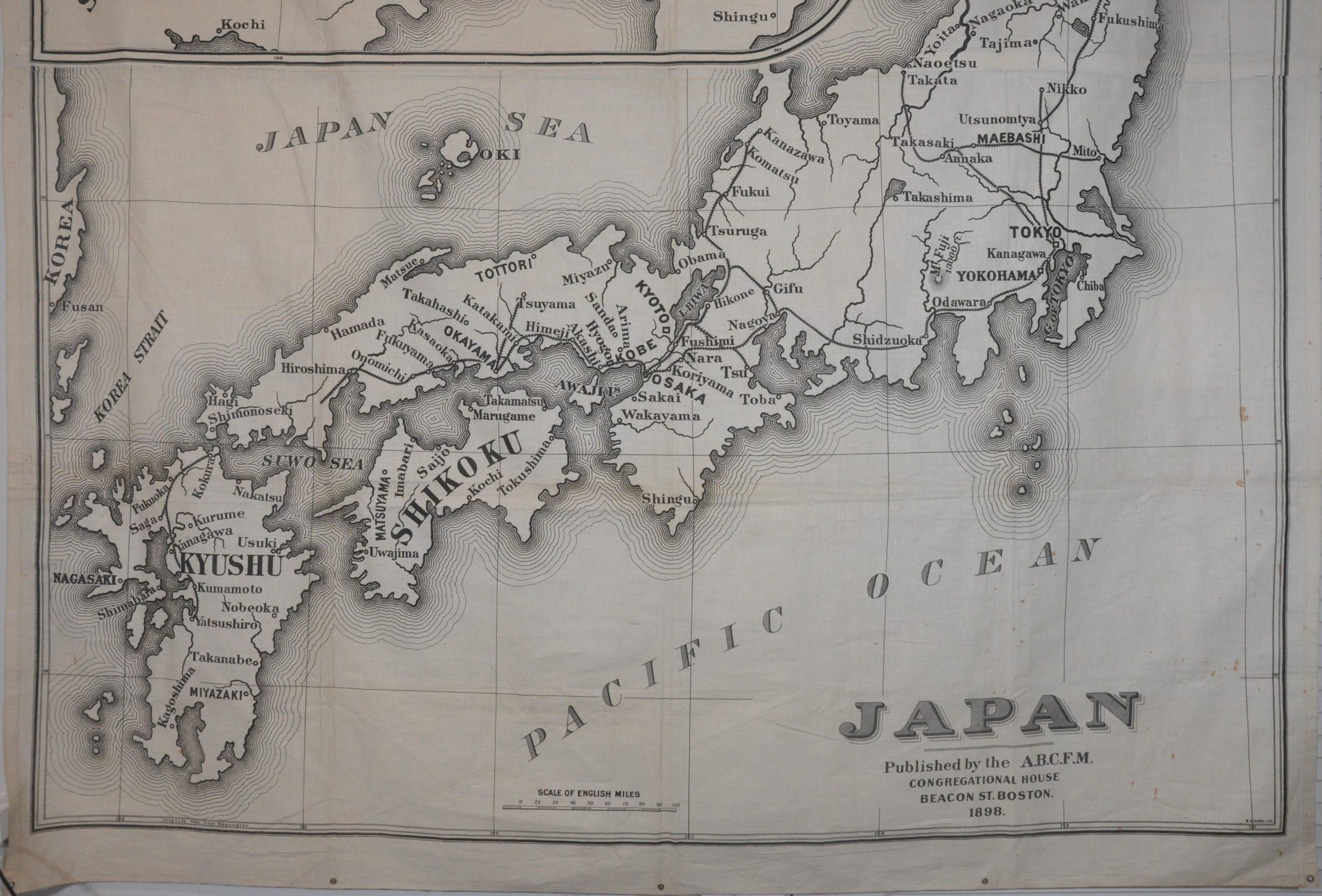
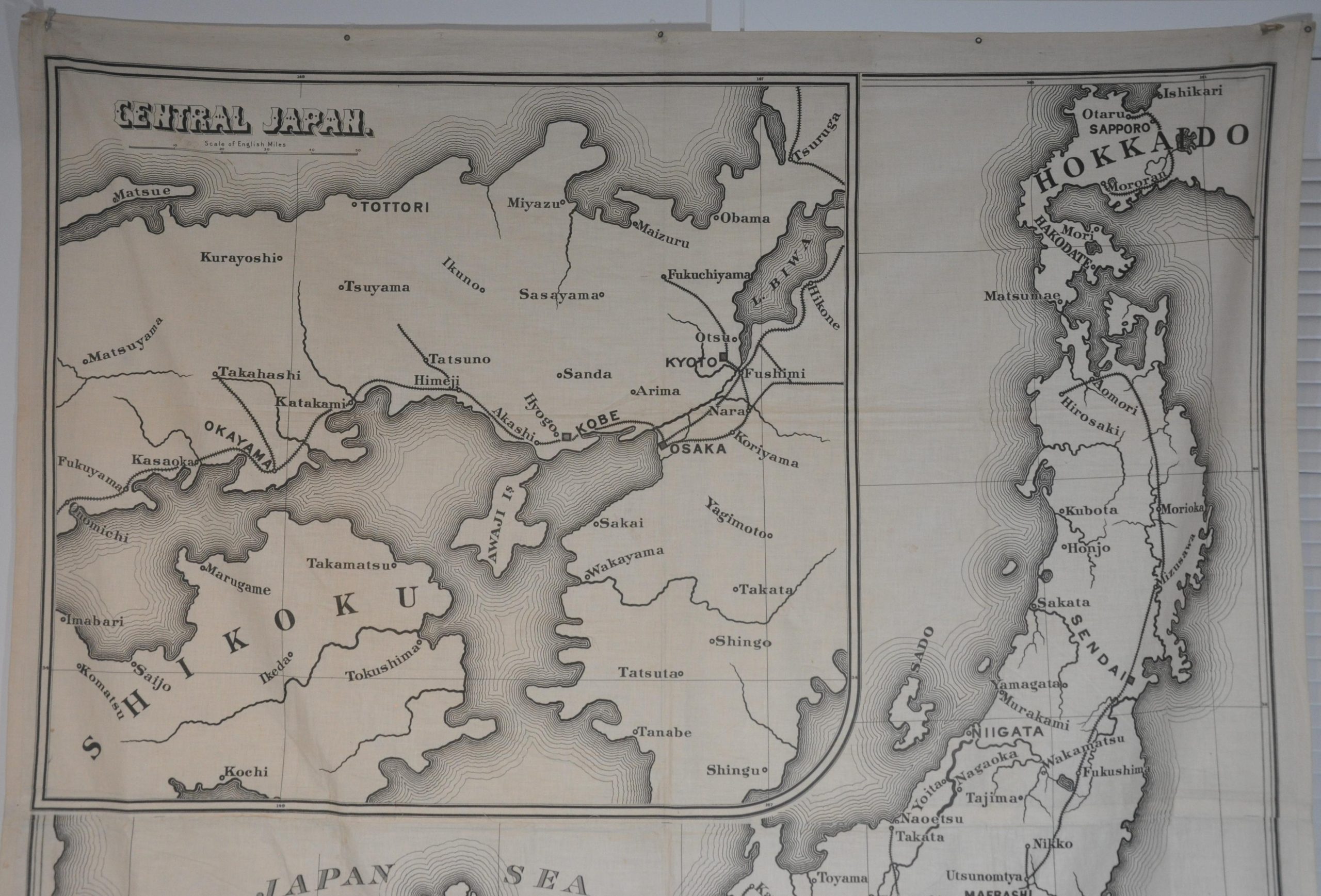
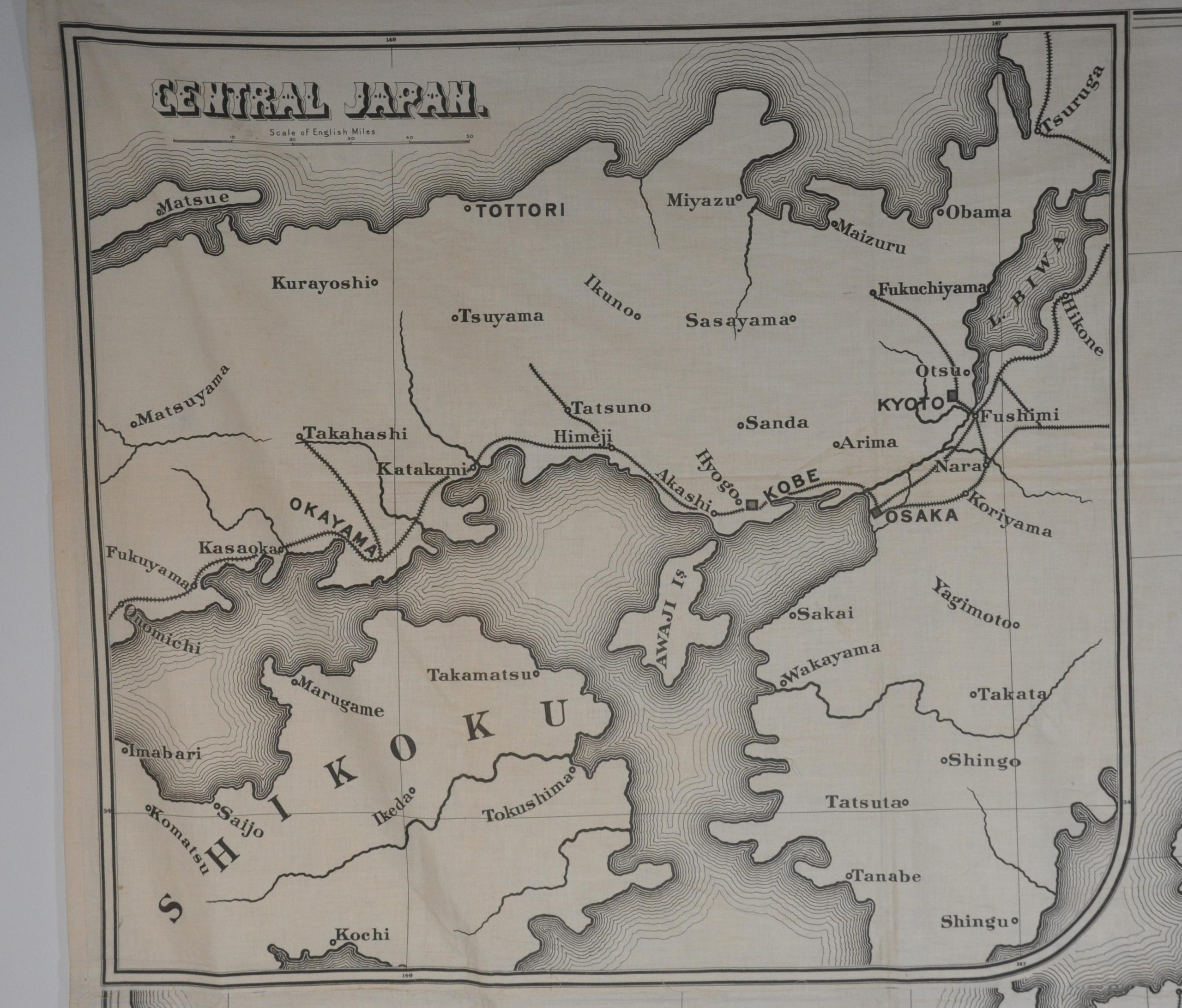
This gigantic map of Japan was published in Boston by the American Board of Commissioners for Foreign Missions (A.B.C.F.M.) in 1898. Organized in 1810, the ABCFM was one of the first Christian missionary organizations in the United States and supported Protestant Reformation religious traditions across the globe. Their first mission opened in Kobe, Japan in 1869, shortly after the Meiji Restoration.
The map, designed for display, presents a basic outline of the four primary islands – Hokkaido, Honshu, Shikoku, and Kyushu. Major cities, railroad lines, and geographic features are presented in an easily comprehensible format. An inset in the upper left emphasizes central Japan, the primary region of operations for the ABCFM. At the time of publication, the U.S. and Japan were experiencing increasing political and economic tension over influence in eastern Asia.
Regional dominance, especially in Korea, shifted from China to the Land of the Rising Sun after the one-sided results from the First Sino-Japanese War (1894-1895). The U.S. acquisition of the Philippines after the Spanish-American War and annexation of Hawaii in 1898 exacerbated the apprehension between the two nations.
Sources: Harvard Library; Congregational Library; Hathi Trust
Map Details
Publication Date: 1898
Author: American Board of Commissioners for Foreign Missions
Sheet Width (in): 56
Sheet Height (in): 68.25
Condition: A-
Condition Description: Two sheets joined along a vertical centerfold. Scattered staining visible in the lower right corner. Grommets punched into the margins to accommodate hanging, two of which are missing. Very good condition overall.
$850.00
1 in stock