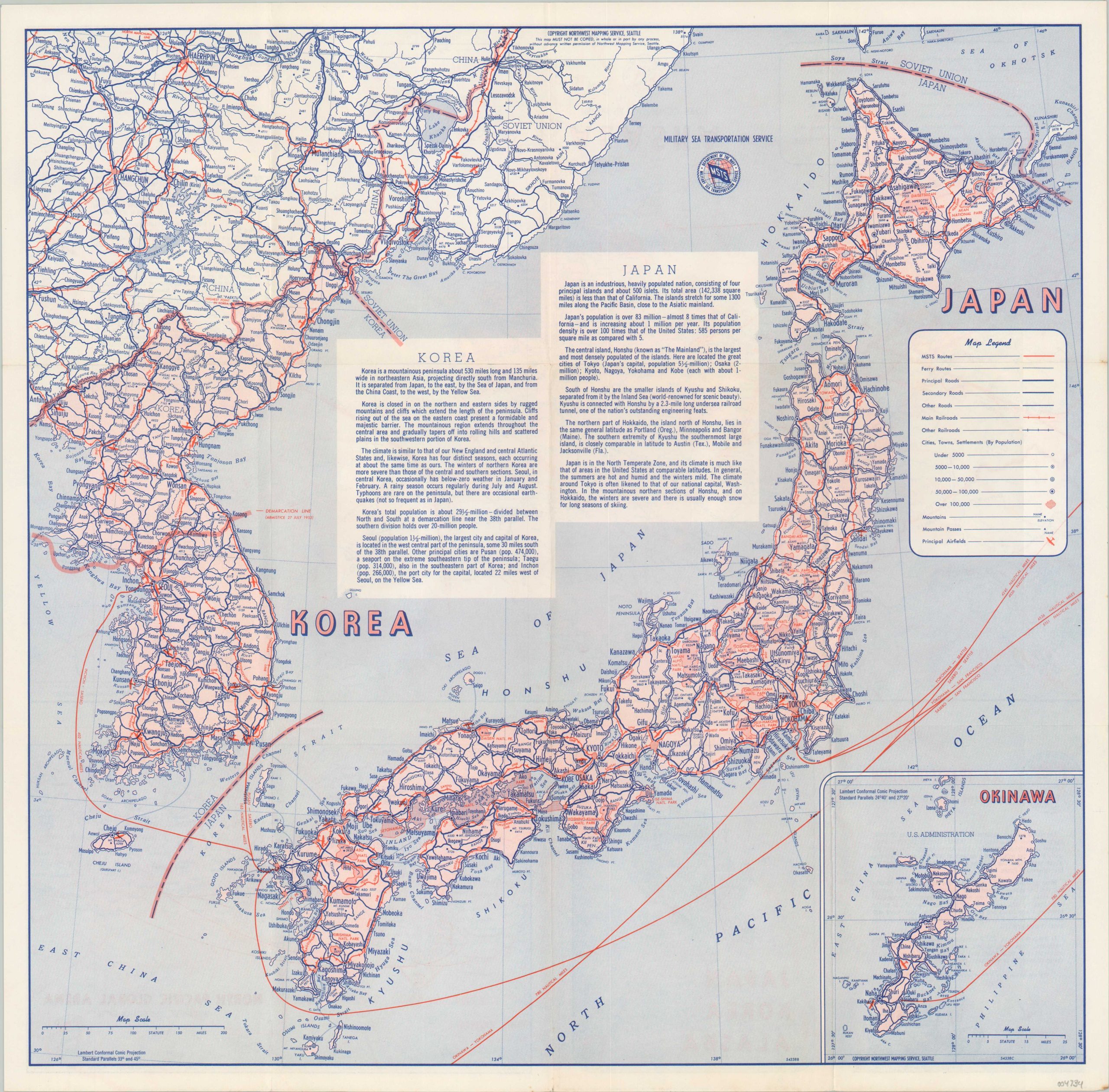
Japan Korea Alaska [Title on Verso]
$75.00
Reinforcing American troops via the Military Sea Transportation Service.
1 in stock
Description
“The Military Sea Transportation Services (MSTS) was set up under the Department of the Navy on 1 October 1949, to provide a single ocean-transportation system for all the Armed forces. Throughout the world MSTS has established a network of sea lanes and 40 terminal offices stretching across the globe from Casablanca to Adak and from Bremerhaven to Pusan…More than 90% of all the American armed forces and equipment now in the Japan-Korea area arrived there via the fleet of MSTS Navy ships and commercial ships under charter to MSTS.” [Text, verso].
This composite map was created in Seattle by the Northwest Mapping Service for distribution by the U.S. Navy’s Military Sea Transportation Services, probably around 1954 based on the date code in the lower corner. The centerfold image shows the primary transportation routes across Japan and Korea, the latter divided along the 38th parallel according to the armistice implemented the year prior (and still in effect today). Descriptive text provides contemporary details on each nation and the island of Okinawa can be seen in an inset in the lower right. The verso shows a similarly designed map of Alaska and a smaller map of the MSTS routes across the North Pacific.
Source: American Merchant Marine at War;
Map Details
Publication Date: c. 1954
Author: Northwest Mapping Service
Sheet Width (in): 17.25
Sheet Height (in): 16.9
Condition: A
Condition Description: Creasing along originally issued fold lines. Near fine overall.
$75.00
1 in stock


