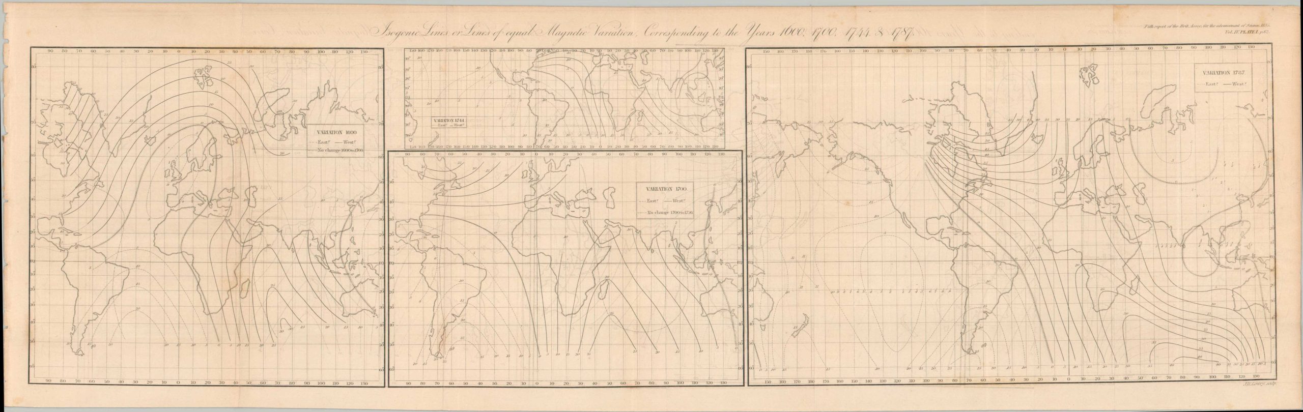
Isogonic Lines or Lines of Equal Magnetic Variation Corresponding to the Years 1600, 1700, 1744, and 1787
$75.00
Antique studies on magnetic declination.
1 in stock
Description
This rather self-explanatory print was published in London in 1835 as part of the Fifth Report for the British Association for the Advancement of Science. A series of four world maps using the Mercator Projection shows the global isogonic lines for the years 1600, 1700, 1744, and 1787. The level of variation in question is referring to the angle between magnetic north and true north at a particular location on the Earth’s surface magnetic declination, the angle between magnetic north and true north at a particular location on the Earth’s surface.
Map Details
Publication Date: 1835
Author: British Association for the Advancement of Science
Sheet Width (in): 25.25
Sheet Height (in): 10.25
Condition: B+
Condition Description: Engraved map, folded with six vertical creases. Minor offsetting and spotting consistent with age. Good condition overall. Blank on verso.
$75.00
1 in stock