Island of Oahu
$95.00
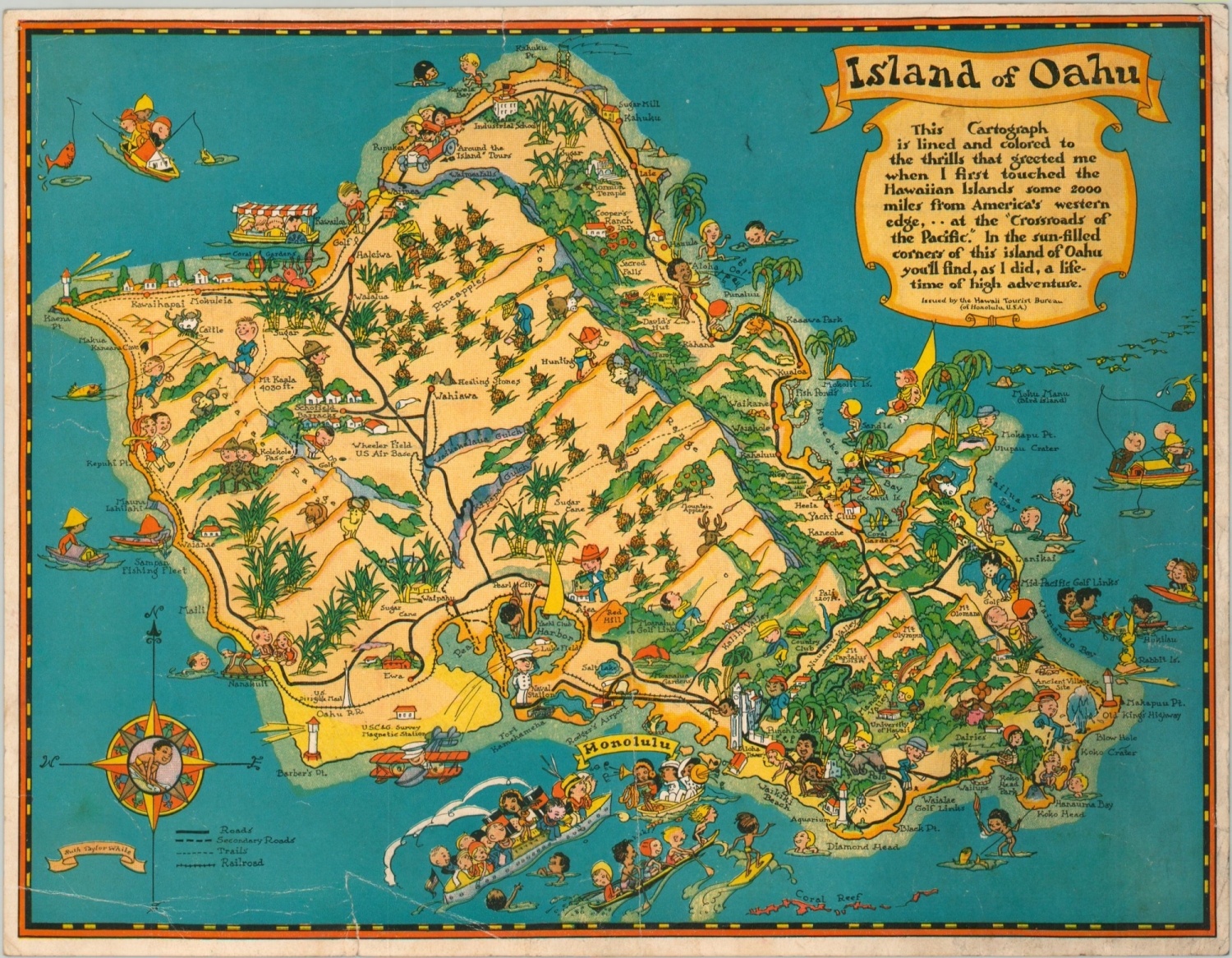
Ruth Taylor White’s iconic map of Oahu.
1 in stock
Description
Exhibiting the characteristic whimsical style of its creator, Ruth Taylor White, this map of Hawaii’s Oahu Island is filled with bright vignettes, amusing characters, and exaggerated topography. White first visited Hawaii in 1931 and shortly thereafter produced a number of pictorial cartographs of the various islands.
This example was published slightly later, in 1935, by the Hawaii Tourist Bureau in Honolulu. According to the text in the upper right, “this cartograph is lined and colored to the thrills that greeted me when I first touched the Hawaiian Islands some 2000 miles from America’s western edge…at the “Crossroads of the Pacific.” In the sun-filled corners of this land of Oahu you’ll find, as I did, a lifetime of high adventure.”
Map Details
Publication Date: 1935
Author: Ruth Taylor White
Sheet Width (in): 10.50
Sheet Height (in): 8.25
Condition: B
Condition Description: Heavily worn around the outer edges, including several small tears that have been repaired on the verso.
$95.00
1 in stock

