
Island of Kauai
$200.00
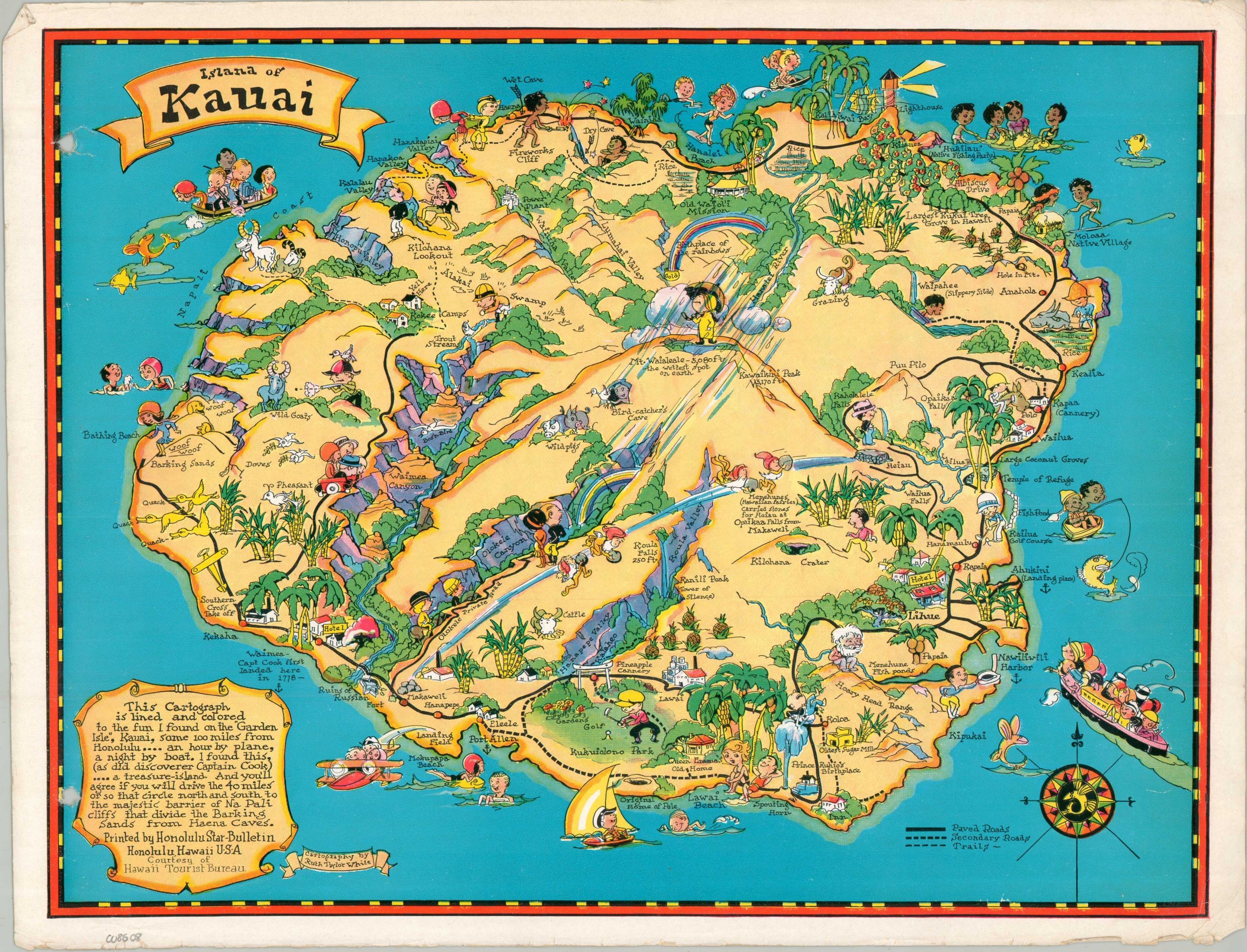
An uncommon pictorial map of Kauai from the 1930s.
1 in stock
Description
“This cartograph is lined and colored to the fun I found on the ‘Garden Isle,’ Kauai, some 100 miles from Honolulu…an hour by plane, a night by boat. I found this (as did discoverer Captain Cook)…a treasure island. And you’ll agree…” – Text, lower left.
This whimsical pictorial map of Kauai was illustrated by the talented Ruth Taylor White. It’s one of the first editions of the popular souvenir piece, printed by the Honolulu Star-Bulletin and distributed courtesy of the Hawaii Tourist Bureau around 1933. Several variants were issued, though this is among the scarcer versions. A brightly colored image captures the inviting charm of the island, inhabited by a multi-ethnic group of smiling visitors and residents. Recreational opportunities, historic sites, major industries, and cultural features are labeled throughout. Of particular interest is Mt. Waialeale (the wettest place on Earth), the ruins of a Russian fort, Olokele Canyon, and the Moloaa Native Village. The road network reflects the construction boom of the late 1920s, with early rental agencies and tour companies taking advantage of the automobile’s surging popularity.
Ruth Taylor White was a dominant figure in the Golden Age of pictorial cartography, renowned for her vibrant and whimsical “Cartographs” that favored regional personality over geographic precision. Her signature style, defined by vibrant color palettes and humorous vignettes, played a pivotal role in 1930s tourism, particularly through her iconic work for the Hawaii Tourist Bureau. These maps were instrumental in rebranding the islands for the American mainland, transitioning Hawaii’s image from a remote outpost to a vibrant, exotic playground during the Interwar Period.
Source: Los Angeles Public Library
Map Details
Publication Date: c. 1933
Author: Ruth Taylor White
Sheet Width (in): 15.50
Sheet Height (in): 11.75
Condition: B
Condition Description: Color printed map on a single-sided sheet of glossy paper. Moderate to heavy marginal wear and two holes on the left side, where previously bound. About good condition overall.
$200.00
1 in stock