Island of Guam
$295.00
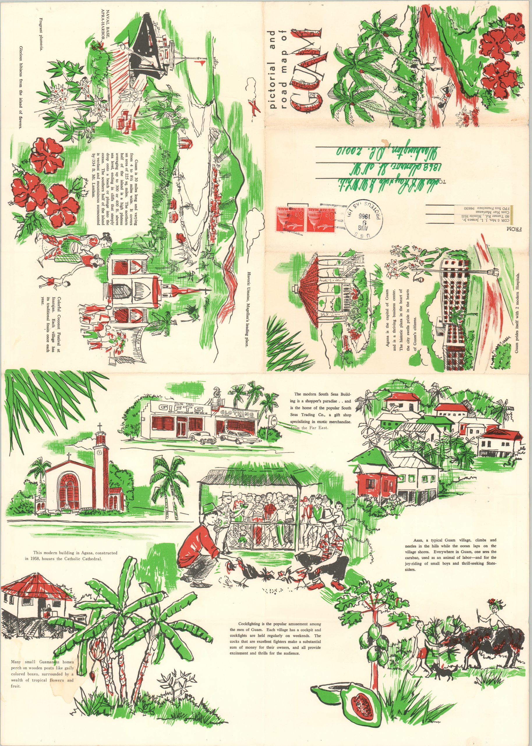
Lovely tourism map of Guam in the Marianas Islands with handwritten notes by a U.S. Naval Commander.
1 in stock

Description
This brightly colored, charming map of Guam details the various roadways, villages, and geographic features of the island. A welcoming sun acts as the compass rose, and the scale can be found embedded within a tropical fish off the eastern coast. Magellan’s landing, military installations, and conservation areas are also noted.
On the verso are illustrations of prominent buildings in the island’s capital, a cockfighting arena, and a carabao (water buffalo). The drawings are broken into separate panels to facilitate folding the map as a mailer for tourists to send to family and friends. This particular example (postmarked 1966) was sent via Com Nav Marianas to a recipient in Washington, D.C. The image reflects extensive annotations written by the prior owner, a Navy officer stationed on the island. It includes references to Russian surveillance ships, a B-52 Bomber Base, the U.S.S. Proteus, and ‘Our Home’ on Nimitz Hill.
Guam has the longest history of colonialism of any Pacific Island, starting with the Spanish in the 17th century and continuing today with the United States’ oversight of the territory. The map was copywritten by Victor A. Olsen in 1966 and published by the South Seas Trading Company.
Map Details
Publication Date: 1966
Author: Victor A. Olsen
Sheet Width (in): 17.2
Sheet Height (in): 24
Condition: A-
Condition Description: Creased along originally issued fold lines and some scattered discoloration visible in the lower right corner. Manuscript annotations throughout in green ink. Very good overall.
$295.00
1 in stock