
Iran
$110.00
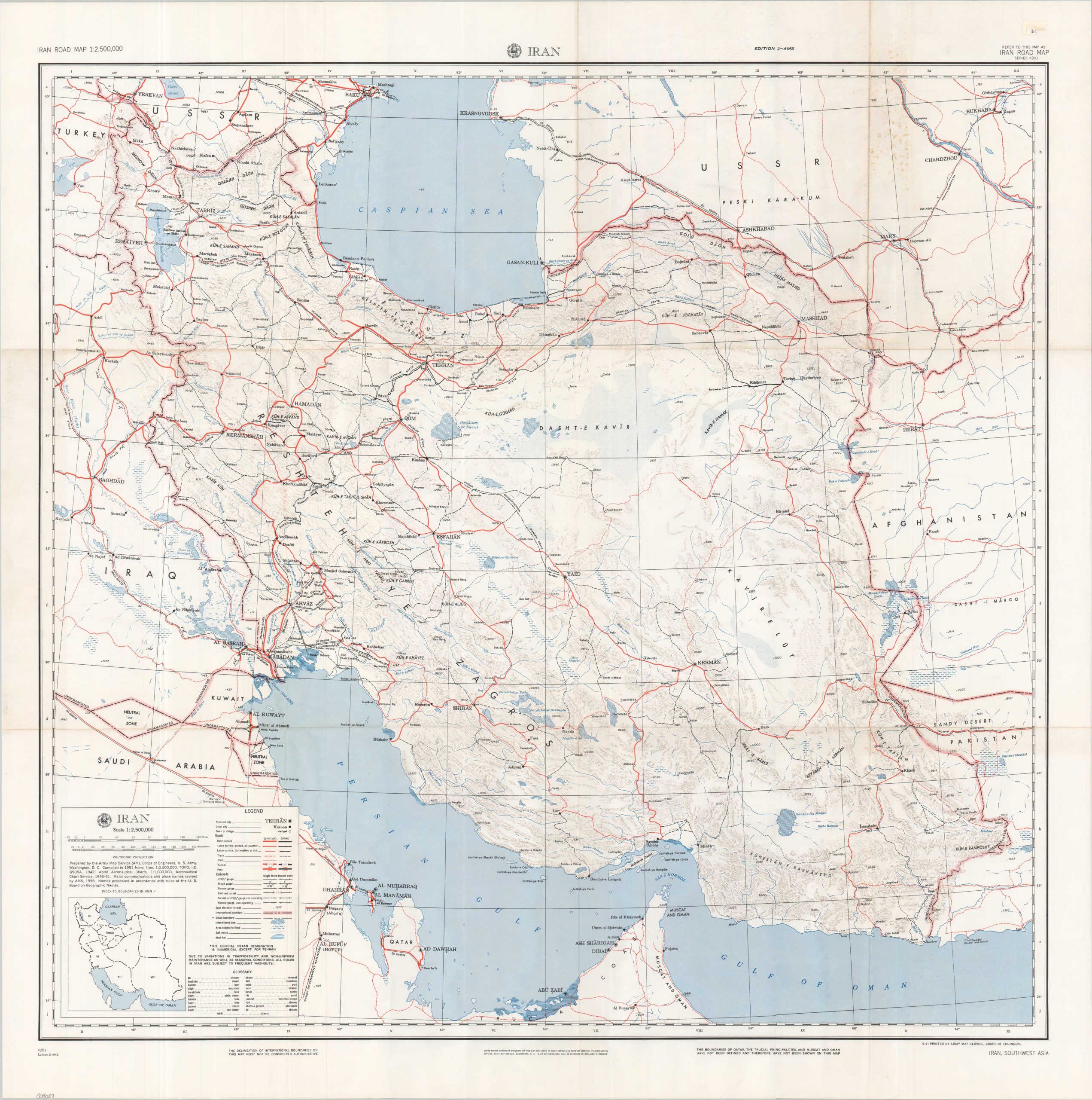
Iran’s transportation infrastructure in the early 1960s.
1 in stock
Description
This detailed map of Iran highlights the nation’s modernizing infrastructure less than a decade after the CIA-backed coup that restored the authority of Shah Mohammad Reza Pahlavi and overthrew Prime Minister Mohammad Mosaddeq, whose nationalization of Iran’s oil industry had precipitated the crisis. Roads, railroads, international boundaries, and prominent geographic features are identified according to the legend in the lower left – the essential components of a country undergoing rapid economic development and occupying a strategically vital position during the Cold War. Historic regional disputes are reflected in the various neutral zones and poorly demarcated borders, underscoring the geopolitical complexities of the Middle East at mid-century.
Originally compiled in 1951 by the Army Map Service, a component of the U.S. Army Corps of Engineers, the map underwent major revisions in 1956. This somewhat later example was printed in Washington, D.C., in 1961.
Map Details
Publication Date: 1961
Author: Army Map Service
Sheet Width (in): 33.75
Sheet Height (in): 33.75
Condition: A-
Condition Description: Color printed map on a single-sided sheet, creased along old folds with some extraneous wrinkling at the fold joints. Some surface toning and light spotting visible in the upper right. Good to very good condition overall.
$110.00
1 in stock