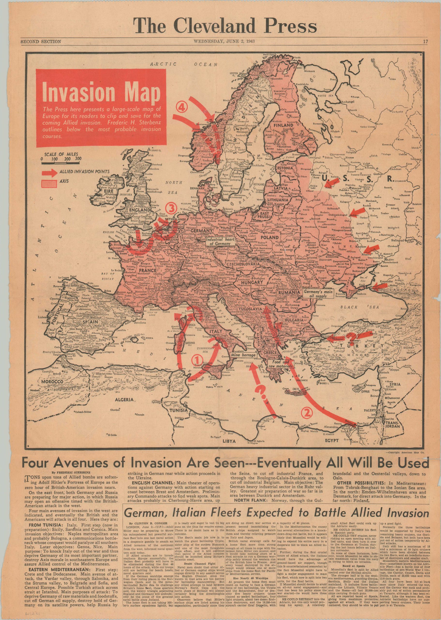
Invasion Map
$250.00
“Four Avenues of Invasion Are Seen – Eventually All Will Be Used”
1 in stock
Description
“The Press here presents a large-scale map of Europe for its readers to clip and save for the coming Allied invasion. Frederic H. Sterbenz outlines below the most probable invasion courses.” – Text, upper left.
This speculative ‘invasion map’ of Europe was copywritten by the American Map Company and published in the June 2, 1943 edition of the Cleveland Press – a full year before D-Day. Axis-occupied territory is shaded in pink while its further growth is checked by Allied invasion points, represented by red arrows. The accompanying text is astute; identifying a primary objective of knocking Italy out of the war and predicting significant attacks near Cherbourg/Le Havre in northern France.
Map Details
Publication Date: 1944
Author: The Cleveland Press
Sheet Width (in): 16.25
Sheet Height (in): 23.5
Condition: A-
Condition Description: Single sheet of the June 2, 1943 Cleveland Press - moderately toned, consistent with age. Creased along old fold lines with small closed tears along the outer edges of the sheet. Good to very good condition overall.
$250.00
1 in stock