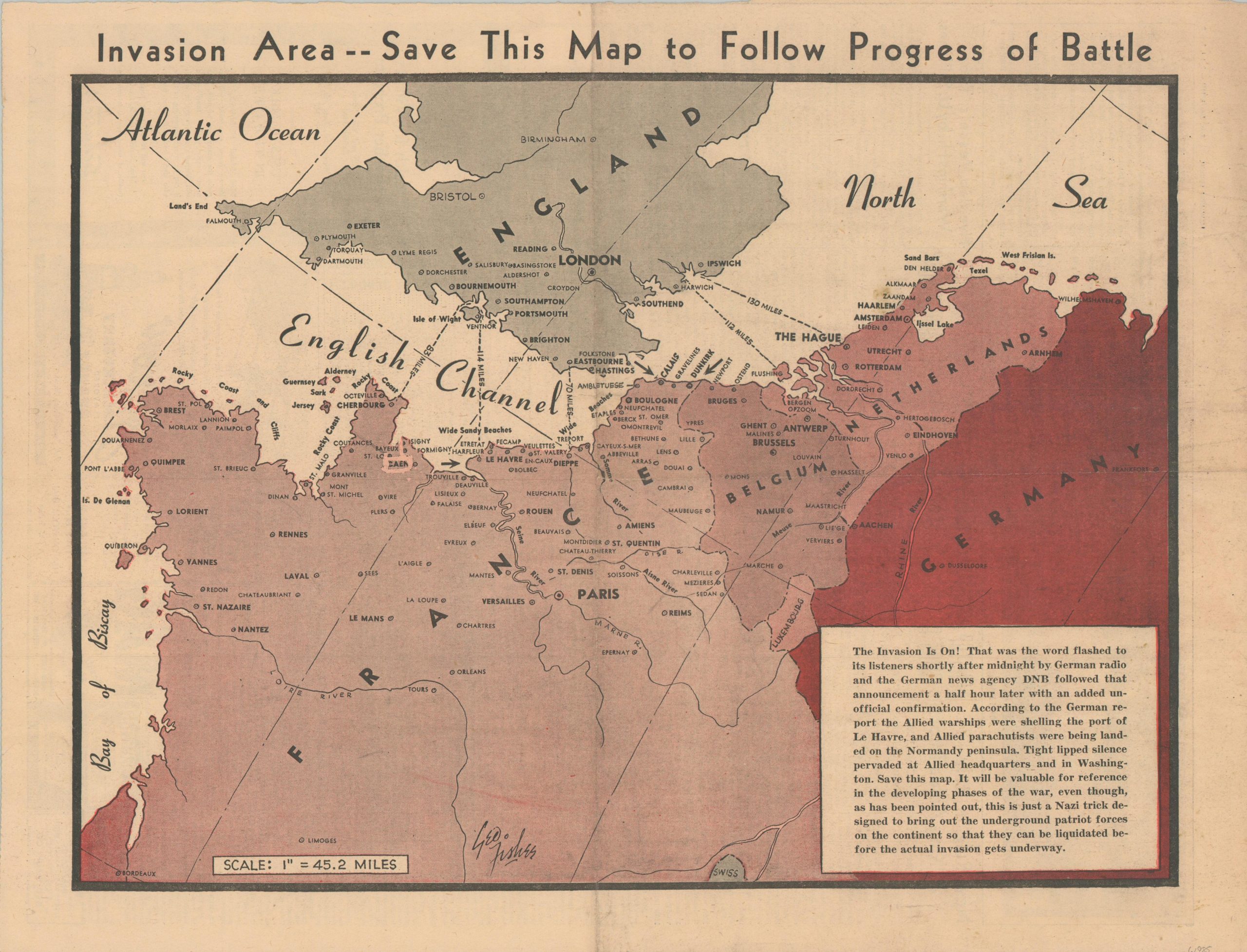
Invasion Area – Save This Map to Follow Progress of Battle
Early reporting on the D-Day landings at Normandy.
Out of stock
Description
“The Invasion Is On!…Save this map. It will be valuable for reference, in the developing phases of the war, even though, as has been pointed out, this is just a Nazi trick designed to bring out the underground patriot forces on the continent so that they can be liquidated before the actual invasion gets underway.” – Text, lower right.
This map of the English Channel and adjacent coastlines was designed by George Fishes and published in the June 6, 1944 edition of the Milwaukee Sentinel. Just a few hours earlier, the largest amphibious invasion in the history of the world began off the coast of Normandy and Allied soldiers were fighting for their lives to establish a beachhead. Caen is roughly circled with an overprint, though an even distribution of place names and numerous distance lines reflect ambiguity about operation details. Information on the attack was gleaned through German news sources.
Map Details
Publication Date: 1944
Author: George Fishes
Sheet Width (in): 21.4
Sheet Height (in): 16.3
Condition: B+
Condition Description: Single page of color newsheet with irregular margins and moderate wear along a vertical and horizontal fold. Soiling in the margins, but overall in good condition. Printed text on verso.
Out of stock