Intercontinental Railway Map
“One of the most ambitious engineering projects in the history of inter-American relations.”
Out of stock

Description
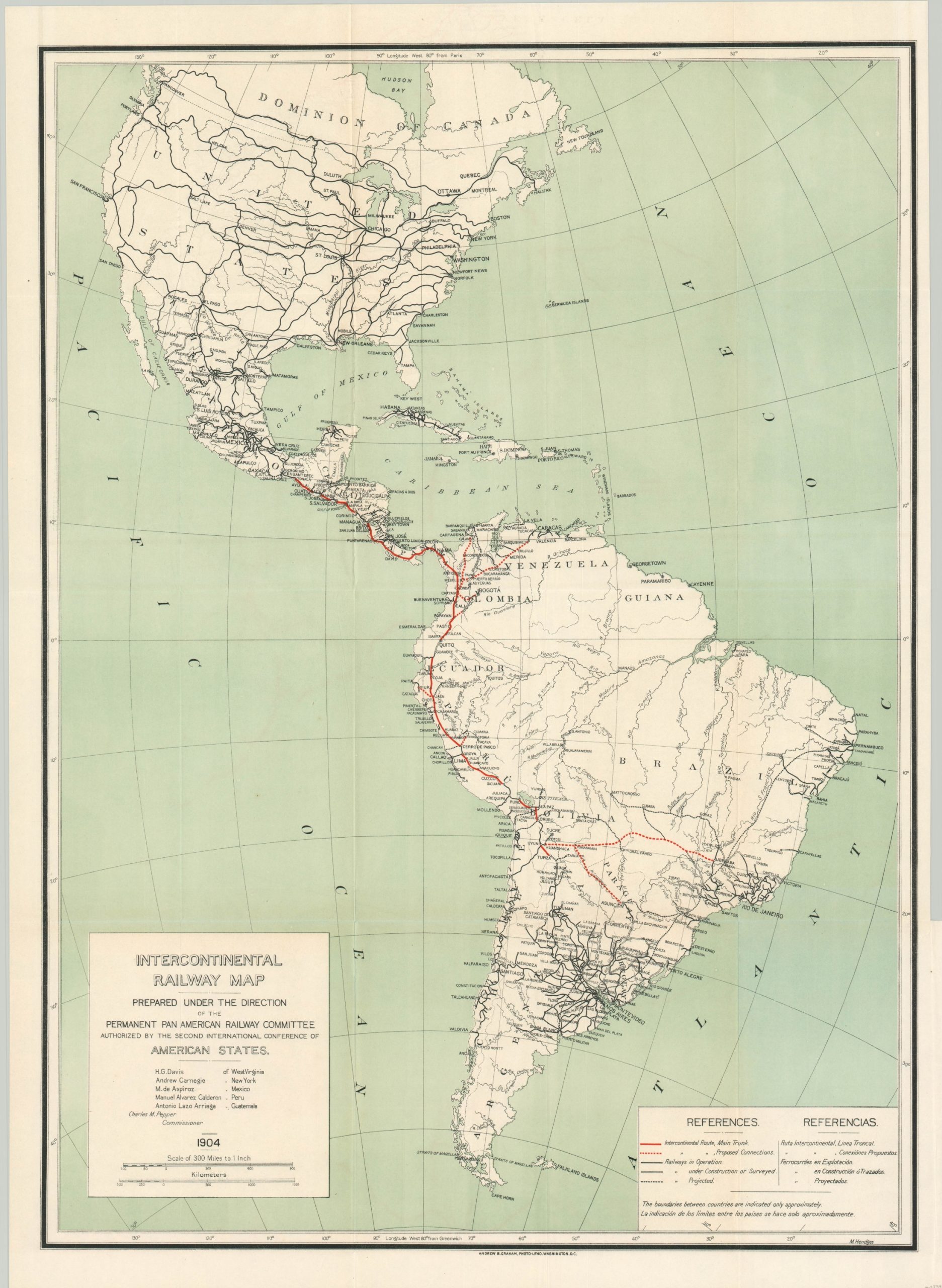
Originally envisioned as a combined network of private companies with government support, the Pan-American Railway was proposed at the First International Conferences of American States in 1890. Subsequent conferences would further refine the goals, organization, and scope of the railway’s operations, and even try to evolve the organizing body into an entity overseeing the entirety of construction. Ultimately, due to the distraction of the First World War and a lack of financial participation, primarily from the United States, the railway was unrealized and largely a failure.
This map and accompanying report were issued in 1904 to the United States Senate and they outline the progress made up to that point. The international route and proposed connections are highlighted in red, with other railways also noted accorded to the dual-language legend in the lower right. The 75-page report, submitted to the Secretary of State by Charles Pepper, Commissioner of the Second International Conference of American States, outlines the contributions of each country and provides detailed estimates of costs, organizational summaries, and additional information.
Drawn by M. Hendges under the direction of the Permanent Pan-American Railway Committee. Lithography by Andrew B. Graham and published in Washington, D.C. in 1904 by the Government Printing Office.
Map Details
Publication Date: 1904
Author: M. Hendges
Sheet Width (in): 21.5
Sheet Height (in): 30
Condition: A
Condition Description: Lightly creased along former fold lines and a tiny tear in the lower right, near the binding strip and confined to the margin. Includes 75 page disbound Senate report on the Pan-American Railway. Very good overall.
Out of stock