Insulae Malta Goza &c.
Original price was: $200.00.$150.00Current price is: $150.00.
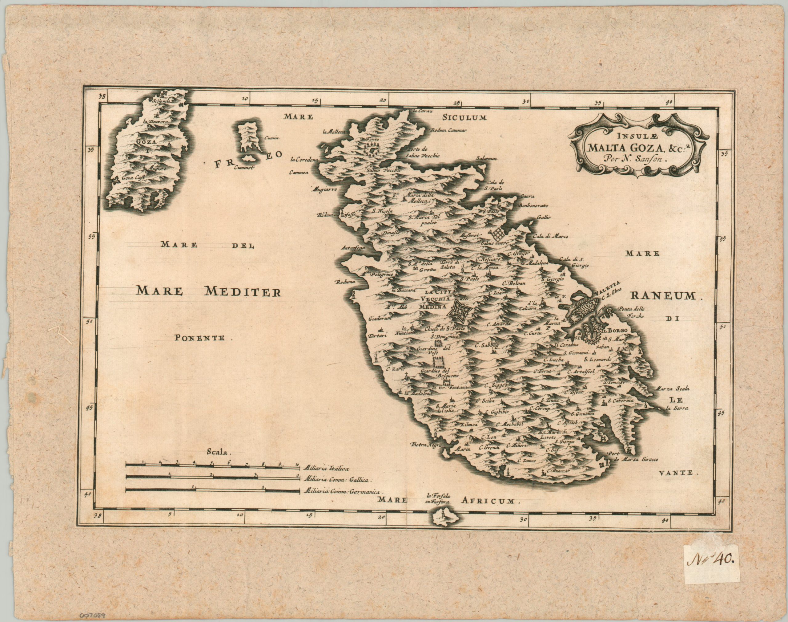
The island of Malta under the Knights of St. John.
1 in stock
Description
This uncommon map of the Maltese archipelago was designed by Nicholas Sanson and mostly likely issued in Johann Zurner’s 1679 atlas published in Nuremberg. The island of Malta takes up the majority of the image, followed by Gozo, Comino, and uninhabited Filfla (lower center). The heavily fortified capital city of Valletta is prominently shown along the eastern shore – the controlling Order of St. John was regularly under threat by the Ottoman Empire during the 16th-18th centuries. Città Vecchia is another fortified outpost to the west. Other locations of interest include cultivated gardens, salt works, religious sites, and the Gozo Citadel.
Map Details
Publication Date: c. 1679
Author: Nicholas Sanson
Sheet Width (in): 12
Sheet Height (in): 8
Condition: B
Condition Description: Single copperplate engraved sheet with trimmed margins and mounted onto an old sheet of laid paper. Manuscript page number in the lower corner indicates the map was formerly part of a composite atlas. Light scattered toning and faint spotting visible throughout (see scan). About good condition overall.
Original price was: $200.00.$150.00Current price is: $150.00.
1 in stock