
Insulae Americanae in Oceano Septentrionali cum Terris adiacentibus
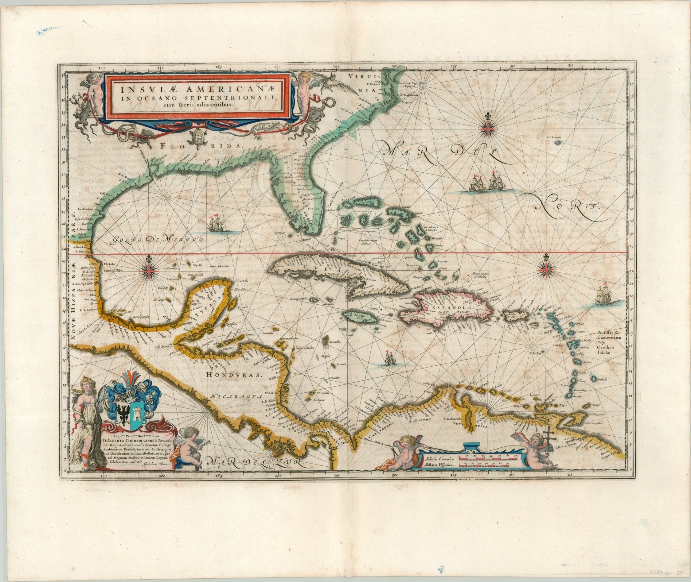
A captivating map of the West Indies published during the region’s famous buccaneering period.
Out of stock
Description
This fascinating map of the Caribbean was first issued by Willem Janszoon Blaeu in 1635, and is based off a highly influential chart by Hessel Gerritsz, the first hydrographer of the Dutch East India Company. Blaeu would succeed Gerritsz in that post after the latter’s death in 1632. Three years later, he would issue the first edition of his work Theatrum Orbis Terrarum sive Atlas novus, which would be re-published in numerous editions and four languages in successive years.
This particular example comes from a 1650 Dutch edition of the Nieuwe Atlas, published by Blaeu’s sons, Cornelis and Joan. The map presents coastal details from southeastern North America to northern South America during a period of tremendous maritime economic competition between European powers. Spain was trying desperately to maintain its regional supremacy, while rivals France, Britain, and the Dutch were simultaneously attempting to undermine it. The Thirty Years’ War (1618 – 1648) extended from Europe into the Caribbean, where opportunistic captains under sovereign authority would raid merchant ships. The legal lines between these “privateers” and outright robbery would blur during this period, largely contributing to the rise in piracy in subsequent decades.
Apart from the political implications, there are numerous embellishments throughout the image. Rhumb lines crisscross throughout the Atlantic Ocean and Gulf of Mexico, which also feature several sailing ships and compass roses. Other decorative elements are present in the two cartouches; the first in the upper left presents the title flanked by two cherubs holding aloft a ribbon of exotic animals of the New World. The lower left cartouche contains a dedication block with an allegorical figure immediately adjacent, as well as another cherub. Two more cherubs, each holding a tool of the surveying trade, can be seen on either side of the scale.
A wonderful map of the West Indies published during the Dutch Golden Age of Cartography, with original body color.
Map Details
Publication Date: c. 1650
Author: Willem Janszoon Blaeu
Sheet Width (in): 24.75
Sheet Height (in): 20.10
Condition: B
Condition Description: Moderately spotted throughout the image, with a bit of ink smudging and a few spots visible in the margins. Good condition overall, with original outline color and modern color in the cartouches.
Out of stock