Inland Cruising Guide New York Waterways and Adjacent Canadian Waterways
$95.00
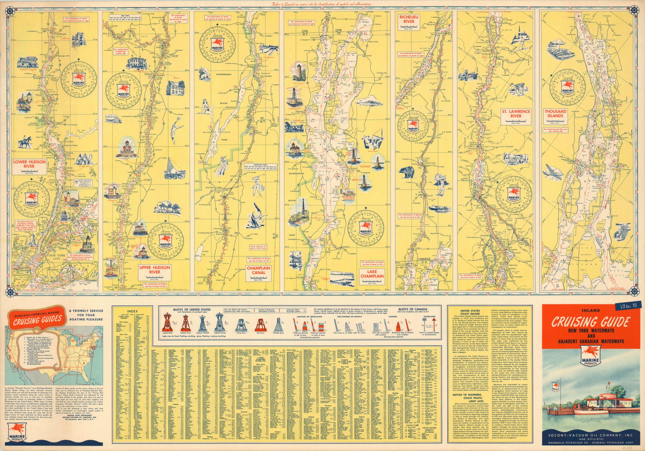
A series of strip maps for marine navigation along rivers in New York and Canada.
1 in stock
Description
Designed and published for yachtsmen and sailors (preferably those piloting boats with combustion engines), these seven strip maps show a detailed portion of different major waterways in Canada and New York. Refueling stations, water hazards, navigational beacons, and buoys are shown on each; the last being identified and explained in further detail in a chart below.
Small illustrations highlight notable landmarks along each route, which covers the Hudson River, Champlain Canal, Lake Champlain, Richelieu River, St. Lawrence River and Thousand Islands. An index of cities and towns and information on the U.S. Coast Guard and boating regulations are provided at the bottom of the sheet. Published by Rand McNally on behalf of he Socony-Vacuum Oil Company, Inc.
Map Details
Publication Date: c. 1960
Author: Rand McNally
Sheet Width (in): 33.00
Sheet Height (in): 22.90
Condition: A-
Condition Description: Faint soiling along the outer edges and a bit of extraneous creasing where the map was previously rolled.
$95.00
1 in stock