Indianapolis
$40.00
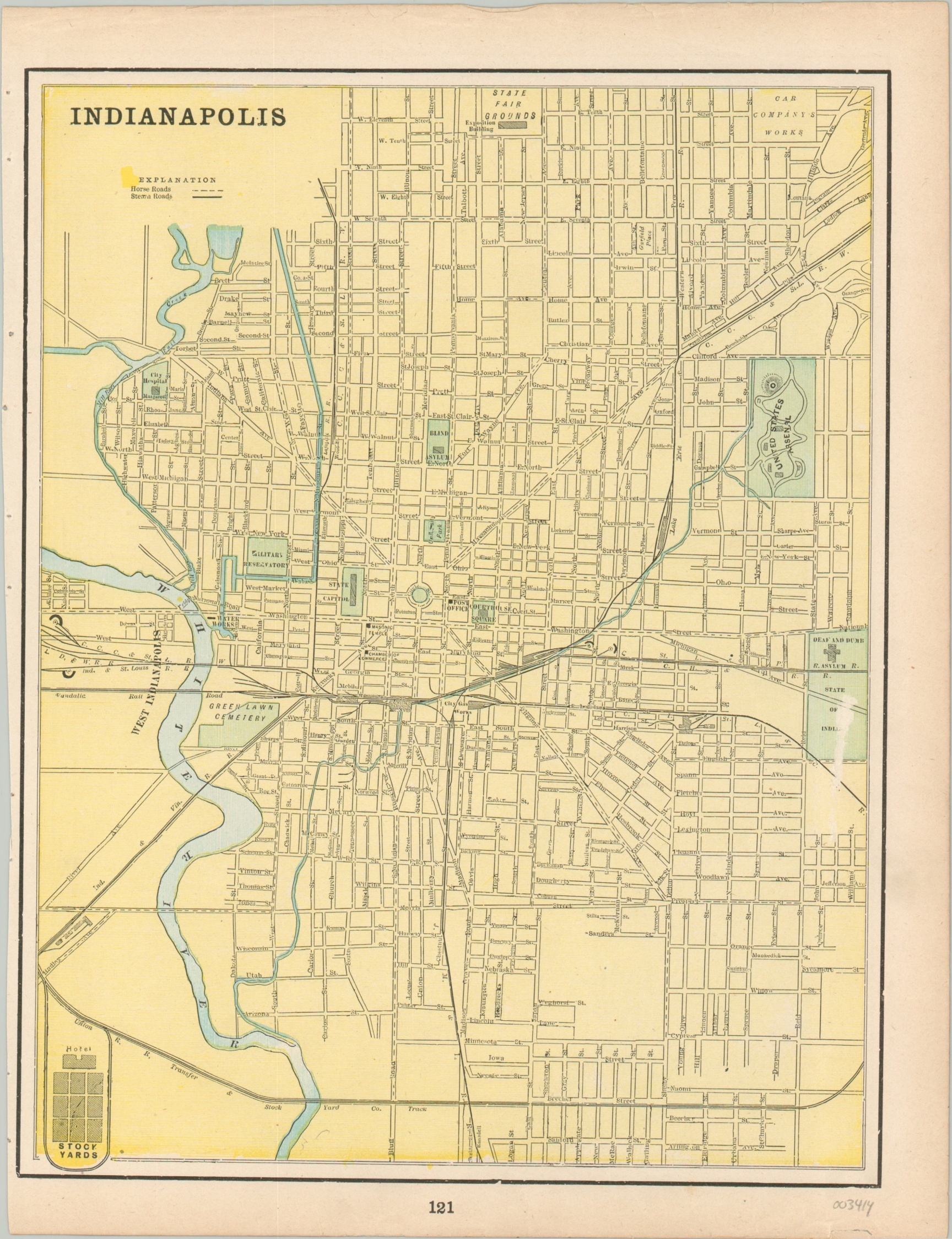
Color lithographed map of Indianapolis from the late 19th century.
1 in stock
Description
This detailed map of Indianapolis was published locally around 1894 by George Cram. It shows a fascinating early look at Indiana’s capital city, with the various horse roads and steam roads available to residents and travelers alike.
Points of interest include the United States Arsenal, which closed in 1902 in ultimately became Arsenal Technical High School. The Deaf and Dumb Asylum, visible near the left edge of the sheet, moved in 1911 and the area became known as Willard Park. West Indianapolis is shown as a separate entity, as it was not incorporated into the city proper until 1897. Last, though the Circle is present, the Monument for which it would be known would not be dedicated to veterans of the Civil War until 1902.
Map Details
Publication Date: c. 1894
Author: George Cram
Sheet Width (in): 11.00
Sheet Height (in): 14.25
Condition: A-
Condition Description: Light wear and toning around the outer margins, consistent with age. A bit of paper loss in the center right.
$40.00
1 in stock