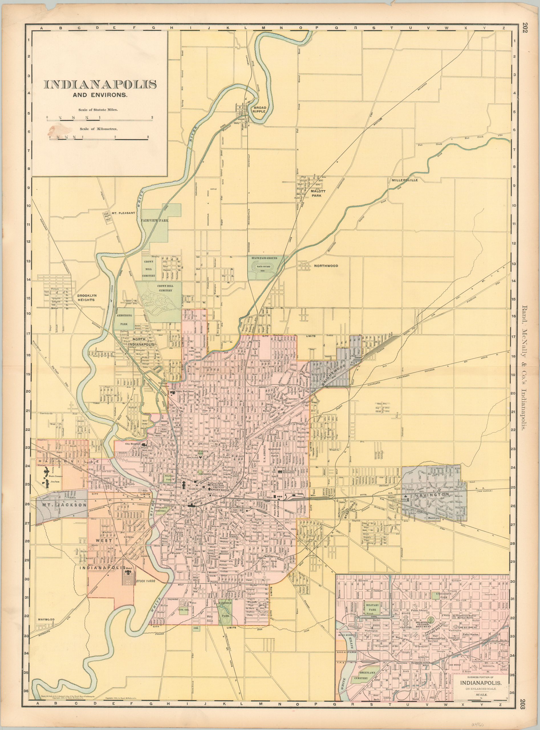
Indianapolis and Environs
$80.00
Lithographed map of Indianapolis from the late 19th century.
1 in stock
Description
This detailed map of Indiana’s capital was published in Chicago by Rand McNally around 1898. It presents an informative snapshot of Indianapolis near the end of the 19th century. Truncated city limits are highlighted in pink, while surrounding communities like Irvington and Broad Ripple are identified separately.
A fascinating variety of toponyms identifies prominent transportation options, neighborhoods, important buildings, parks, and geographic features. Of particular interest are Butler University (shown at its old location on the city’s east side), the stockyards (recently acquired by Samuel E. Rauh), and Tomlinson Hall (still standing today as City Market). An inset in the lower right shows a large scale outline of the downtown area.
Map Details
Publication Date: c. 1898
Author: Rand McNally
Sheet Width (in): 20.5
Sheet Height (in): 27.5
Condition: B+
Condition Description: Quarter sized damp stain in the upper left corner, in the title block. Creased upper right corner and some wear along the horizontal centerfold. Scattered soiling and a few chips in the margins, but otherwise in good condition overall.
$80.00
1 in stock

