Indian Villages of the Illinois Country
$125.00
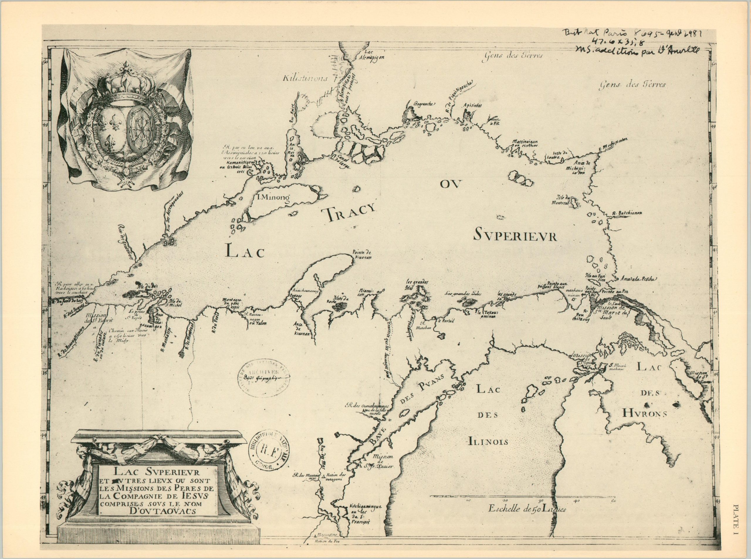
Reprints of early maps showing the original indigenous inhabitants of Illinois.
1 in stock

Description
“This is the first of two volumes relating to the early days of contact between Indian and White in the Illinois area. The atlas presents those maps which show the increasing knowledge of the territory, of the river course, and the location of Indian tribes and villages.” – Foreword.
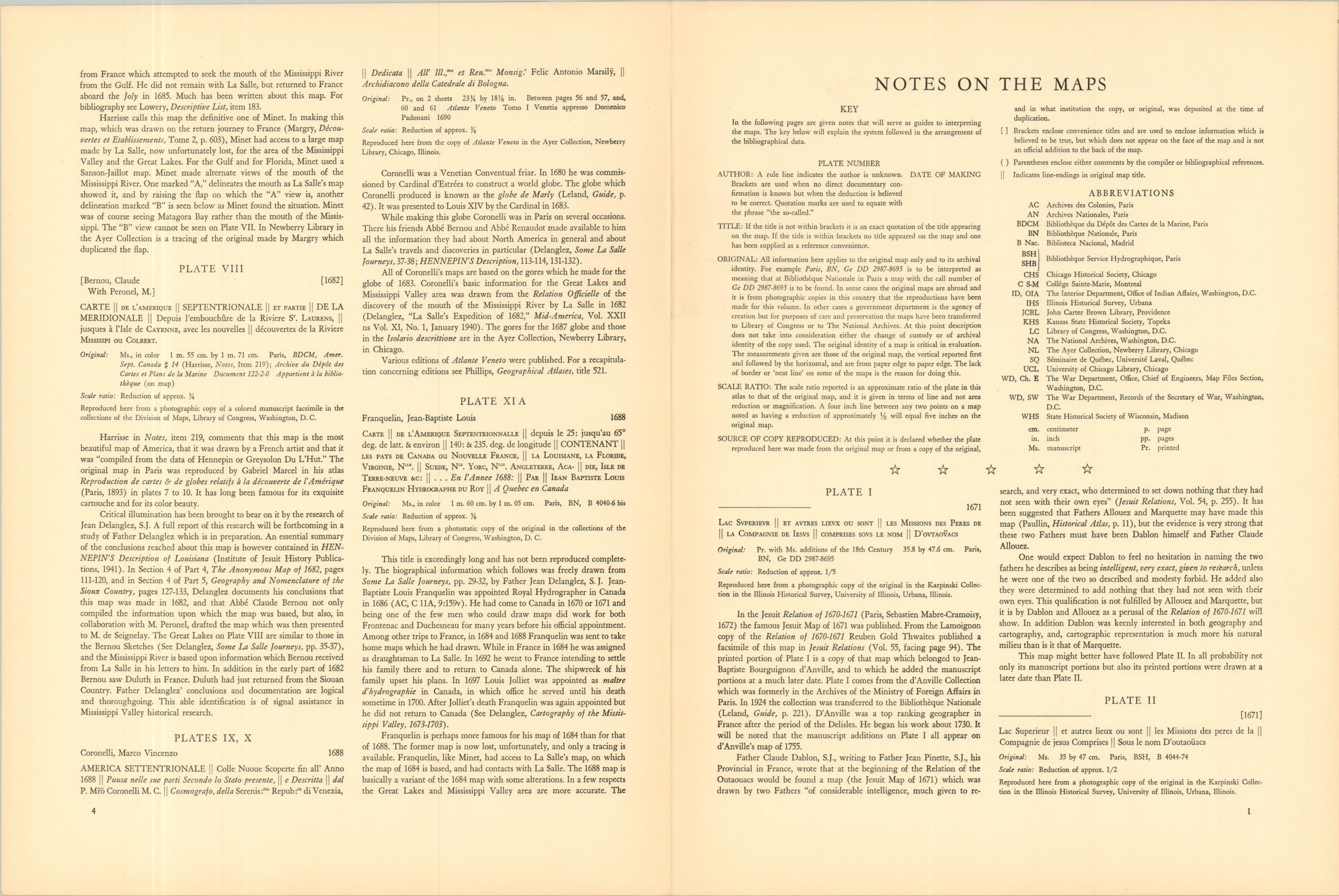
This interesting ‘atlas’ is a fascinating WWII-era compilation of Midwestern exploration, museum curation, and Native American history. Over fifty important maps of Illinois, dating from the late 1670s to 1830, were carefully selected from a variety of collections and reprinted for mass consumption and comprehension. Accompanying summaries offer descriptive information about each, including the author, scale, source, and relevant historical context.
The collection was compiled by historian and University of Chicago employee Sara Jones Tucker, who was hired at the university in the early 1940s to organize the materials within the Ethno-History collection. This work formed the backbone of the volume. Published by the Illinois State Museum in 1942 as Part I (the Atlas), of the Scientific Papers, Volume II.
Map Details
Publication Date: 1942
Author: Sara Jones Tucker
Sheet Width (in): 12.00
Sheet Height (in): 16.00
Condition: A
Condition Description: i - xii +18 pp. index and bibliography (each sheet folded once, comprised of four pages). Fifty four map reproductions, some in color, across approximately 30 sheets. Light toning, consistent with age. Includes original paper folder, with small tears along the flaps. Very good overall
$125.00
1 in stock