India
$350.00
Laying the groundwork for Indian Independence during World War II.
1 in stock
Description
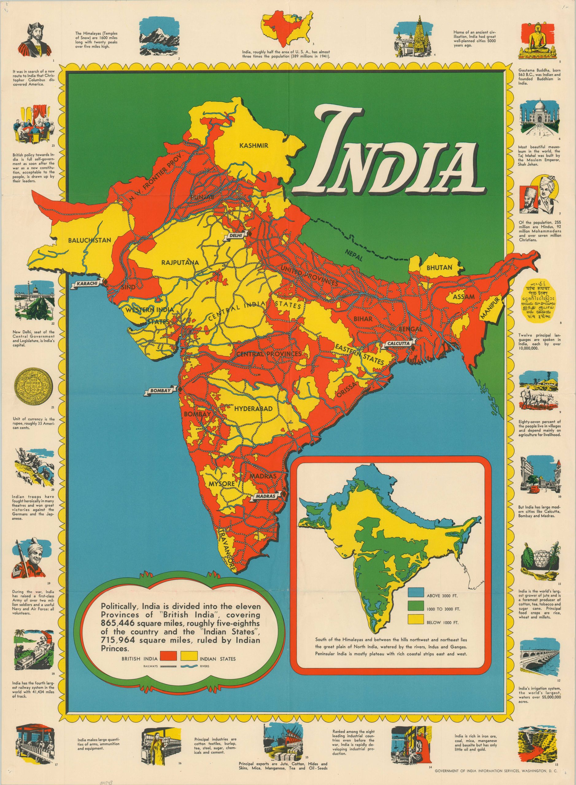
This vibrantly colored map of India highlights the extent of the British Raj during the Second World War. Areas controlled directly by the British state are shown in red, while the ‘Princely States’ (nominally autonomous regions subject to strict oversight) are yellow. Railways and rivers are noted, and an inset map in the lower right emphasizes the drastic elevation changes present on the subcontinent.
Twenty-three captioned vignettes around the border showcase major events, prominent statistics, and signs of national maturity indicative of the ability for self-governance. Examples of the last category include the presence of major local industries, a huge domestic population, extensive infrastructure, and impressive Allied efforts during the war.
Map Details
Publication Date: c. 1944
Author: Government of India Information Services
Sheet Width (in): 21.9
Sheet Height (in): 29.9
Condition: A-
Condition Description: Pinholes in each corner and creasing along old fold lines. Very good condition overall. Blank on verso.
$350.00
1 in stock

