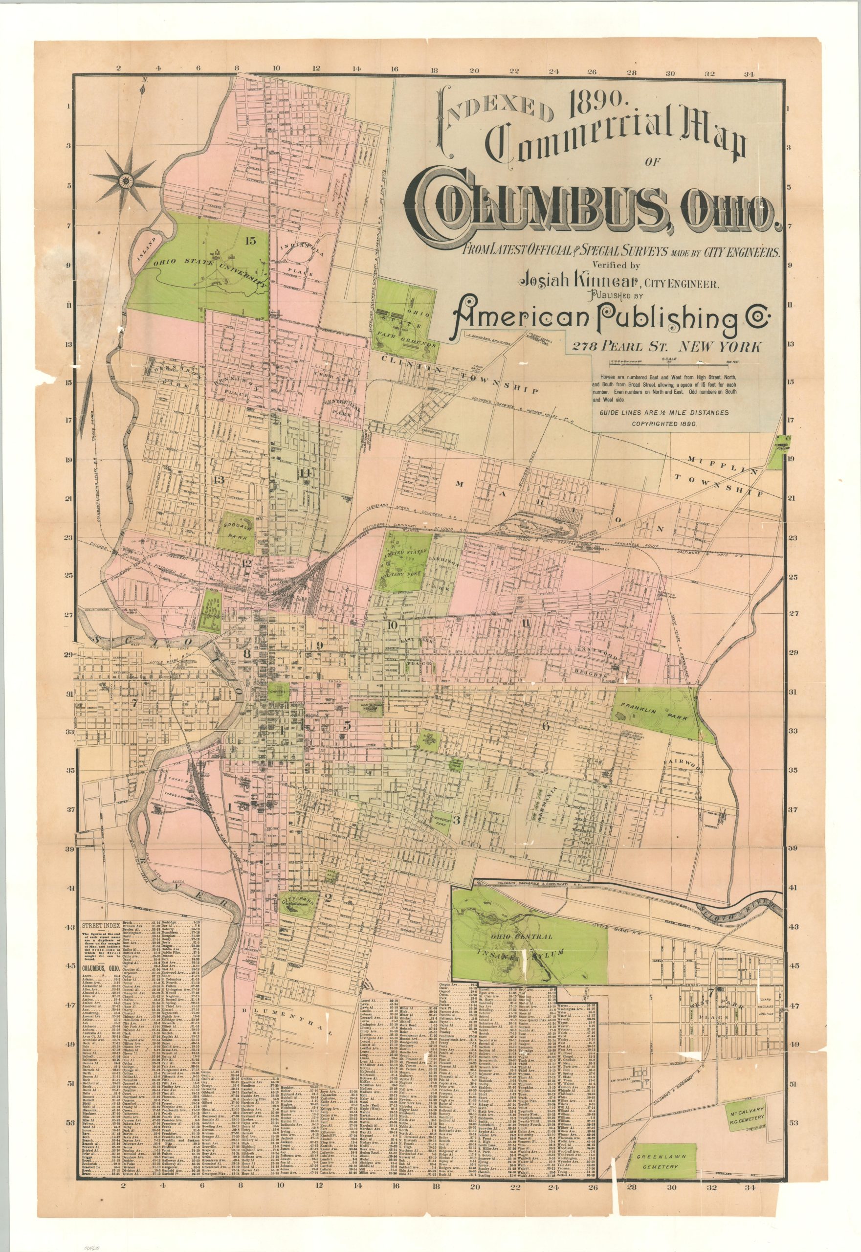
Indexed Commercial Map of Columbus, Ohio
Columbus two decades after the founding of The Ohio State University.
Out of stock
Description
This rare plan of Columbus, Ohio was designed by City Engineer Josiah Kinnear and published in New York by the American Publishing Company in 1890. Just two years prior, the city of approximately 80,000 hosted a quarter million Civil War veterans and their families as part of the Grand Army of the Republic’s reunion during the Ohio Centennial Exposition. Columbus had grown precipitously since the Confederate surrender, and by the end of the 19th century, it was a focal point for manufacturing in central Ohio.
The dozens of businesses outlined within the image reflect this status, identifying carriage builders, breweries, ironworks, and more. Bright green color highlights public parks, the capitol building, the United States Military Post, and several state-run facilities like the Ohio Central Insane Asylum, the Ohio Penitentiary, and the Fair Grounds. The campus of Ohio State University, established in 1870, can be seen in the upper left, while an inset in the lower right extends the image further to the west. Immediately adjacent is a comprehensive street index.
The map is rare, with only one example identified in WorldCat at the Ohio State Historical Society.
Sources: Ohio History Central; Columbus Library
Map Details
Publication Date: 1890
Author: Josiah Kinnear
Sheet Width (in): 27.9
Sheet Height (in): 41.6
Condition: B
Condition Description: Former pocket map disbound from its covers (not present) and mounted on linen for preservation and stability. Several areas of image loss are visible in the lower right and left margin (see scan). Light toning along old fold lines in a few places. About good condition overall, with original printed color.
Out of stock