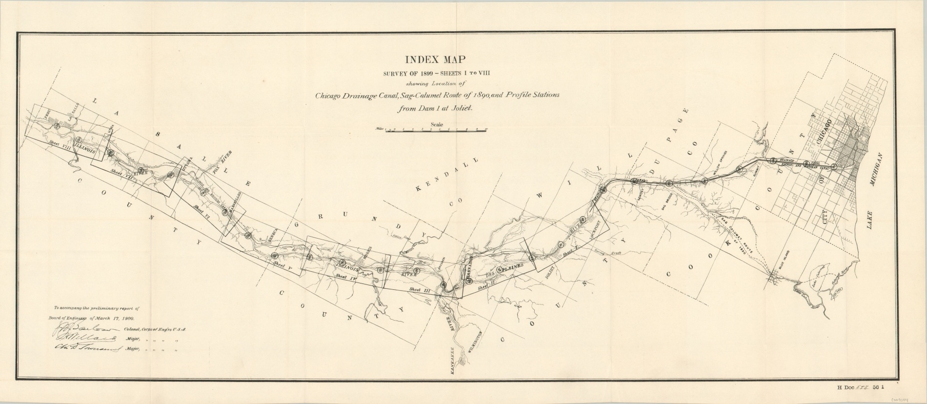
Index Map Survey of 1899 – Sheets 1 to VII showing Location of Chicago Drainage Canal
$200.00
Reversing the flow of the Chicago River – one of the engineering marvels of the millennium.
1 in stock

Description
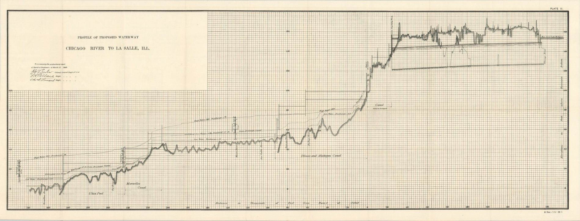
Chicago’s rapid development in the second half of the 19th century posed a number of problems for the growing metropolis. Clean drinking water was one such consideration, and successively longer tunnels were dug out into Lake Michigan to obtain potable H20. Realizing this was a temporary solution, city engineer Isham Randolph theorized a deep canal cut across the Great Lakes basin, connecting the Chicago River to the Mississippi.
Work on the Drainage Canal (later renamed the Chicago Ship and Sanitary Canal) began in 1892, but it wouldn’t be until early 1900 that the canal opened permanently for use. In the intervening eight years, over 40 million cubic yards of earth were removed from the ‘Big Ditch’ – the largest earth-moving operation in the world until the completion of the Panama Canal.
This map showing the route of the canal was created by the Army Corps of Engineers and published in a U.S. Government Report to the House of Representatives in March of 1900 – two months after the canal opened. Eight pages of the accompanying report are also included.
Map Details
Publication Date: 1900
Author: J.W. Barlow
Sheet Width (in): 27.3
Sheet Height (in): 11.8
Condition: A
Condition Description: Light creasing along originally issued fold lines but otherwise in near fine condition. Accompanied by sheet II only, as well as 8 loose pages of the corresponding report to the House of Representatives.
$200.00
1 in stock