Index and Map of the City of Providence, R.I.
$75.00
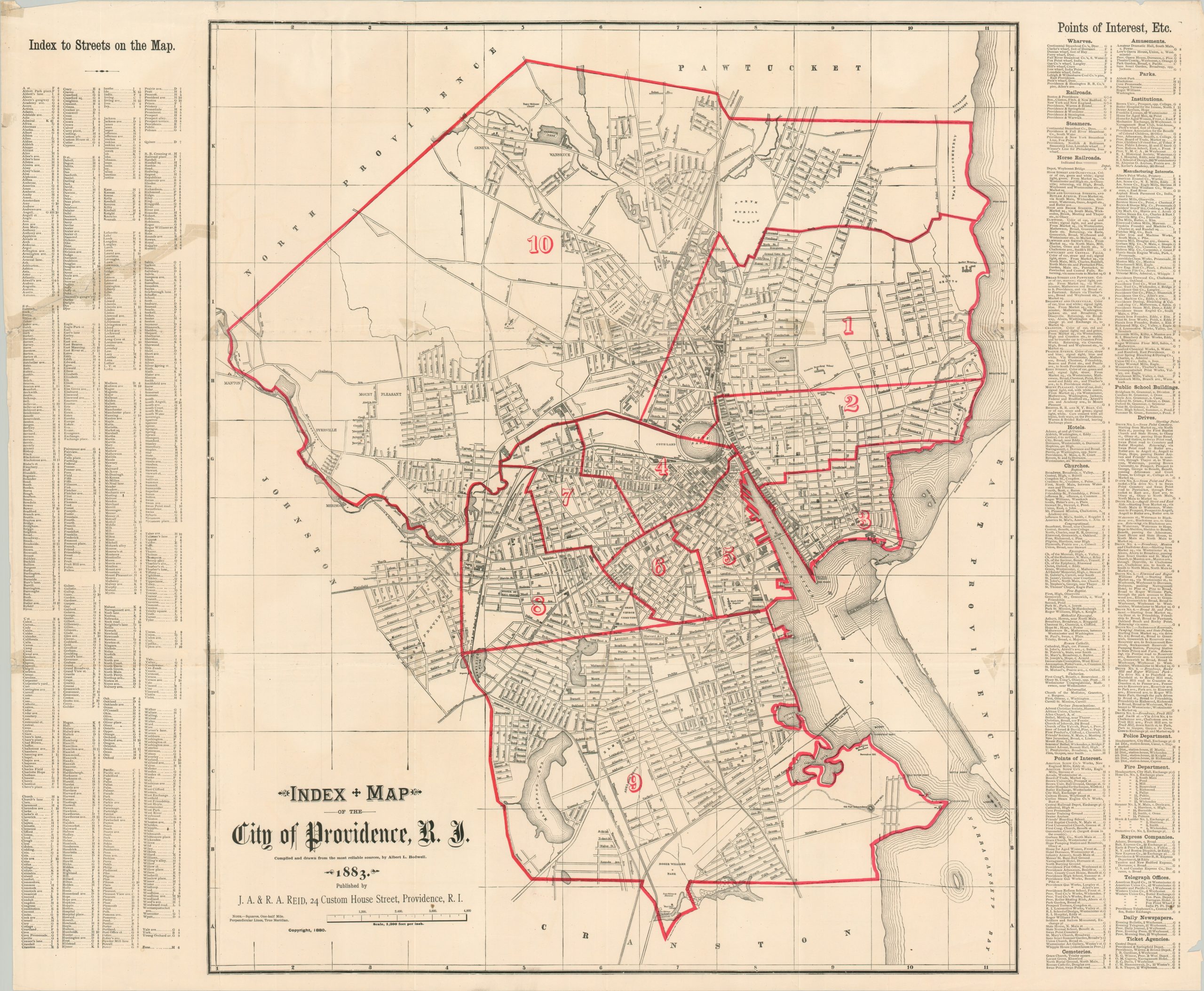
Providence during the Gilded Age.
1 in stock
Description
This informative street plan of Providence, Rhode Island was ‘compiled and drawn from the most reliable sources’ by Albert Bodwell and published locally in 1883 by J.A. & R.A. Reid. Outlines of important buildings are shaded throughout the image and different neighborhoods, parks, cemeteries, geographic features, and important structures are labeled. Bright red overprinting divides the city into its 10 wards, with points of interest and a street index printed on either side. A list of recommended drives, horse-drawn railroads, and other contemporary details are also provided.
Map Details
Publication Date: 1883
Author: Albert Bodwell
Sheet Width (in): 33.75
Sheet Height (in): 28
Condition: B
Condition Description: Several old cellophane repairs on the verso, resulting in some see through. Creased along old fold lines and moderate wear along the outer edges. About good condition overall.
$75.00
1 in stock