Illustrated Map of the Great Southwest
$110.00
Pictorial celebration of the great American Southwest.
1 in stock

Description
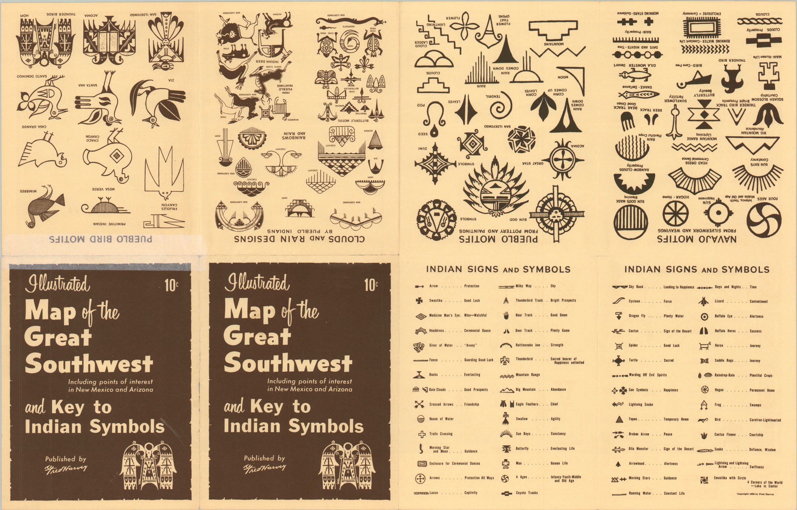
This eye-catching two-tone promotional map is emblematic of the many pictorials that were issued in the 1940s and 1950s encouraging American motorists to hit the road. This particular example emphasizing the American Southwest was distributed by the Fred Harvey Company. Fred Harvey got his start by building restaurants along new railroads that spread west in the late 19th century, and is credited with creating the first restaurant chain; the Harvey House. By the time Harvey died in 1901, his family inherited 45 restaurants and 15 dining cars in operation across 12 states.
He left a tradition of customer service and dedication to the American West evident in this publication, which heavily emphasizes the scenery and natural beauty of the region. An inset map of the Grand Canyon National Park is prominently shown at the top of the sheet. Also of interest is the comprehensive index of Native American signs and symbols, including those specific to Navajo and Pueblo Indians, on the verso. The map was issued in two editions – the first was a blue and white copy published in 1946. This is the later, brown and white version issued in 1958.
Map Details
Publication Date: 1958
Author: Fred Harvey Company
Sheet Width (in): 21.9
Sheet Height (in): 14
Condition: B+
Condition Description: About 6" of separation along the horizontal fold line has been repaired on the verso with archival tape. Otherwise in good condition overall.
$110.00
1 in stock